|
Land Tour of Historic America- 2014 |
|
Land Tour of Historic America- 2014 |
![]()
![]()
![]()
|
This is the first part of a two-piece excursion. We spent one week on a nice, air-conditioned bus, visiting Historic Colonial America. Something that every American should try to do at least once. It awakens an interest in our country's past history, and allows you to add the value of personally experiencing so many things that we spent so many years in school learning. The second part of the trip was a cruise up the eastern coastline from New York to Halifax. You can experience that cruise - HERE - Following the cruise portion of the trip that disembarked in Brooklyn, we remained in Manhattan for two days to explore the area. That portion is included in this section, at the end. |
| DAY ONE: Departure From
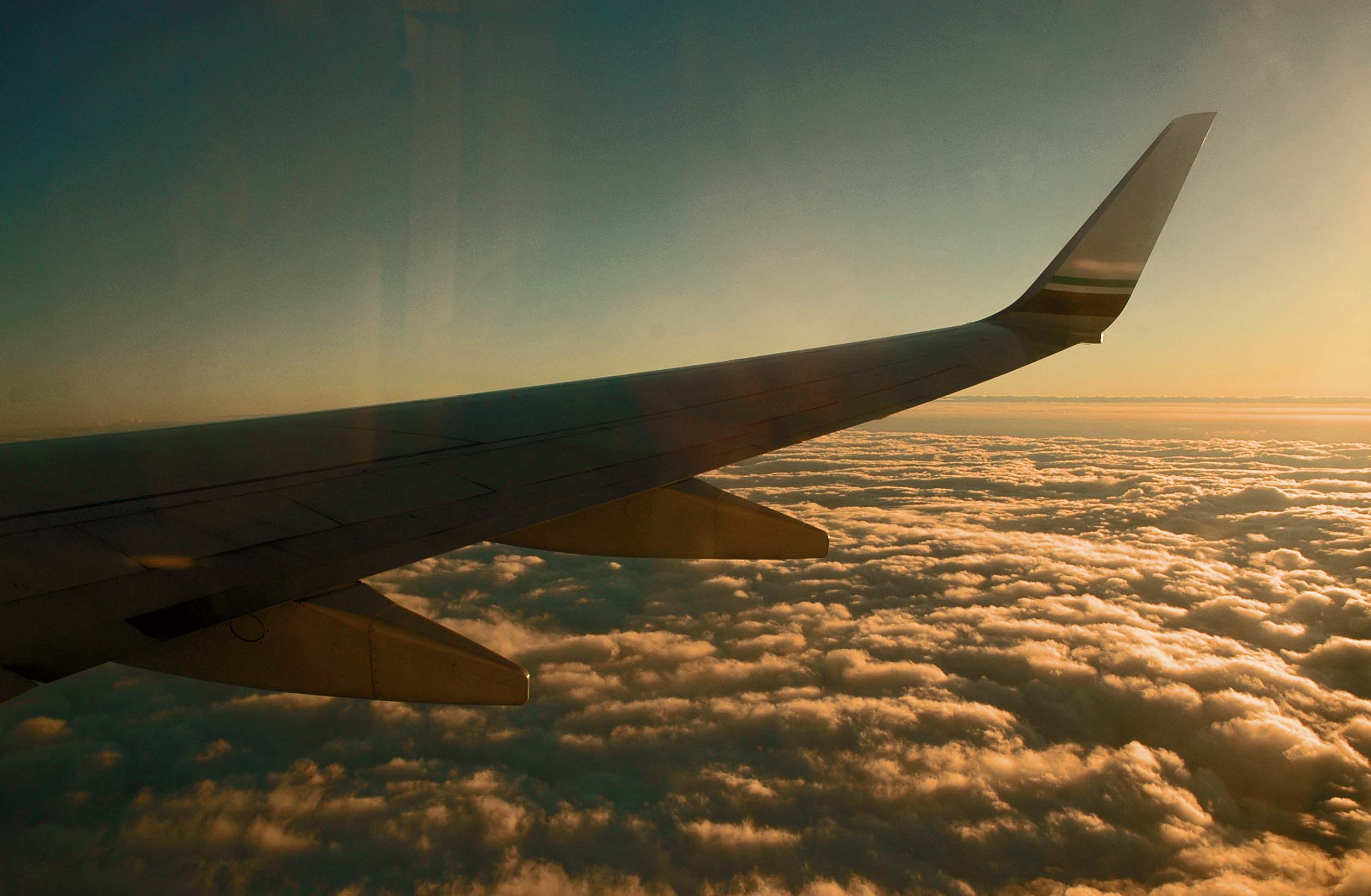
San Francisco 09-18 We were up pretty early to meet our driver to take us to the San Jose Airport. We were to board the plane before 7:00 am, so that meant we were awake before 4:00 am. We sat in the lounge area of the airport waiting to board the plane and struck up a conversation with a gentleman taking the same flight. We found plenty to discuss. Our first flight was to Portland Oregon, where we had a little lay-over before flying to Washington’s Ronald Reagan Airport. On the way across the continent I used my I-phone with an app that allows me to track the flight of the plane. It was interesting knowing our height, our airspeed, and a map of the features that were visible below us. As the app said that we were just crossing over the beach of one of the Great Lakes, I looked down and six and one half miles below us I could see the actual beach.
We had two good flights, so now we had to ‘navigate’ our bodies and our luggage from Ronald Reagan to our hotel in D. C. The hotel is in a nice area downtown. It is about four blocks north of the White House, in the NE section of town. We hailed a cab that was waiting at the exit to the airport terminal building. The driver was all fired up about the political unrest in Iran and Somalia and other areas. He eventually calmed down and went pretty much directly to the hotel. I suppose other cities have the same type of regulations for cabs... when the driver let us out at the hotel, he had to refuse those waiting at the hotel because he was only allowed to pick up fares at the airport, and not able to pick them up in town. I guess the unions are at work. We got checked into our room, and it was a fine room. It required several phone calls before I could log our computers into their internet. The irritating part was that I had to log into the system several times a day. Each time it was a guess whether it would come up or not. We decided to try the hotel’s restaurant for dinner. I was not excited about the food, but Rosalee said that she did not mind hers. Certainly not high praise at all. LOL We checked over our plans for the following day and turned in.
|
| DAY TWO:
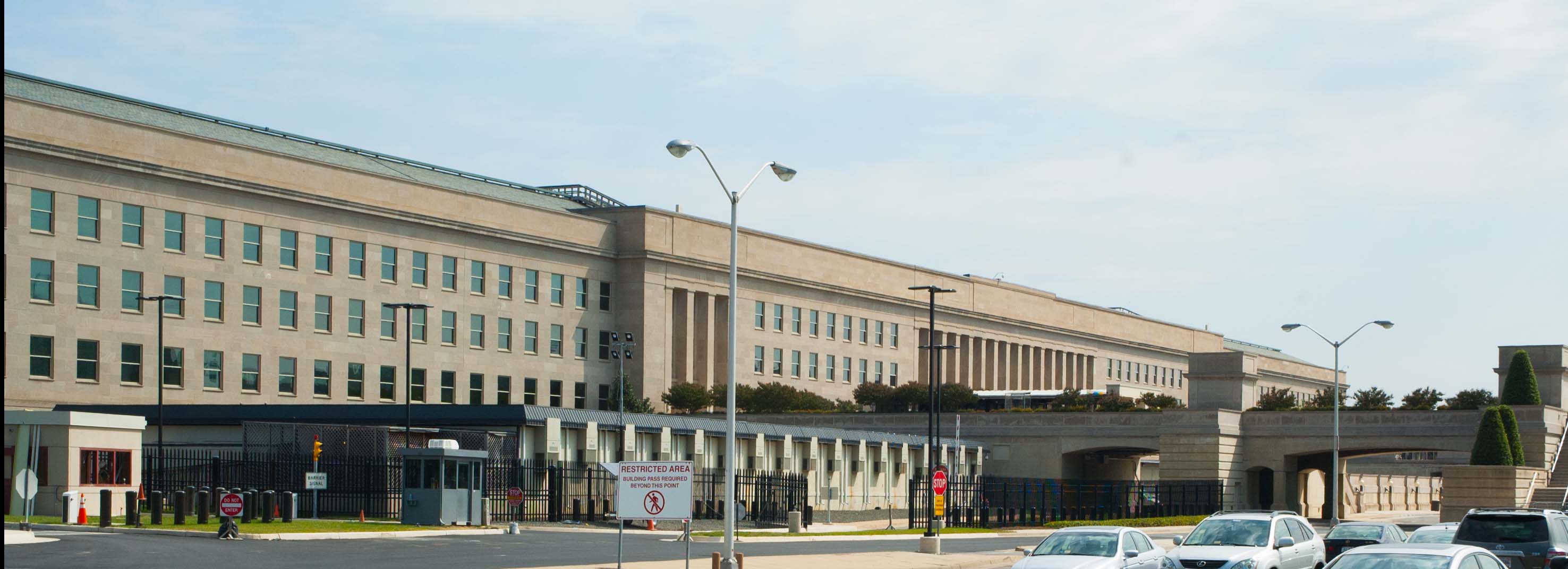
Washington D.C. On Our Own 09-19 Rosalee had read several years ago that there was a memorial to those killed on 9-11 when the plane was flown into the Pentagon. She has always wanted to check that out, so that was part of the reason we came two days early to D. C. We determined that if we spent a bundle and got a taxi to the Pentagon, we would be within shouting distance of where we flew into town the day before. So we decided to learn how to ride the Metro and headed out on foot to find the closest station. It was about five blocks from the hotel. Having experience with California’s BART system in the Bay Area, we were able to buy our tickets and get onto the right color-coded train. It was a quick ride across town, under to Potomac River to Virginia, and past Arlington Cemetery to Pentagon City where we found the Pentagon. I never knew there was a Pentagon City before. With 26,000 personnel going to work in that huge building, they have their own Metro station. That building is huge. It contains six and one half MILLION square feet of floor area. It is the same as 1,885 of my homes in one building. There is a five acre park in the center of the building. We walked from the east side of the building to the west side, and we could not get any closer than 300 yards from the building. It was a long walk. But it was worth it.
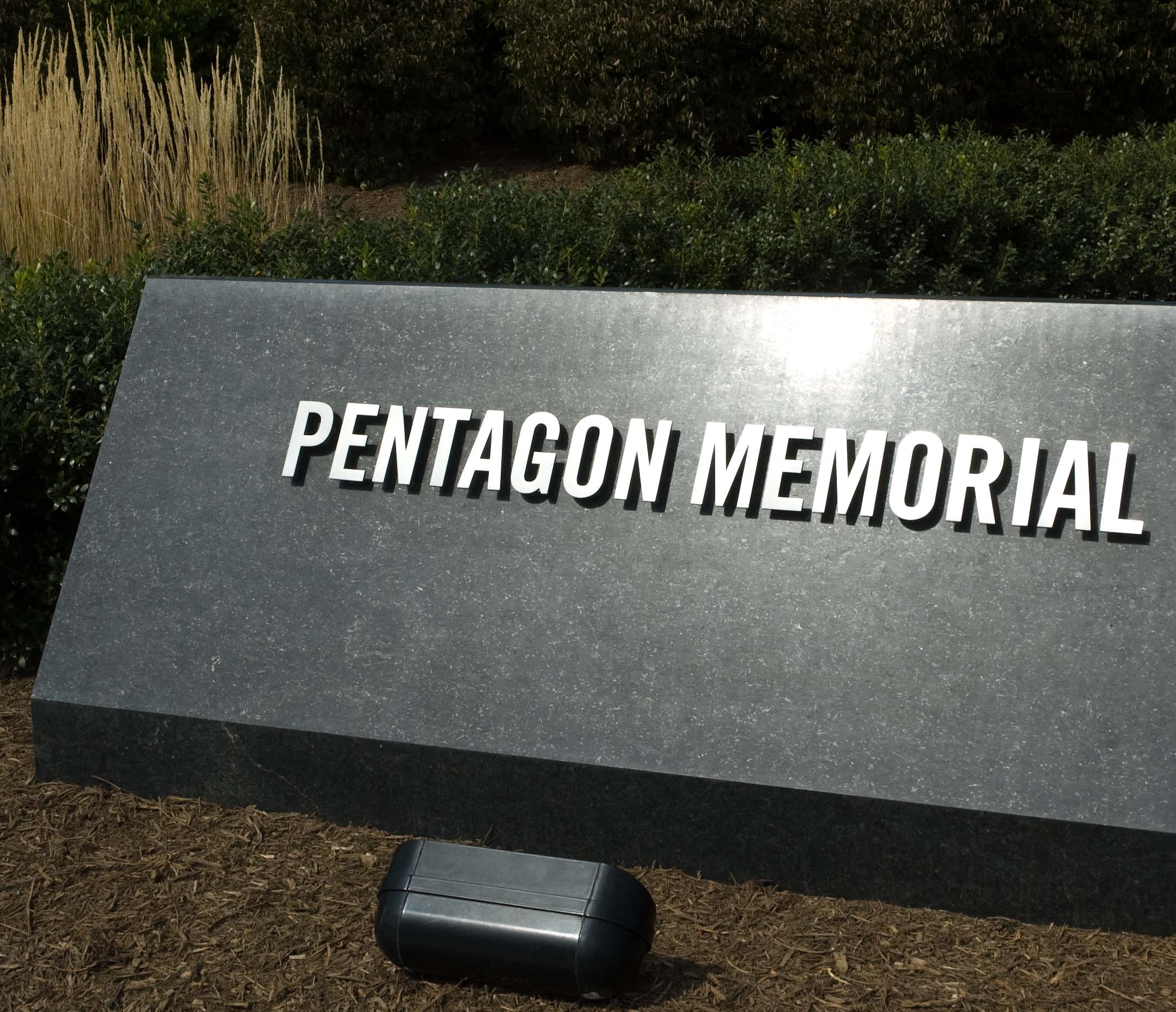
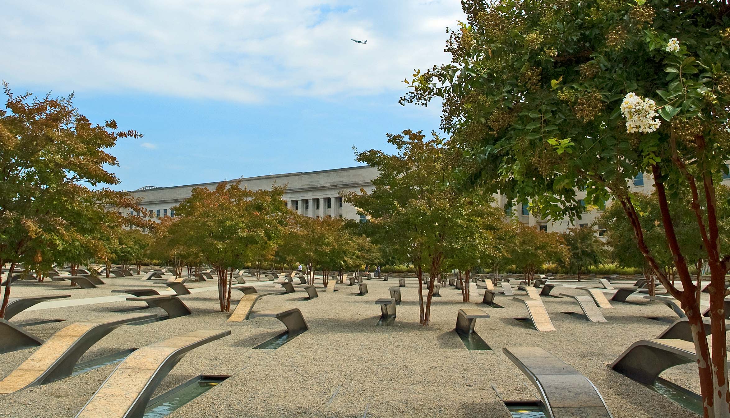
The memorial was on the western side of the Pentagon because that was where the plane was directed into the building. This image is almost one of the five sides of the Pentagon. This shows the Metro station to the right of the image. We need to walk to the left of this image past another side of the building, and then turn toward the third side before we reach the memorial. All along the side of the building there were signs indicating pictures were not to be taken of the building, so don't tell anyone that I took this, ok? Our first view of the memorial was a monument with the name of the area. It also included a section that listed the names of all of those that died when the plane was flown into the Pentagon.
The memorial was laid out so that the victims were each represented by an unusual bench that seems to curve up out of the ground, with a small water-filled reflecting pond under each one. The unusual part we noticed was that every victim that was born in a particular year were lined up in a row, each row designating a separate year in time.
A sharp eye will detect an airliner taking off in the upper middle of the image. It also shows the close proximity the Pentagon is to Ronald Reagan Airport, the one where our plane had landed the day before. The benches that curve up from the ground came up and leveled out, pointing either toward the Pentagon or away from the building, almost as if they were cut out of the landscape and pulled up like metal tabs. Each bench facing the building contained the name of a passenger on the plane. Those benches that curved up and leveled out pointing away from the Pentagon represented a person killed while working in the Pentagon.
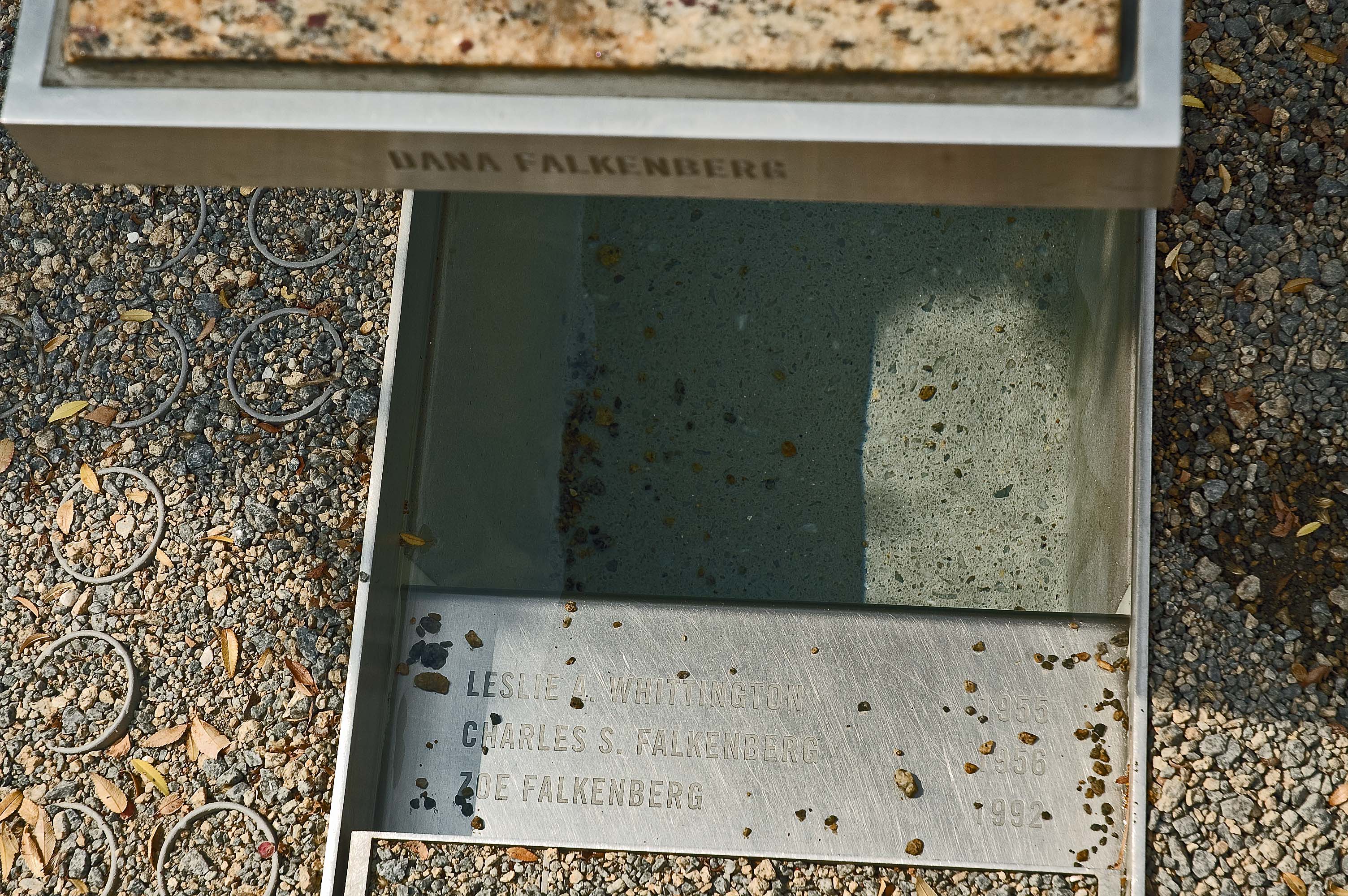
Another unusual feature is that anyone who was traveling with others who also perished, their memorial lists the others’ names. And they also had a memorial of their own. Near the top of the image, along the end of the bench, is engraved the name Dana Falkenberg. You can see the small amount of water held under the bench. The stainless steel plate near the bottom of the image lists three other names: Leslie A. Whittington 1955, Charles S. Falkenberg 1956, and Zoe Falkenberg 1992. We surmised that Leslie and Charles were the parents or partners and Zoe was the 9-year old sister of Dana, who was only a couple of years old, and they were booked on the flight together, heading home to the west coast before misguided minds ended their trip early. Charles had his own bench in the 1956 row of benches, with each of these other names included on it. The other two names also had their own benchs
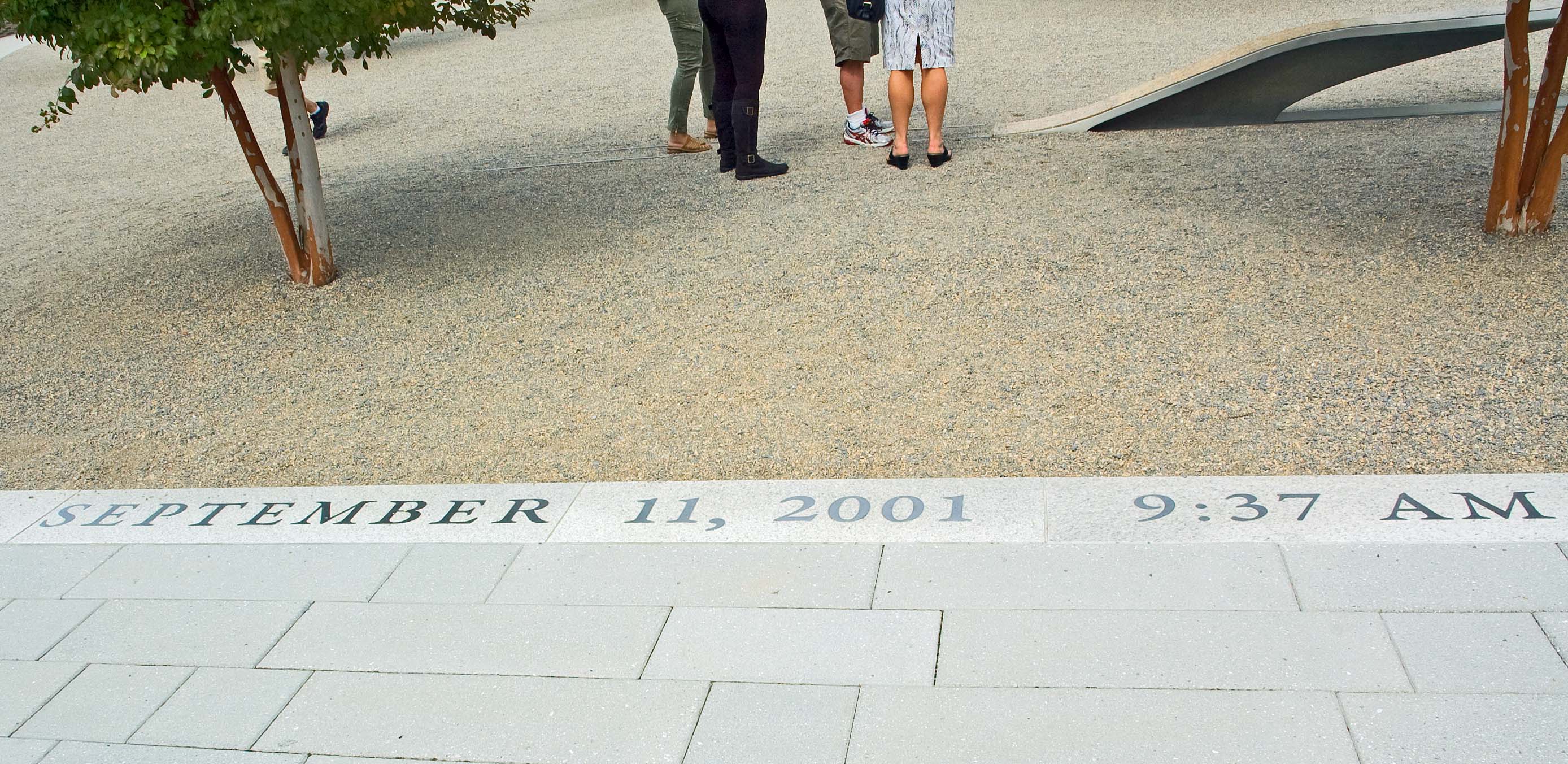
That fateful date and time are imbedded in the stone as you enter the area with the tree and benches. There is no indication of the area of the building where the damage was done. It has been totally restored. We were never allowed to be closer than 200 yards from the building, so we did not get a close-up look. We met a couple from Indiana and chatted with them while walking back to the Metro station. They were traveling to Arlington Cemetery, and I knew that the next station was their stop. I had seen it when we came down that morning. In the evening, we decided to go out and look for a better choice for dinner, and we found a restaurant that we had noticed advertised in a book in our hotel room. It was called the Commissary, and I ordered Fish & Chips. It was absolutely wonderful. Our long-time favorite had been from a restaurant in Vancouver, BC. This was definitely my all-time best choice… hands down! And was I ever surprised to learn that it was Tilapia fish. Back to the hotel. We were not feeling really good about being out late in the evening. Washington D.C. may be our nation’s capital but it has been under some very corrupt leadership over the last few decades, and the crime rate is horrendous. When Rosalee arranged for this room, she asked if the hotel could arrange it so that we could have the same room the two nights we need it before we join the tour and not have to move to a new room when we join the tour. Everyone on the tour is joining up here at the hotel. After the total four days were up, we learned that what they did was leave us in the first room, but they dropped the price of the room a hundred bucks a night for the two nights that we would be in the tour group. Others in the group had complaints about their rooms. We were fortunate that we had a good room. The internet connection in the room has been troublesome. I have had to make a phone call to an ‘800” number almost every night to get it to work. Tonight it was not any different.
|
,
| DAY THREE: More Washington
D. C. 09-20 Today we plan to visit the Holocaust Memorial Museum, which is about fourteen blocks south of us. It is down 14th Street to the south side of the Mall… the large park in the center of Washington D. C. We think that we can walk about six blocks from the hotel to a bus stop and take Bus #52 and it will stop just short of the Museum.
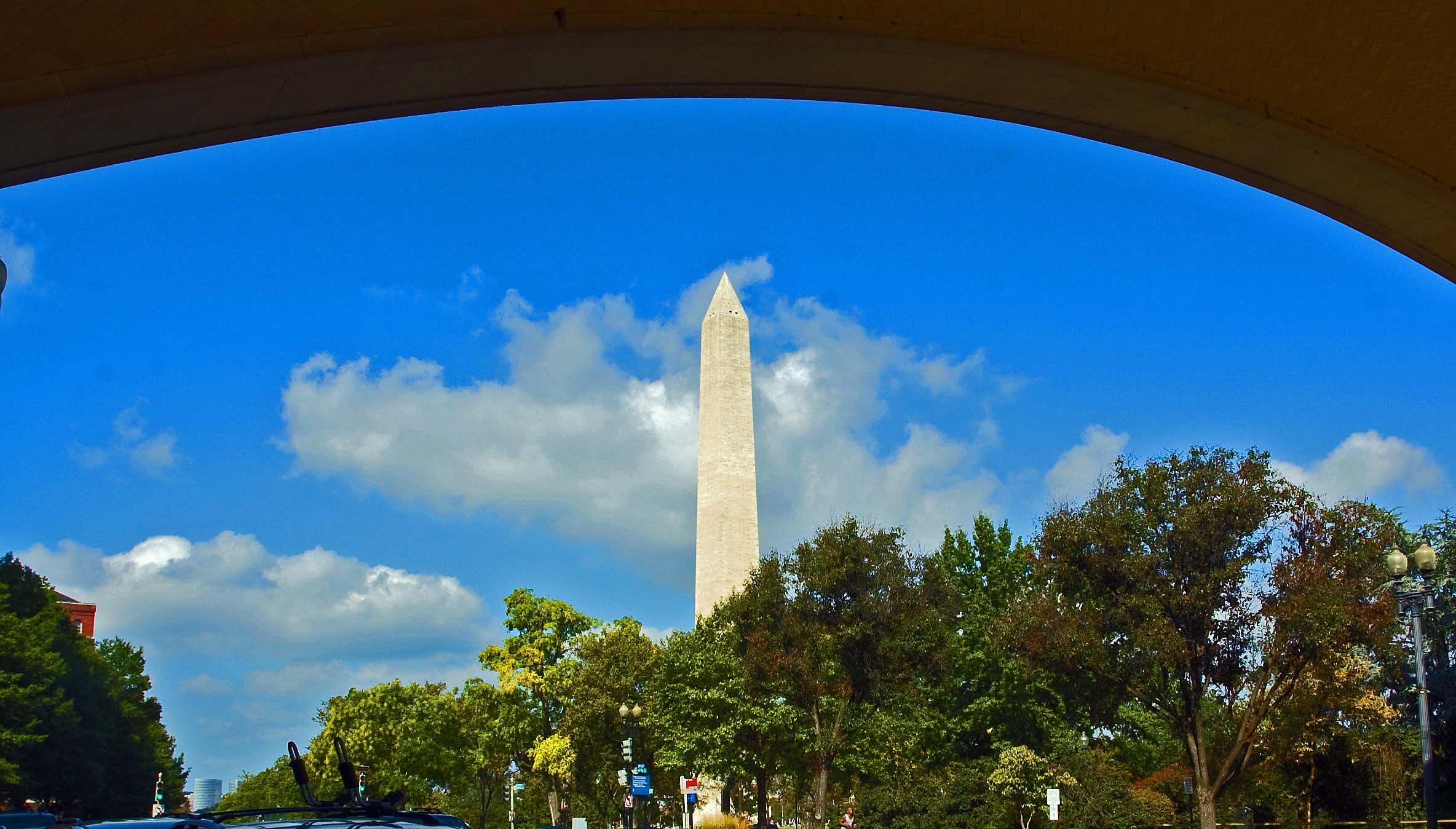
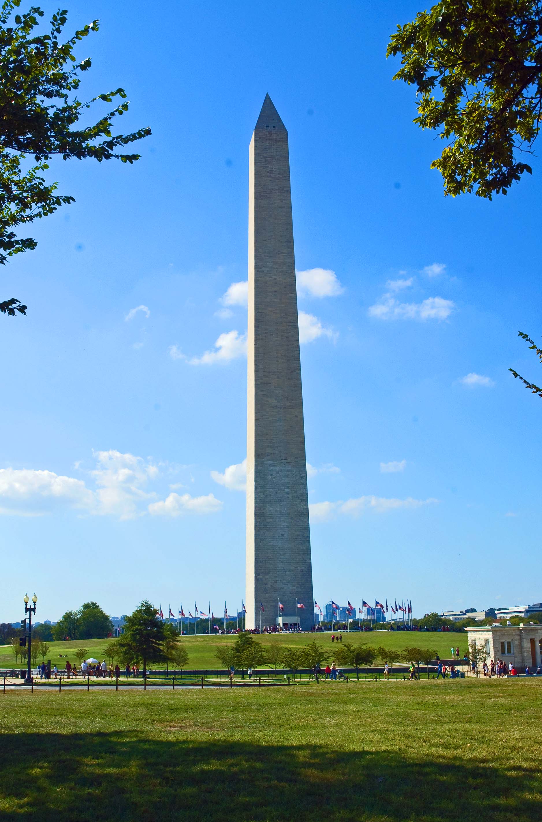
Just past the Washington Monument (which is always larger than I expect it to be), the bus stopped and we had a direct view of the Holocaust Monument Museum. We found airlines-type security awaiting us to enter the building. I had to toss a new bottle of Coke… no liquids allowed in the building. They graciously allowed us to retain our cameras, but were informed that no photography was allowed anywhere in the building. One would think they would want to get their message out to others, through photos taken by visitors to the memorial. I found the trip through the museum to be sobering, but not as much as others have experienced. Perhaps it was because I had studied quite a bit about the tragedy. I actually felt that everything was basically ‘soft pedaled’ for the masses, and that may actually be a mistake. This was a man-made tragedy that was created by an incredibly cruel and sick person and equally important, it was carried out by many people for any of dozens of reasons. Granted, many feared for their own lives if they did not follow directions. There were a lot of videos playing throughout the museum, along with a lot of panels with graphic displays. They told the stories of German society and the influence of Adolph Hitler and how he changed the thinking of the German people. Much was shown about how World War two built up and played out. Playing on a select few video monitors that required someone to be about 4 ½ feet tall to view, were scenes taken at the time of discovery of the concentration camps and gas chambers. They did not make any of it look pretty. I appreciated that they did that, as this is something that everyone should clearly understand without any doubt. When bulldozers have to be used to push dead, diseased and naked men, women and children’s bodies into large common graves… victims of a mad man… one has to realize the atrocities that were done to these people. Another thing that I appreciated was that the message of the museum was clear that many other people were destroyed, not just the Jewish people in Germany. We were feeling brave when we came out of the Museum so we decided to walk the distance back to our hotel.
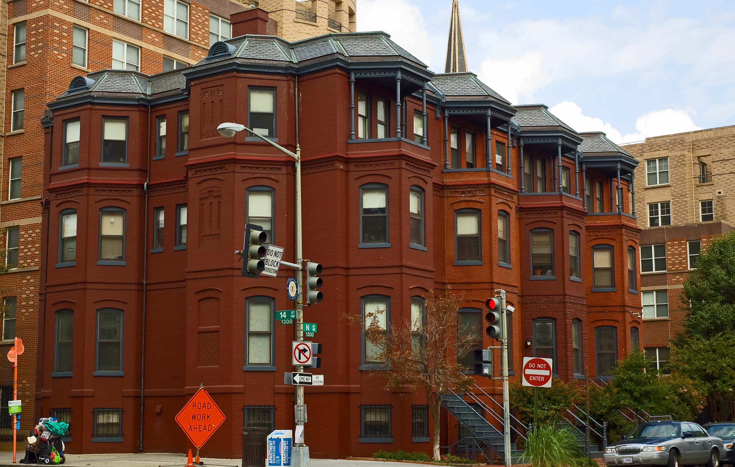
Living my whole life on the west coast, I am fascinated by the architecture on the east coast. Mostly because a lot of it is much older than on the west coast. Also, because we have relatively few masonry buildings, bricks are used much more in the east. It fascinates me to see the many different patterns used when they laid up the brick walls. Having laid a few bricks myself, I can really appreciate the skills that are evident in these buildings. We walked past many buildings that were official something or other… who knows what they were or what happens inside them. Many buildings named after people that occupied the Supreme Court or the House or Senate, or the White House. Most of these are built from (or covered with) various types of stone, with some veneered in marble. They all look like bank buildidngs or museums that we see in California. There were plenty of buildings that were museums. Being this close to the Washington Mall, many of them are parts of the Smithsonian Museum complex which consists of 19 museums and many other buildings used for research and administrative work. It was a couple days afterward that I learned that we walked past the huge aquarium, which I would have loved to visit. There was nothing on the building to tell what it was.
Washington D.C. has plenty of parks and "squares" that are spread all over the city. Most of them are named for one war hero or another. There is usually a statue standing somewhere nearby showing the person that is being honored. I'm not sure how old I was before I realized that the tallest building in Washington D. C. (by law) was built to honor our first president.
When we reached the Metro Station that we had used yesterday, we had lunch. There was a Five Guys Burger and Fries next to the station. They make a great hamburger. Don’t order the large fries. We ate there twice and each time we ordered a small fry and they just dumped a huge pile of them into the bag holding everything else. We decided we had been out enough today so for dinner we munched on goodies that we had started to accumulate in the hotel room. We meet the others in the group in the morning at a breakfast and then start the tour.
|
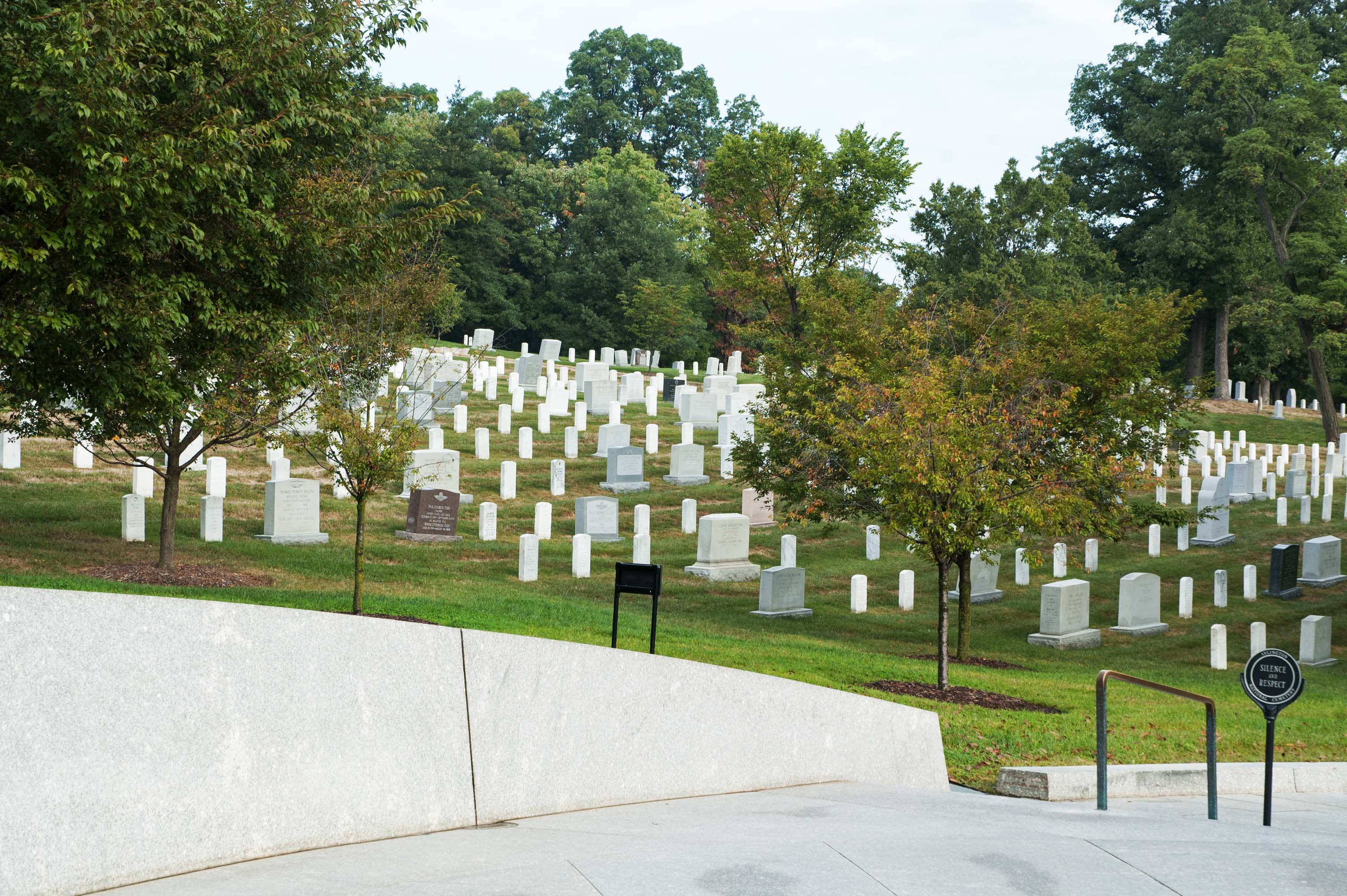
| DAY FOUR: Start Of Tour 09-21 We met downstairs in one of the banquet rooms in the hotel for breakfast. Carlos, our tour director met us at the door and gave us all a number that told us which was our table. That helped him to get paperwork to us. Each table held eight people. Everyone around the room give our names and where we lived. A couple was from Sacramento, and two couples were from Modesto. There were about fifty people in the group, with the youngest about 35 years old. After a lovely breakfast buffet, we boarded the bus and drove to Arlington National Cemetery. Rosalee and I had been there about 19 years ago, and we remember walking through the cemetery. It is more guarded now (as is everything) and we had to board Arlington’s bus system, which leaves a lot to be desired. First, two fellows could not get the brakes to release on the ‘train’ (at least two trailers pulled behind the motor unit) until one finally walked back and noticed a major electrical plug between trailers was not plugged in.
Now they can move the train, so we went to the Kennedy plot… memorial. Everyone out! So we get out and then it was a 20 minute wait for another train. By the time it showed up we had just enough time to ride it back to where the bus was waiting. No time to watch the changing of the guard at the Tomb of the Unknowns.
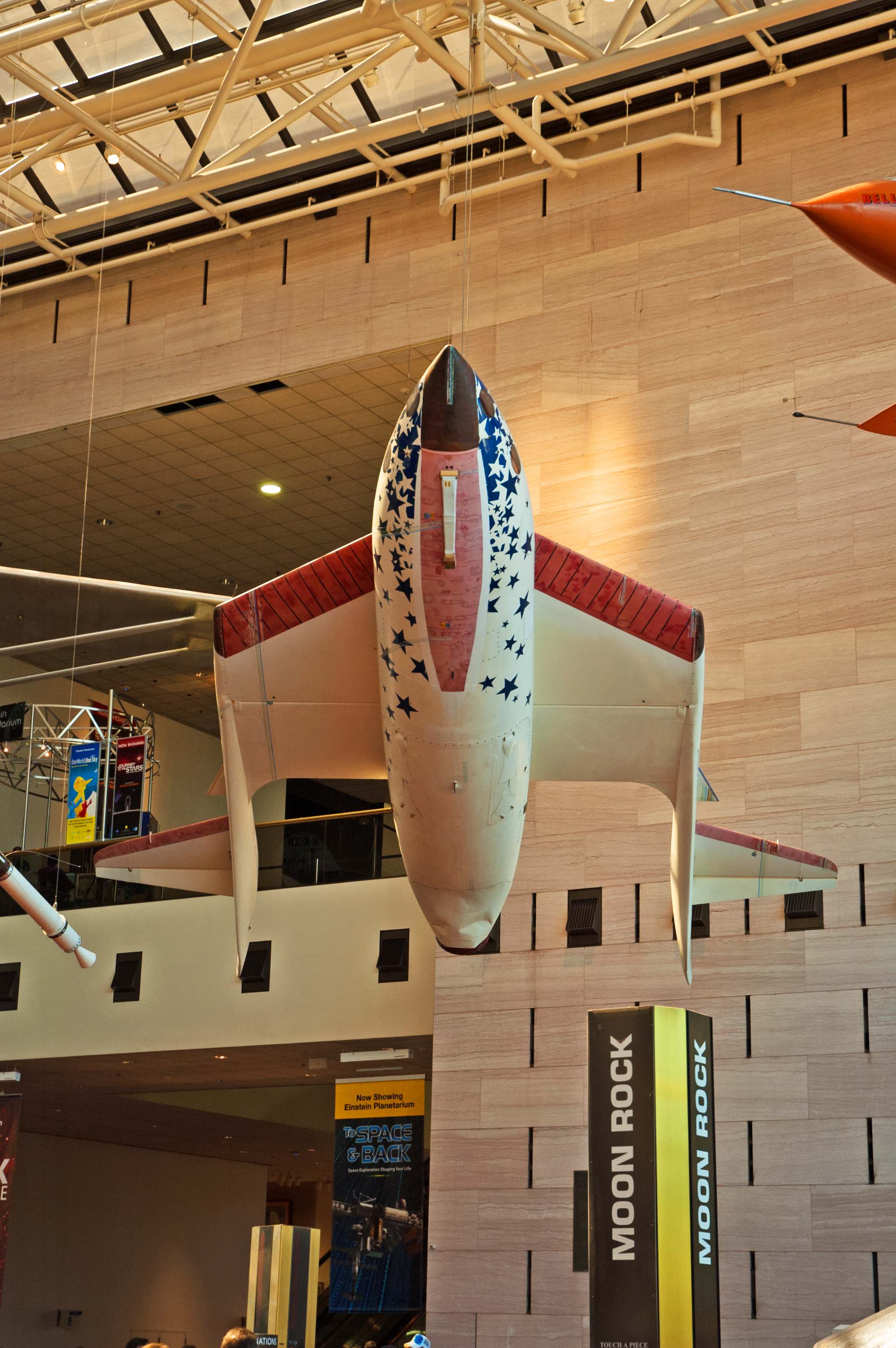
We had a chance to catch a bite for lunch when we stopped at the Washington Mall near the Smithsonian Air and Space Museum. They have a McDonald’s built into the museum. After the museum we spent the day on the bus, driving around Washington D.C., seeing and hearing about a lot of things that are certainly not obvious.
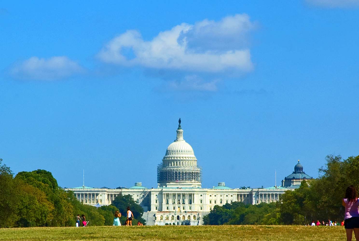
We stopped to view the Capital building. We did not enter the building. It is not very picturesque because it is surrounded by scaffolding on the dome for some refurbishing.
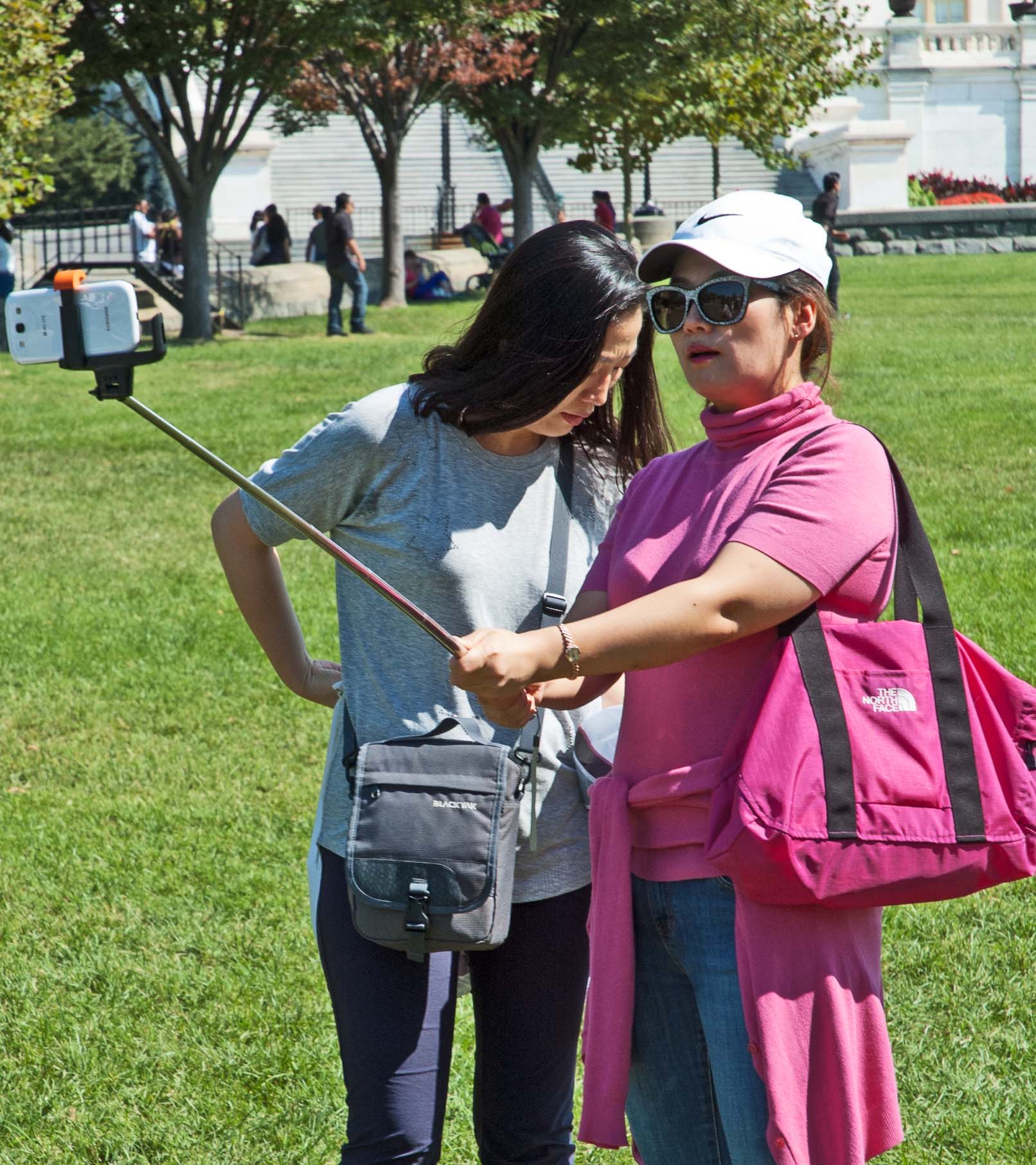
I noticed a couple of girls with a gadget none of us had seen before. The best description I could give to describe it would be “a selfie stick”. It could have been a monopod, but it looked a little flimsy for that, and I’m not sure how they triggered the photo to be taken.
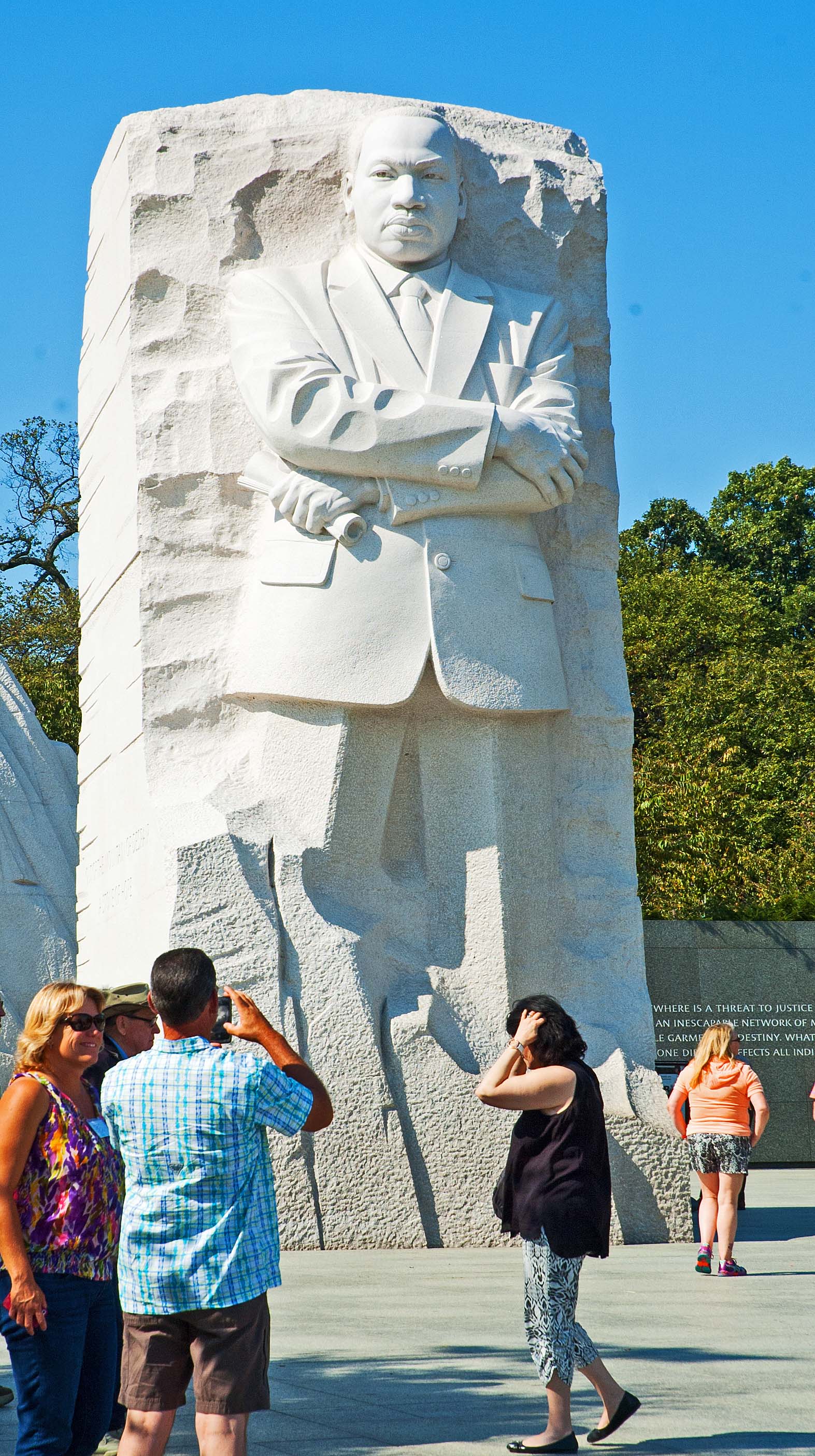
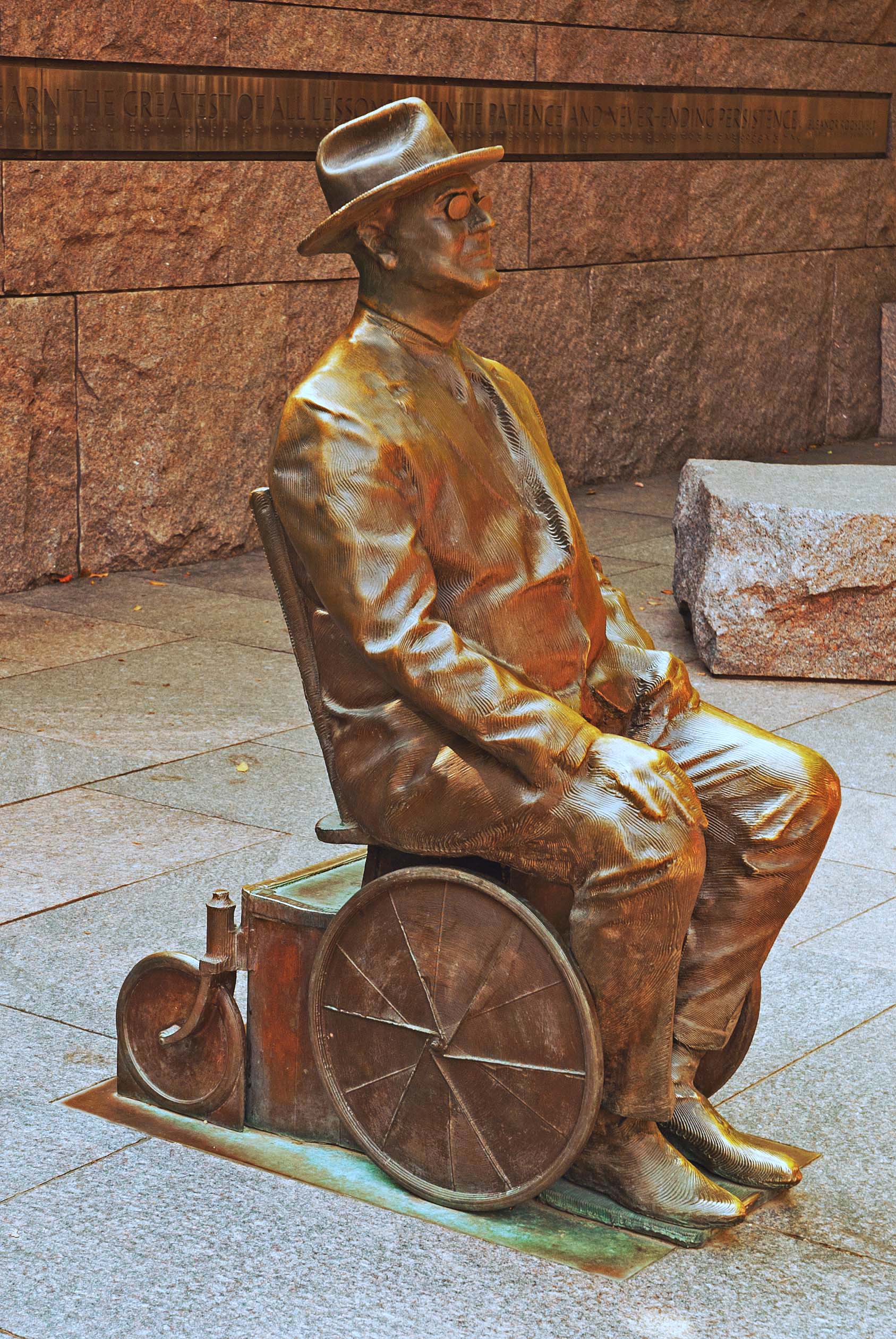
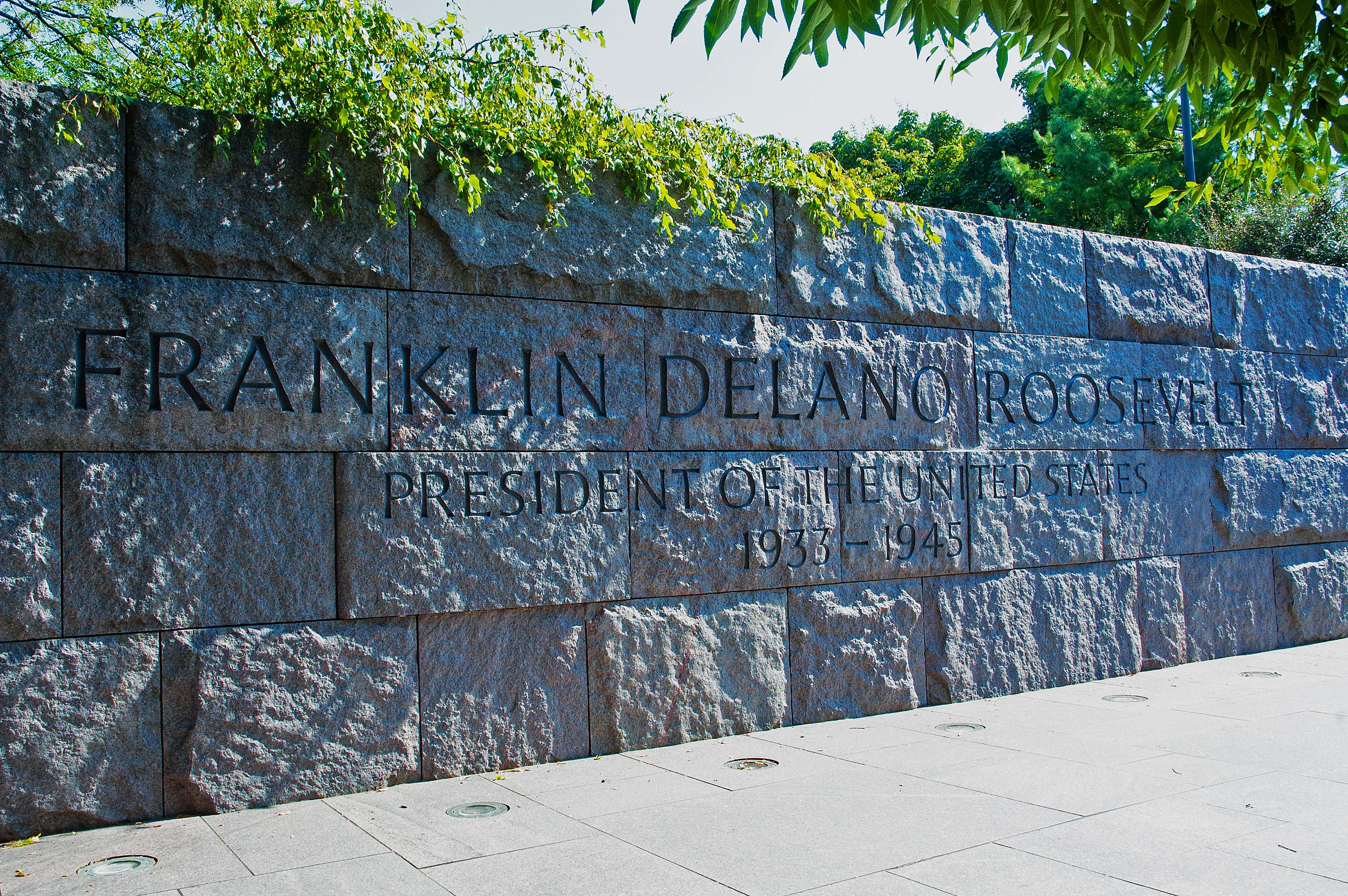
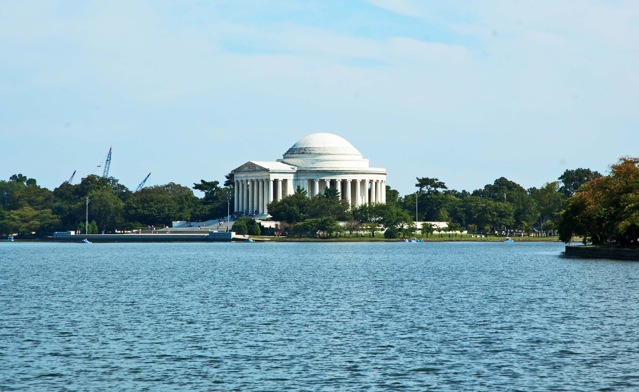
We also toured two monuments in the Marsh area south of the Mall that were new to us. One was the monument to Martin Luther King, and the other was to President Franklin Delano Roosevelt, which was a very large area. Both were at the west side of the lake, with a lovely view of the Thomas Jefferson Monument across the lake.
The monument for FDR had a bronze, life-sized monument of the President seated in his home-made wheel chair, made from a kitchen dinette chair we are told. He was very careful to never be pictured struggling to walk or sitting in a wheel chair when he was in office. He felt that it would be bad to give the impression of his not being fully capable or in the least bit handicapped. He suffered from Polio since childhood, but did not hesitate to drive his own car with hand-controls or to go out on his boat, the USS Potomac, which we toured a couple of years ago in Jack London Square, Oakland, California where it is kept after a complete salvage from being sunk and rotted and restored back to the likes of the days of his use.
The Viet Nam wall is a sight that is to be reckoned with. We remember it from before, and it is still just as impressive. It contains the names of 58,272 Americans that battled and were killed in the Viet Nam War. The names are listed from the center outward in both directions, in the order of their loss, as well as it can be determined. It also contains those that are Missing In Action and their whereabouts are still unknown. Every few months there are new findings locating someone on that wall. Contrary to popular legend, there are no names that were placed on the wall that have been found alive since it was erected three decades ago. As can be seen, the wall dips down below the surface of the ground to lend a feeling of quiet solitude, as well as an openness that is always open to everyone.
A blow-up of the area that reflects the Washington Monument shows how the names have been etched into the wall. We had dinner back at the hotel in the banquet hall where we had breakfast. We had a chance to get to know the six other travelers at our table. We had opportunities to sit and chat with (or eat with) most of the 25 couples before the week was over, and most were going to be on the ship after we finished the bus tour. After dinner we went out for an after-dark view of many of the memorials. Half way through we had a bit of a downpour and messed up the part about getting out of the bus, but it was still enjoyable. We just did not get some of the pictures that we would have liked to have taken.
The World War II Memorial was new to us. We saw it earlier in daylight and again at night, before the rain started. Fift;y-six pedestals stand representing the states at that time and the possessions that were involved in the war. Only one light was burned out… the one that illuminated the pedestal honoring those men and women from California, but the light on the outside of the pedestal was working. The tower and arch at the far end had a matching one behind me, each one signifying the two theaters in which WWII was fought.
It was back to the hotel, to catch some sleep and be up bright-eyed and bushy-tailed in the morning for another breakfast with the group. We also have to have our bags out in front of our doors before 7:00 a.m. for the men to pick them up and place them on the coach. We were told that if we wanted to designate a bag to be carried but not unloaded each night until we reached the ship, they would do that. It would save them and us from handling about 25 large bags all week. Almost every night will be a different hotel. The bag will be available if we NEED it before we end the land tour, however.
|
| DAYS FIVE & SIX: Mt.
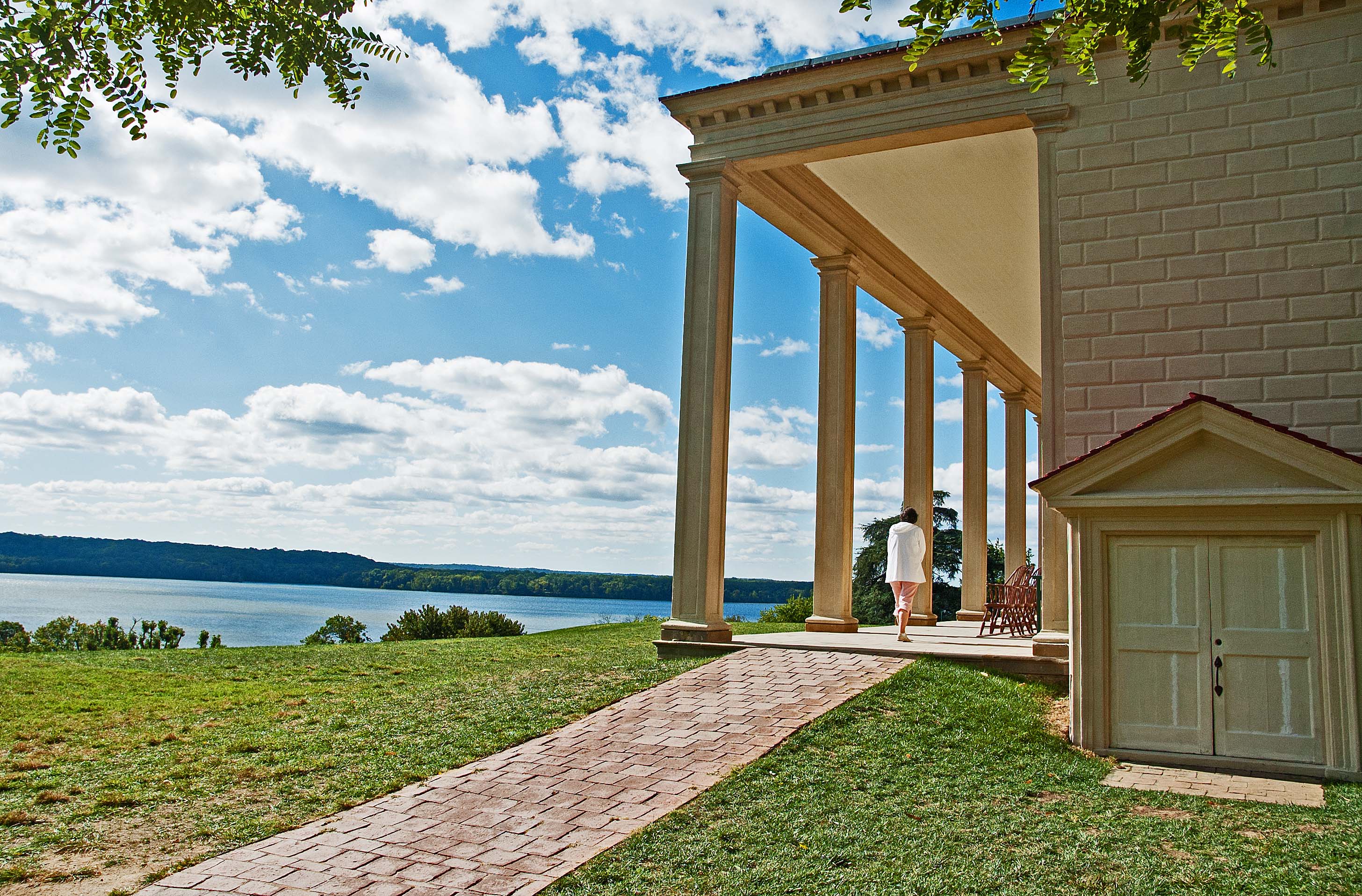
Vernon to Jamestown to Colonial Williamsburg 09-22,23 Breakfast was enjoyable as we continue to get to know the fellow travelers. It took them a little while to get all the bags into the coach, in a manner they hoped would make it easier for them to be retrieved that night in Colonial Williamsburg, I’m sure. Mount Vernon, the home of our first official President, George Washington, was enjoyable. It was once a large estate with thousands of acres. Crops were grown for the consumption of those living on the farm as well as for sale to others. The home overlooks the Potomac River that goes by on the morning side of the home. The estate was actually where the President’s family lived, and George inherited it later in life.
This is not the famous view of the home that we have all grown up to know. The tall columns are on the east side, which is the back side, actually. This is the side with the entrance... the one that you see as you approach the home. Smaller buildings are on either side of the home, giving the layout of the buildings an heraldic symmetry, both in elevation (straight-on view) and in plan view (looking down from the clouds). The smaller buildings to either side consist of the kitchen, the wash house, various storage rooms, granaries, tackle rooms, horse stalls, repair shops, servants’ quarters, etc. The exterior of the home is covered with wood siding that is shaped to look like individual stones. The two elevated walkways to either side of the house (with the arched portico roof over each) take you to the first building of the outbuildings that line up off to the right and to the left.
Walking around to the left of the house you can see the large lawn that stretches out toward the Potomac River. That is the Morning Side of the home. This view of the eastern side of the home shows the tall columns with which we are all familiar. The porch under the tall columns has an array of chairs on which to relax.
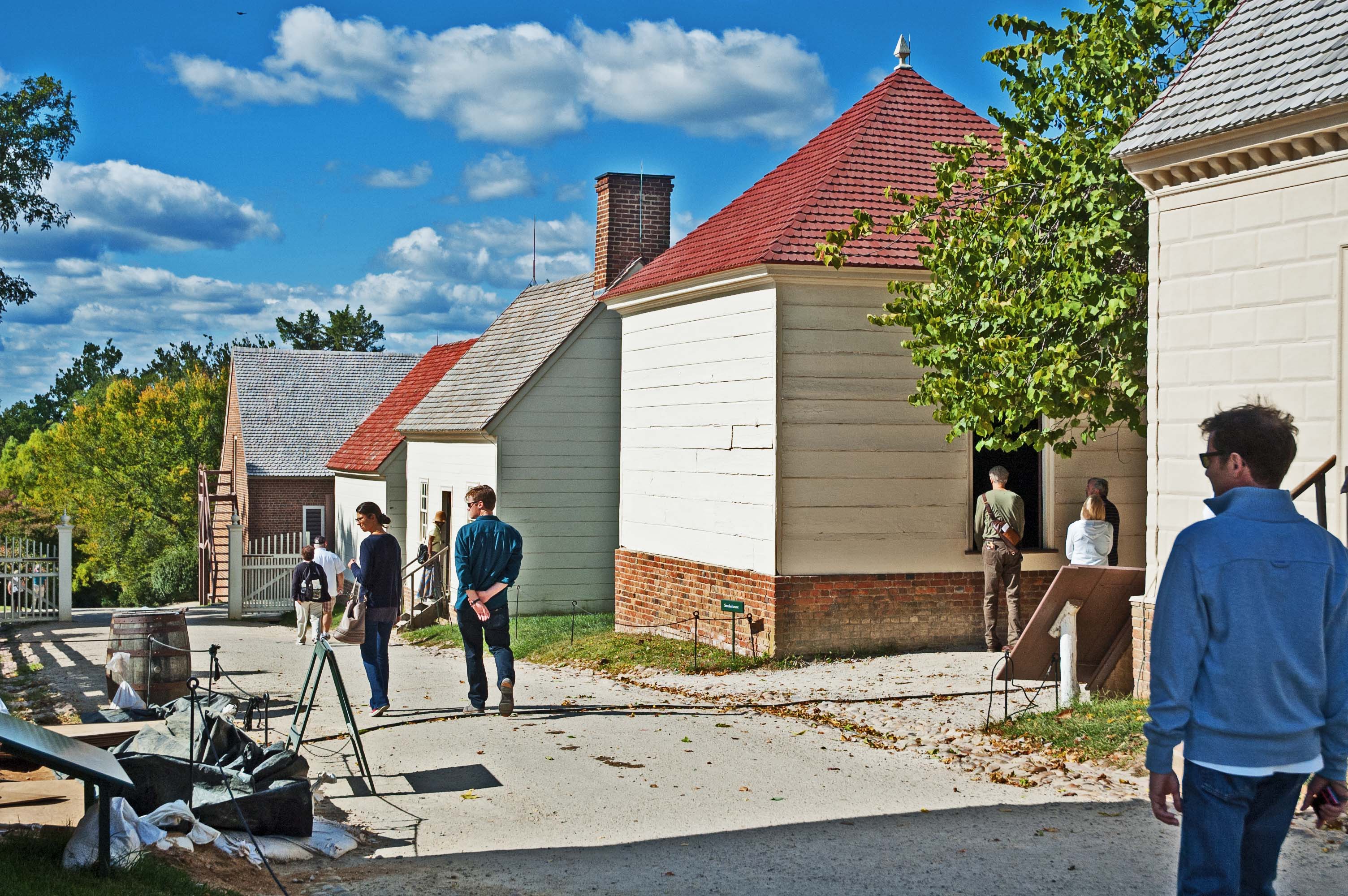
These are the outbuildings that line up in a line heading south of the main house. There is a row of them headed north on the other side of the house as well. The road heads on down the hill to gardens and a glen where President Washington decided he wanted to be buried, and left instructions and wishes in his will.
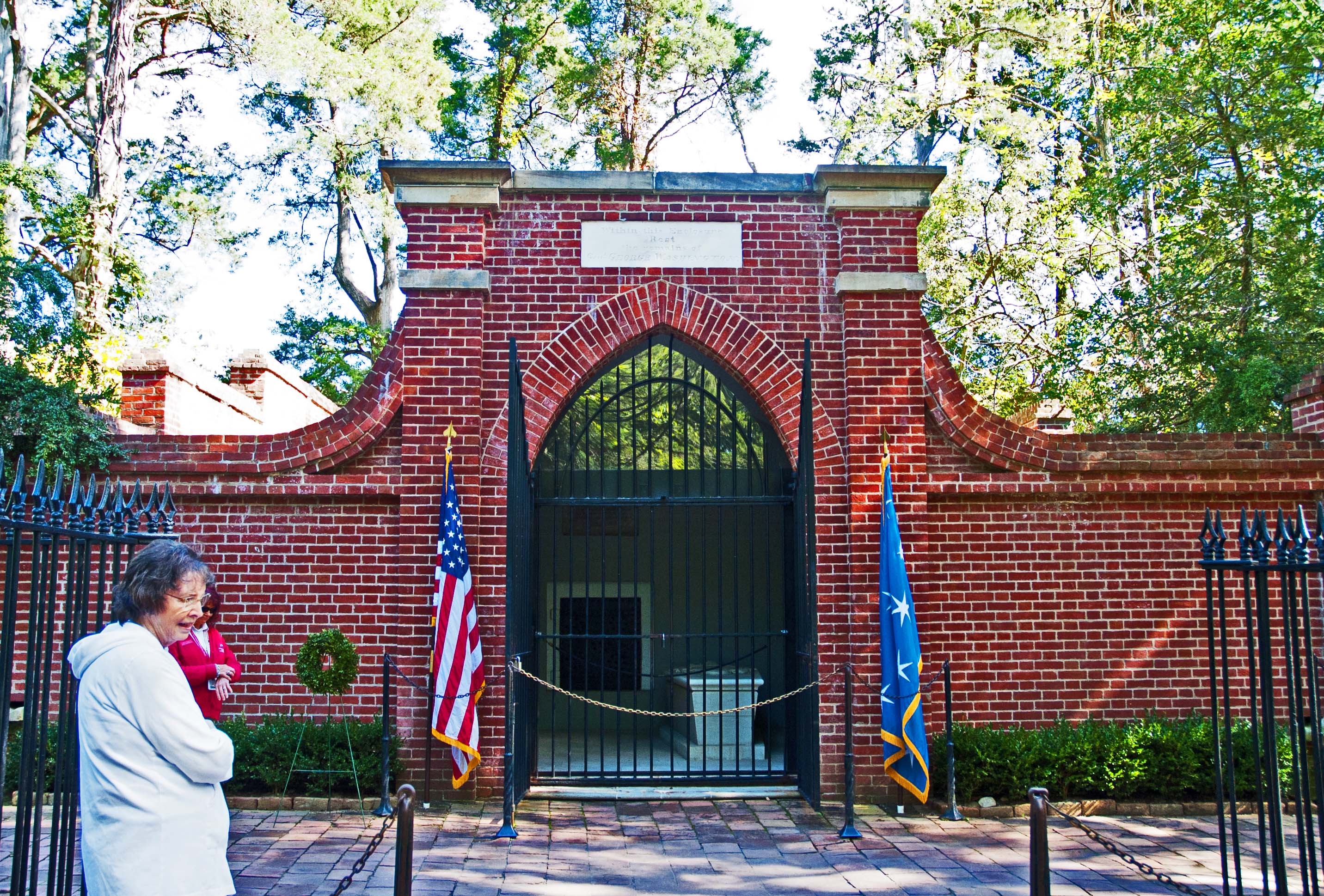
He designated an area down by the creek about 2,000 feet from the house, and that is where a type of a mausoleum was built of brick. An iron gate guards the caskets of George and Martha, and a small steel plate behind them can be removed, and stepping into that opening reveals a room going back into the hill that supports more than two dozen of the Washington’s relatives that have passed on. It is no longer taking residents. There is no more room at this inn. When we reached Jamestown, there was a huge brick building that was the administration building, auditoriums, gift shop and museum which all together was larger than the town of Jamestown itself, as it was originally. As was the case at Mount Vernon, our man Carlos had arranged for the tickets and he went in to get them and had them for us by the time we all got out of the coach and walked into the admin building.
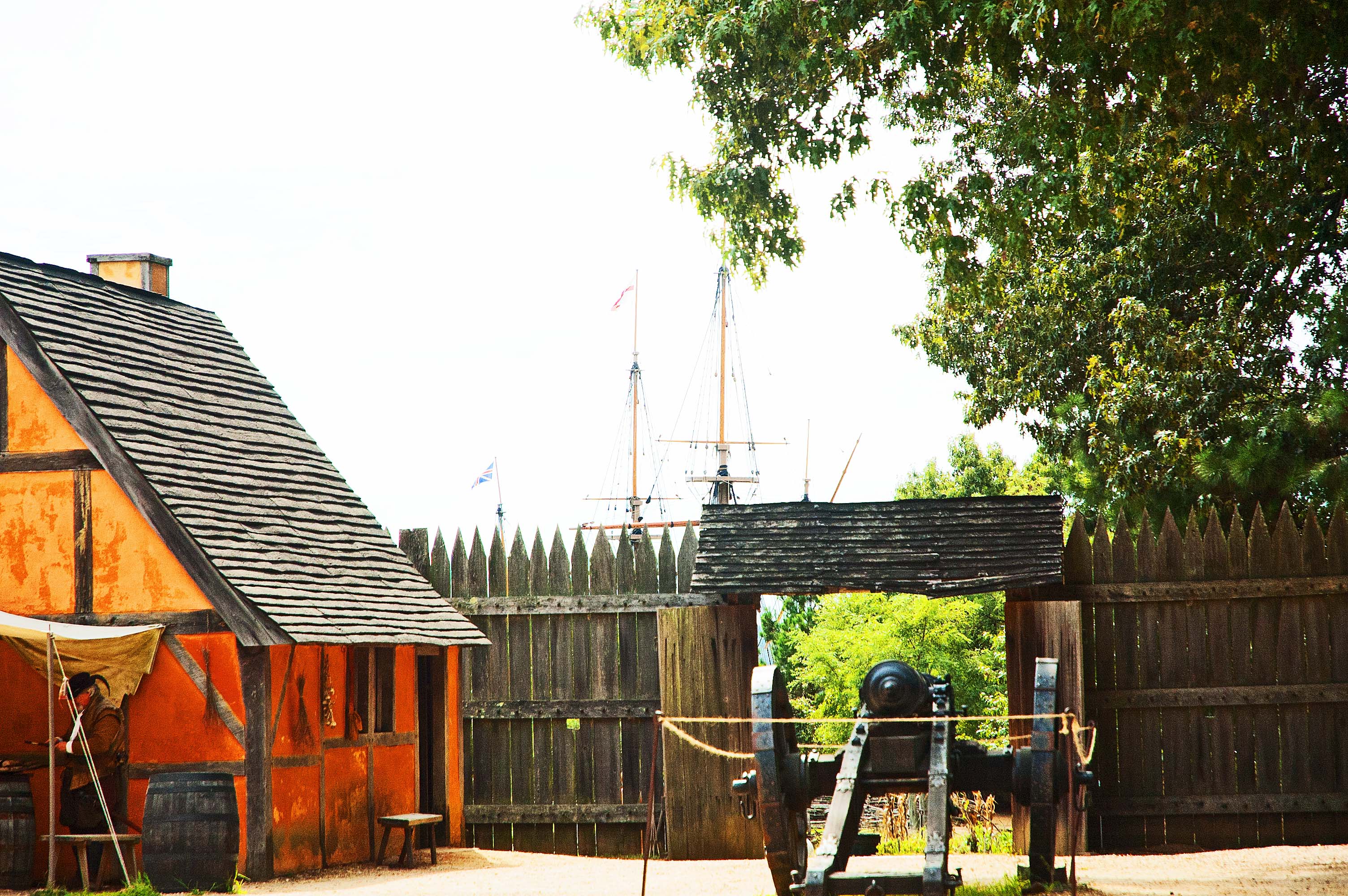
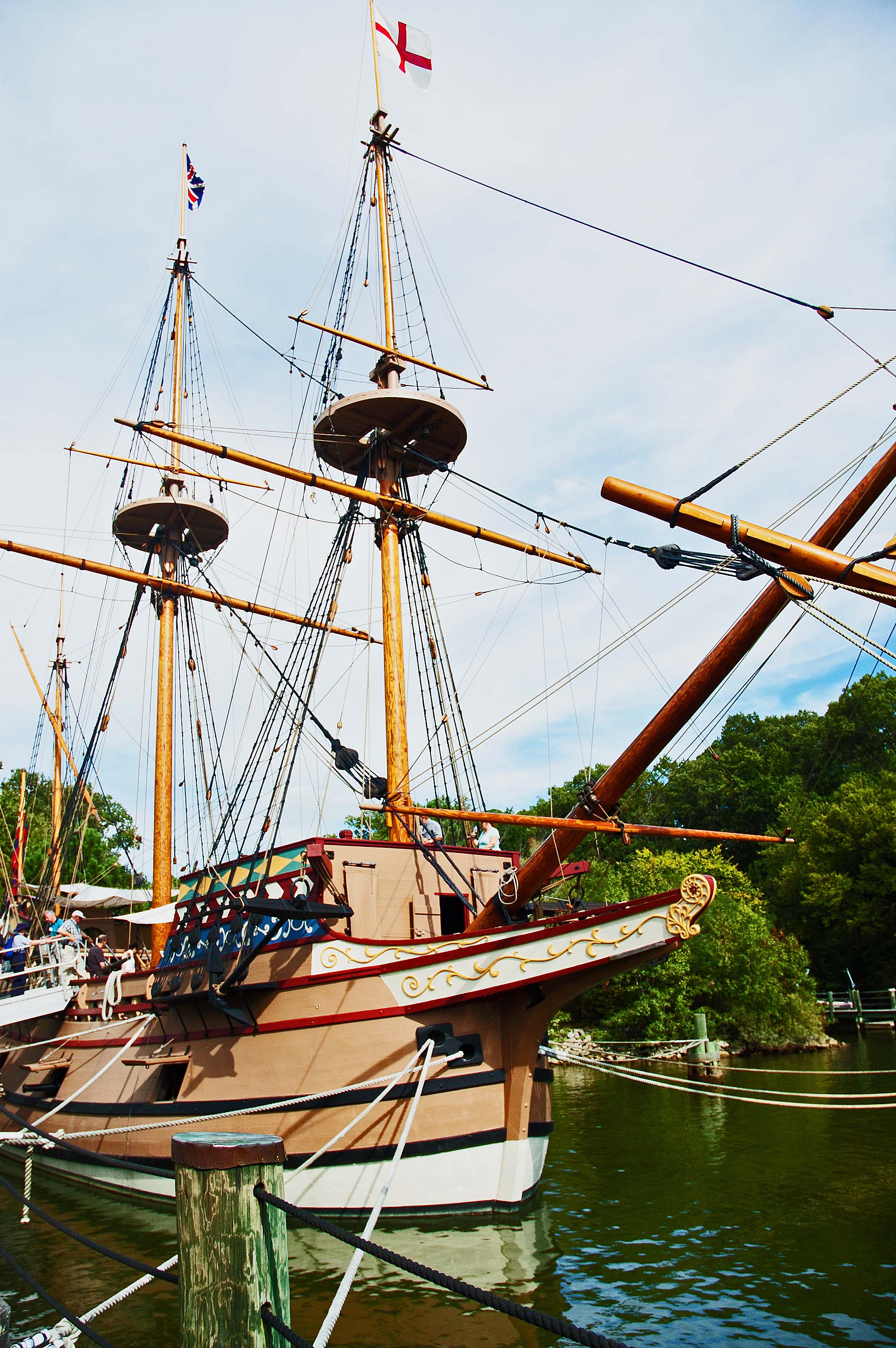
We walked down toward the river and to reach the river we walked through the reconstructed village similar to what was built back in the days the first European settlers came to these shores. The homes and stables were built in the Tudor fashion of building where a frame structure was put up in the heavy timber style, and then the open space between the timbers was filled in with wattle, which consisted of mud and manure and straw. When it hardens, it is quite hard. The town stood inside a fort that was constructed of trees cut locally, with pointed tips at the top. Down at the dock were three ships, all done to perfectly match three of the ships that brought people originally to Jamestown.
Back on the bus, we are headed to Colonial Williamsburg.
While we were In the Tavern, Carlos and the driver went on over to the hotel and deposited the luggage into our rooms and brought back out room keys. A quick trip across town on the bus and we were ready to bed down.
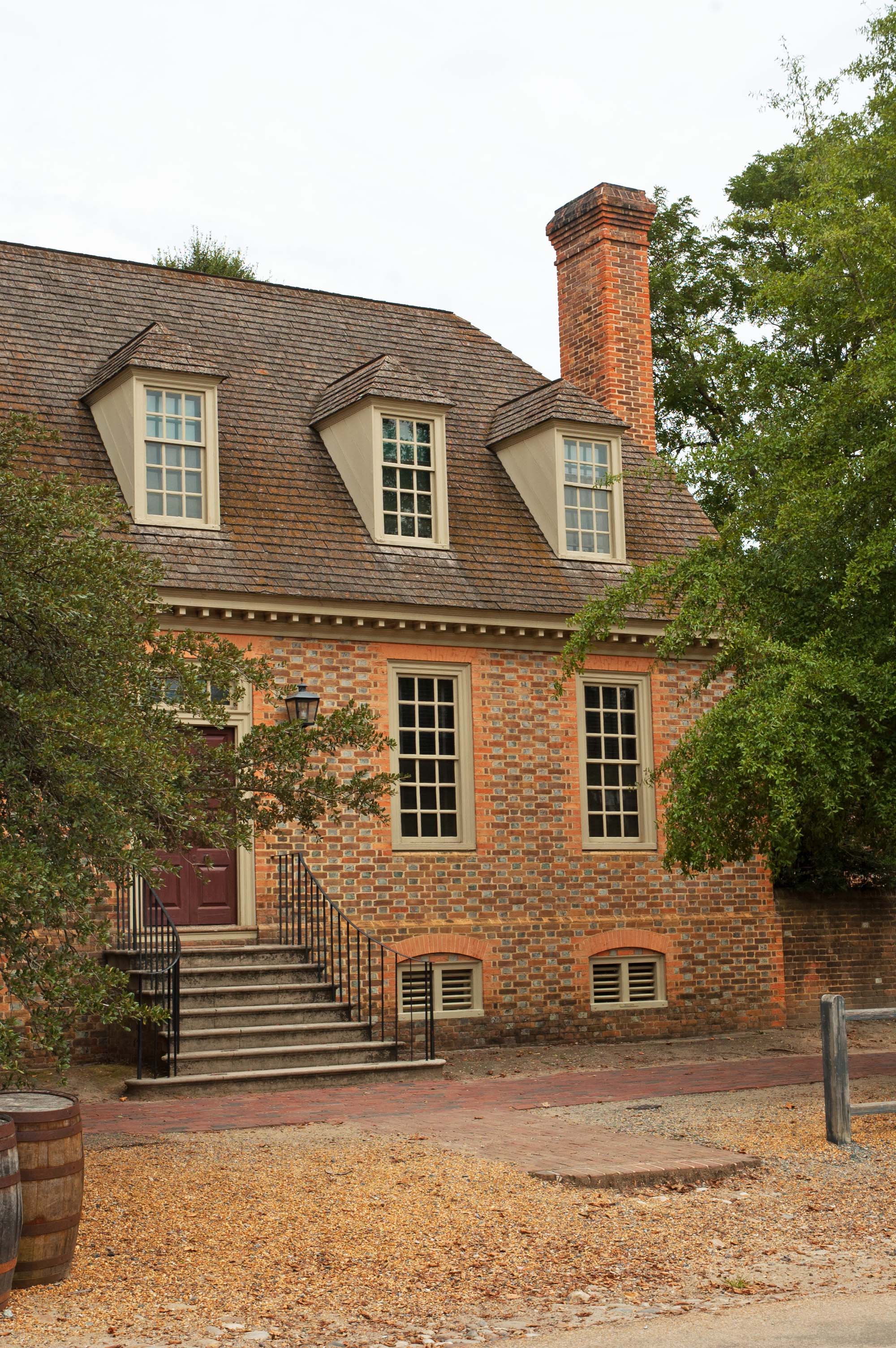
The next day is “ours”, all day, to do as we wish. It is a quick walk into Williamsburg, or we can hop on a little bus that will take us into town. We have tickets that will basically allow us entry into any part of the town. Rosalee and I considered hopping the bus but another couple that we have gotten to know was walking, so we walked with them. We did not have breakfast, because ever since our visit here 19 years ago we dreamed of a crawfish bisque that we had here, and we were intent on finding it again. I had asked the server at the King’s Arms Tavern if she knew who was serving that and she said it was right next door.
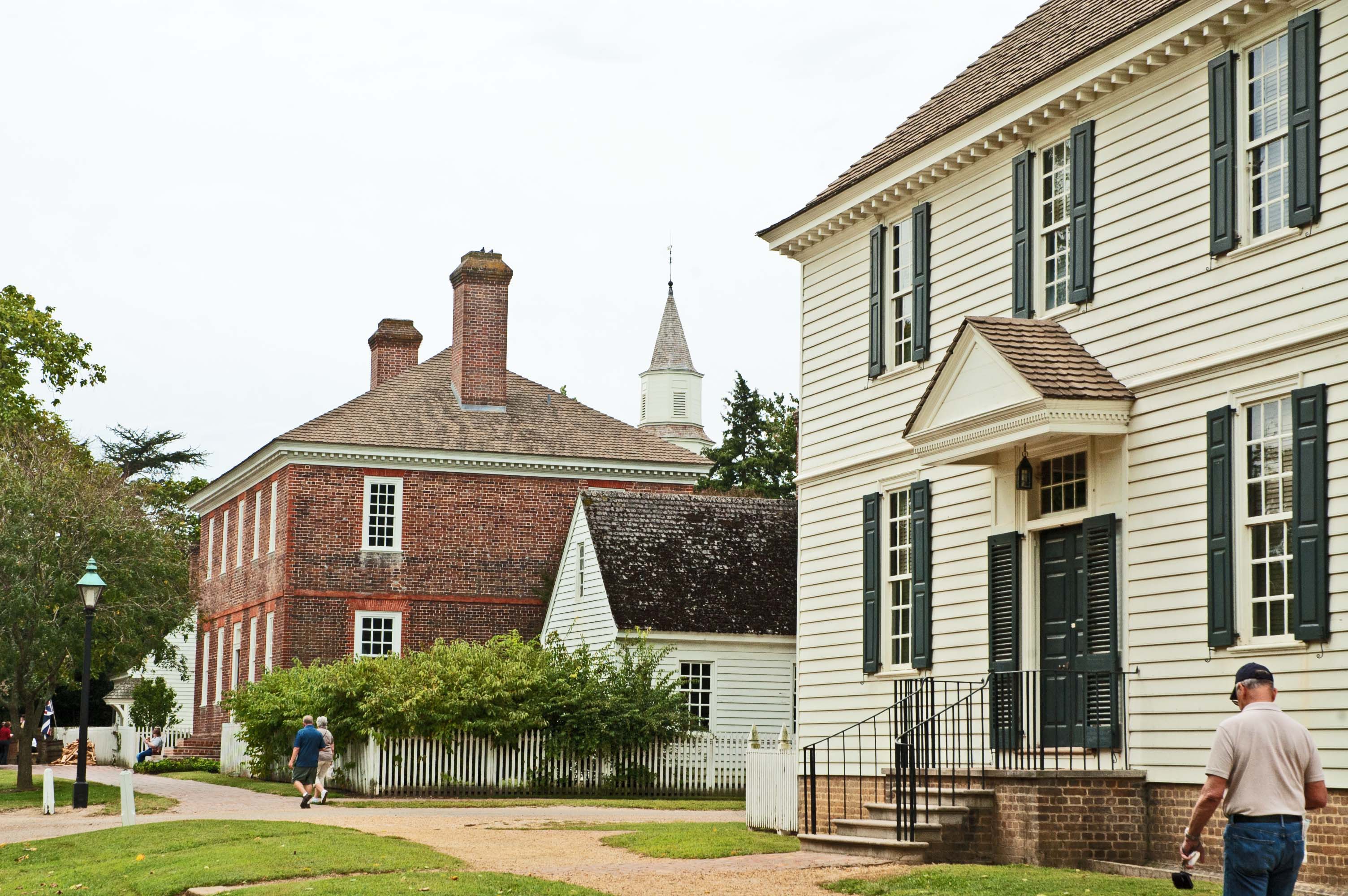
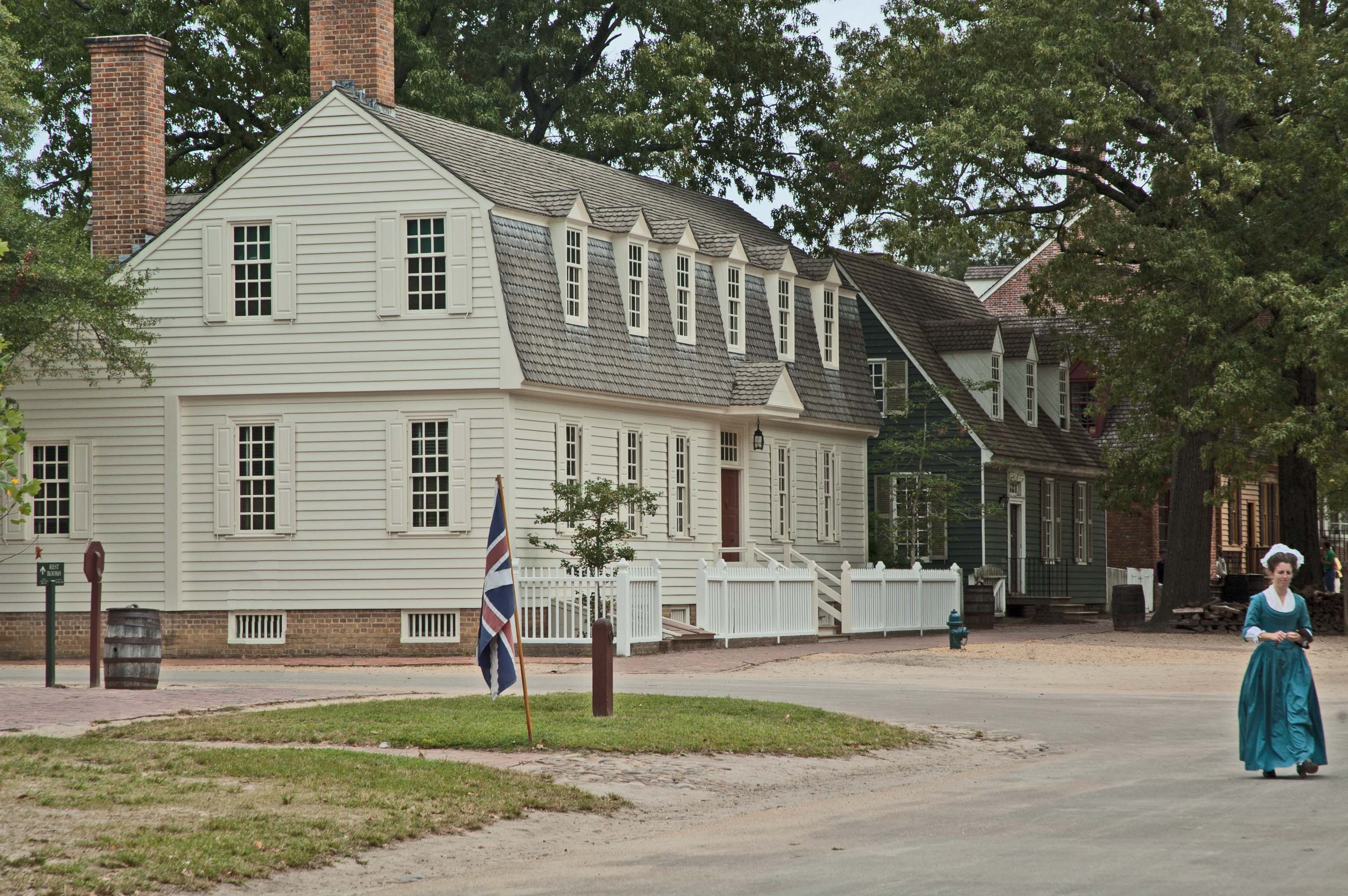
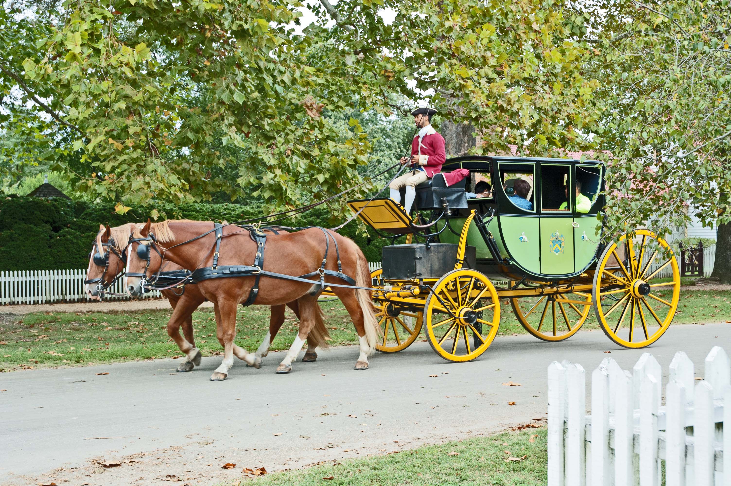
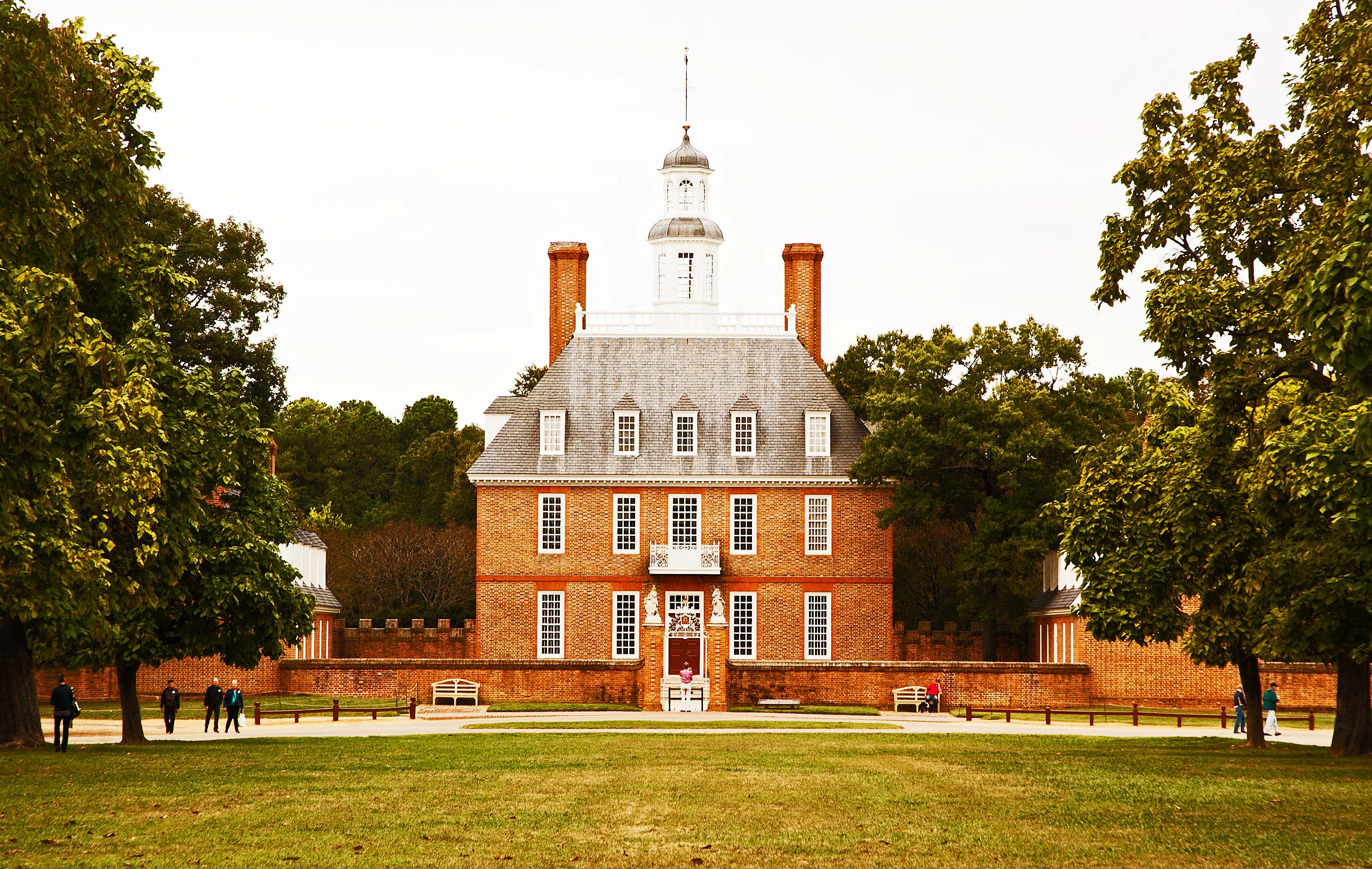
We found the restaurant, and it was indeed the correct one, but the bisque is now a lobster and crawfish stew, which was good, but not at all what we remembered. The waitress told us that they no longer served the bisque and hoped that we would be pleased with the alternative. We can let that dream die now. Bummer. We did visit a few of the places that we remembered from before… the silversmith, the gunsmith, the Governor’s Palace, and just walking through the town looking at all of the beautiful homes. Some people actually live in some of these homes. Others that work there dress in the fashion of the times. There are multiple carts pulled by horses that you can ride if you need to get across town… or you just want to feel the steel-tyred wheels on the cobblestone streets.
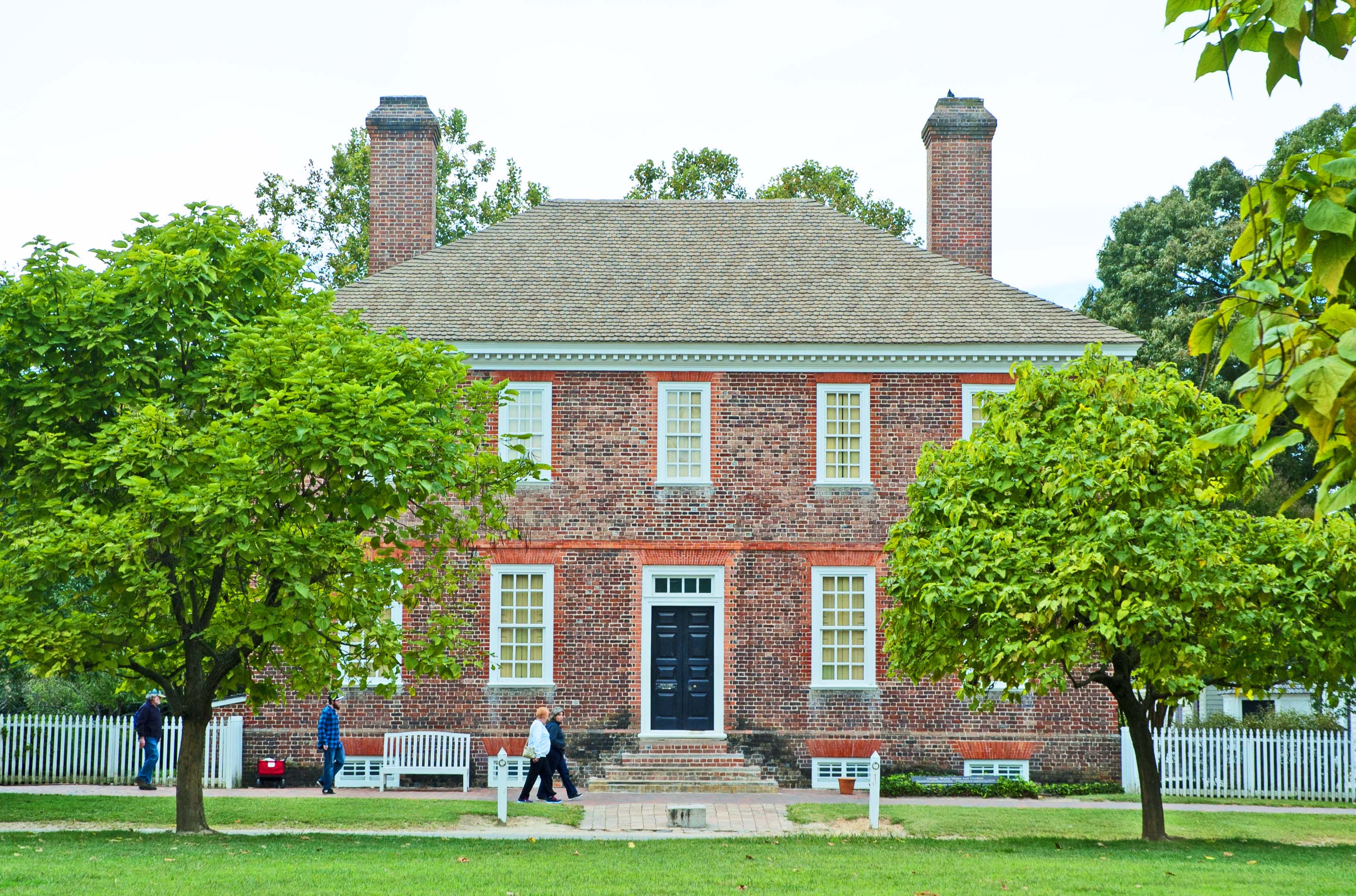
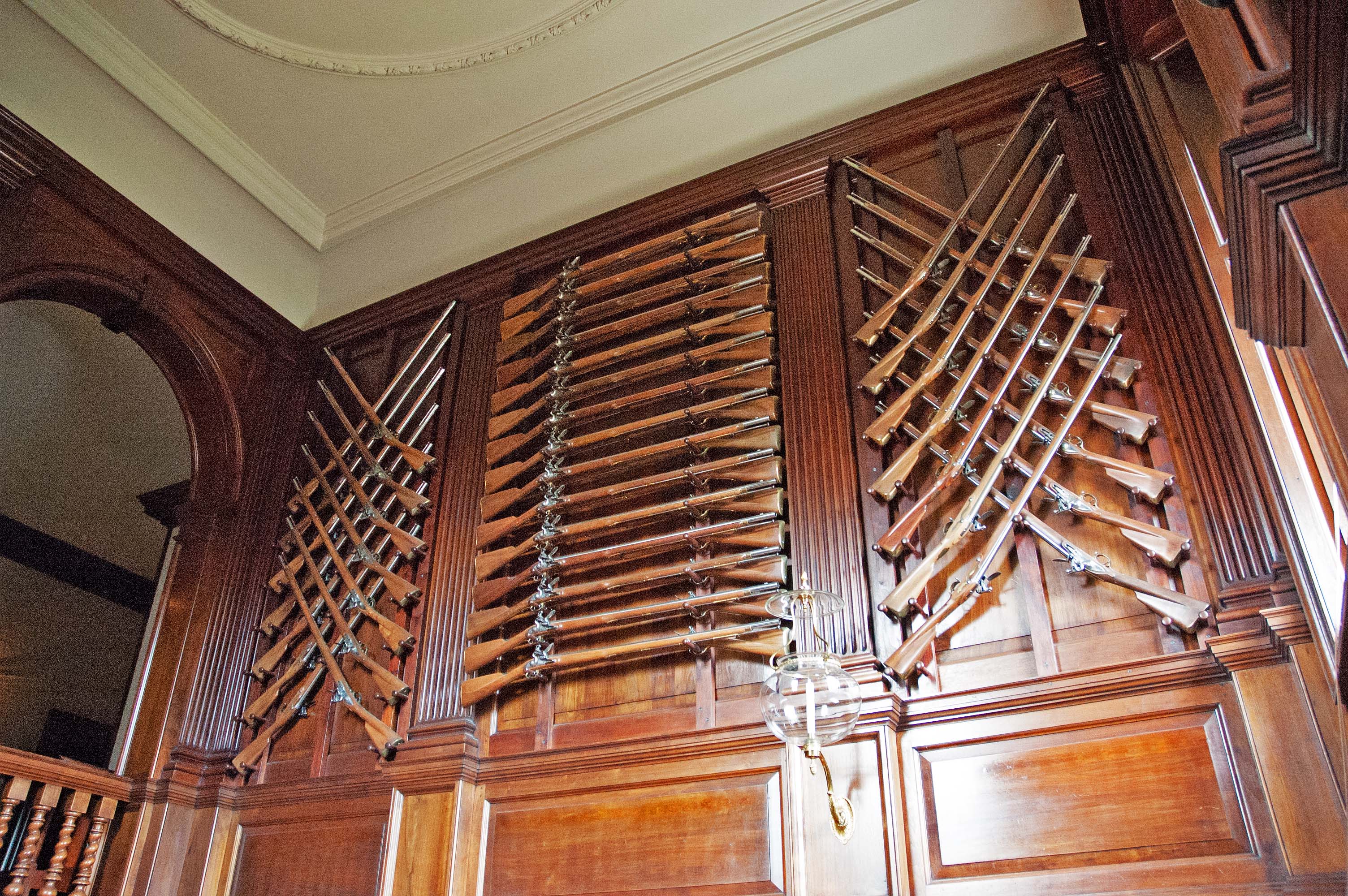
This is the Governor's Mansion. Notice that it is an example of heraldic symmetry, like we saw at Mt. Vernon. Notice that the dormers are in line with the lower windows, matching and balancing chimneys, similar out-buildings on each side. Carolyn Fenzl, a member of our cancer support group, told us that her sister was a docent in the Governor's Mansion. It was beautifully decorated and furnished. Inside the entry and the staircase were many guns and swords on the wall. It was done to give the impression to visiting powers that the town was well armed and prepared to protect what they had.
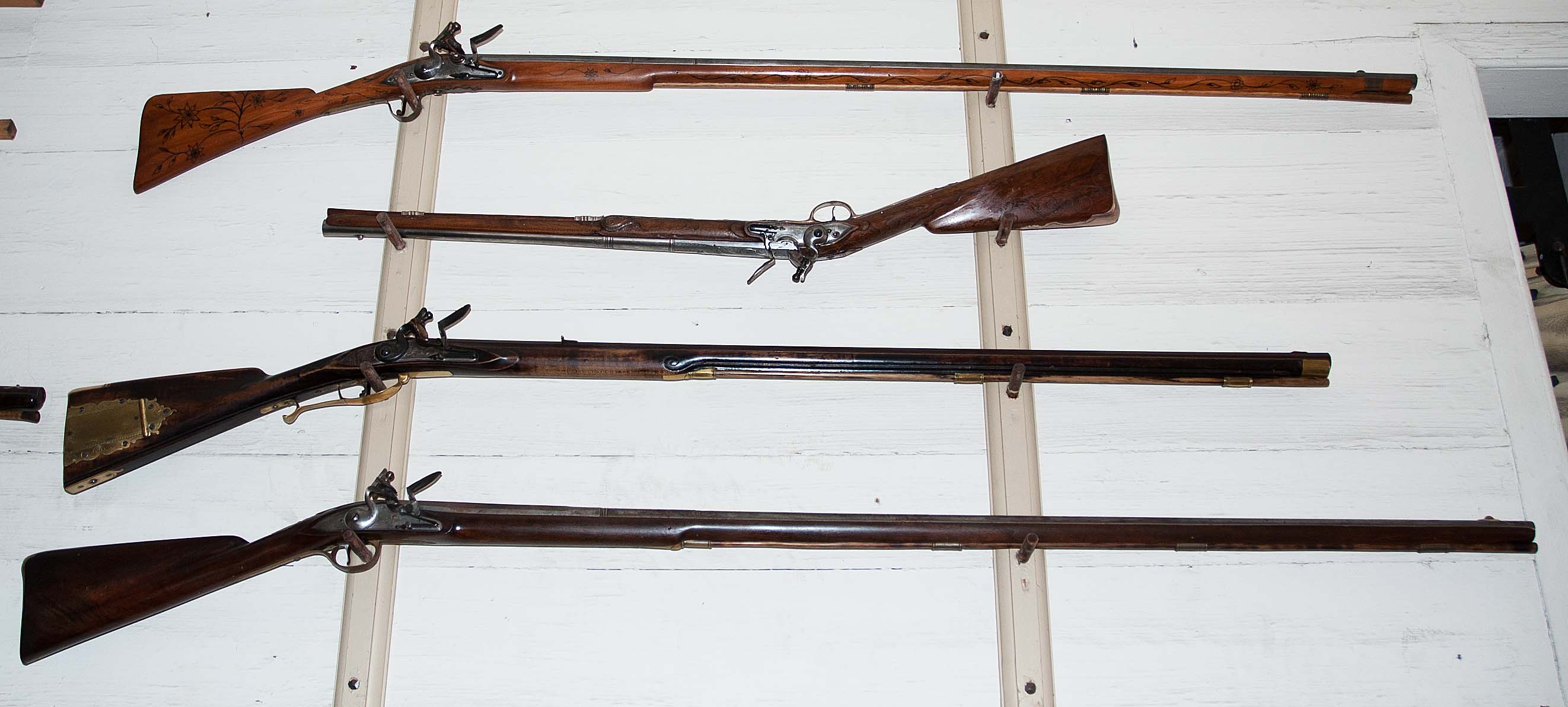
Several workers were in the gunsmith’s shop where one was working on making a long gun. They build them there, at the rate of about one per year. If you wish to own one, you can leave a deposit, wait about 8 years, and you should get what you want. They test fire them all, and they even forge the barrels right there in the shop, and include the rifling of the barrel to make the bullet spin for more accurate shooting. The price? About twenty K.
There was a nice restaurant on the grounds of our hotel, and so we ate with another couple from the bus. In his career he was a radio sports caster in the midwest. Bags out early in the morning, and we will be on our way again.
|
| DAY SEVEN: Monticello 09-24
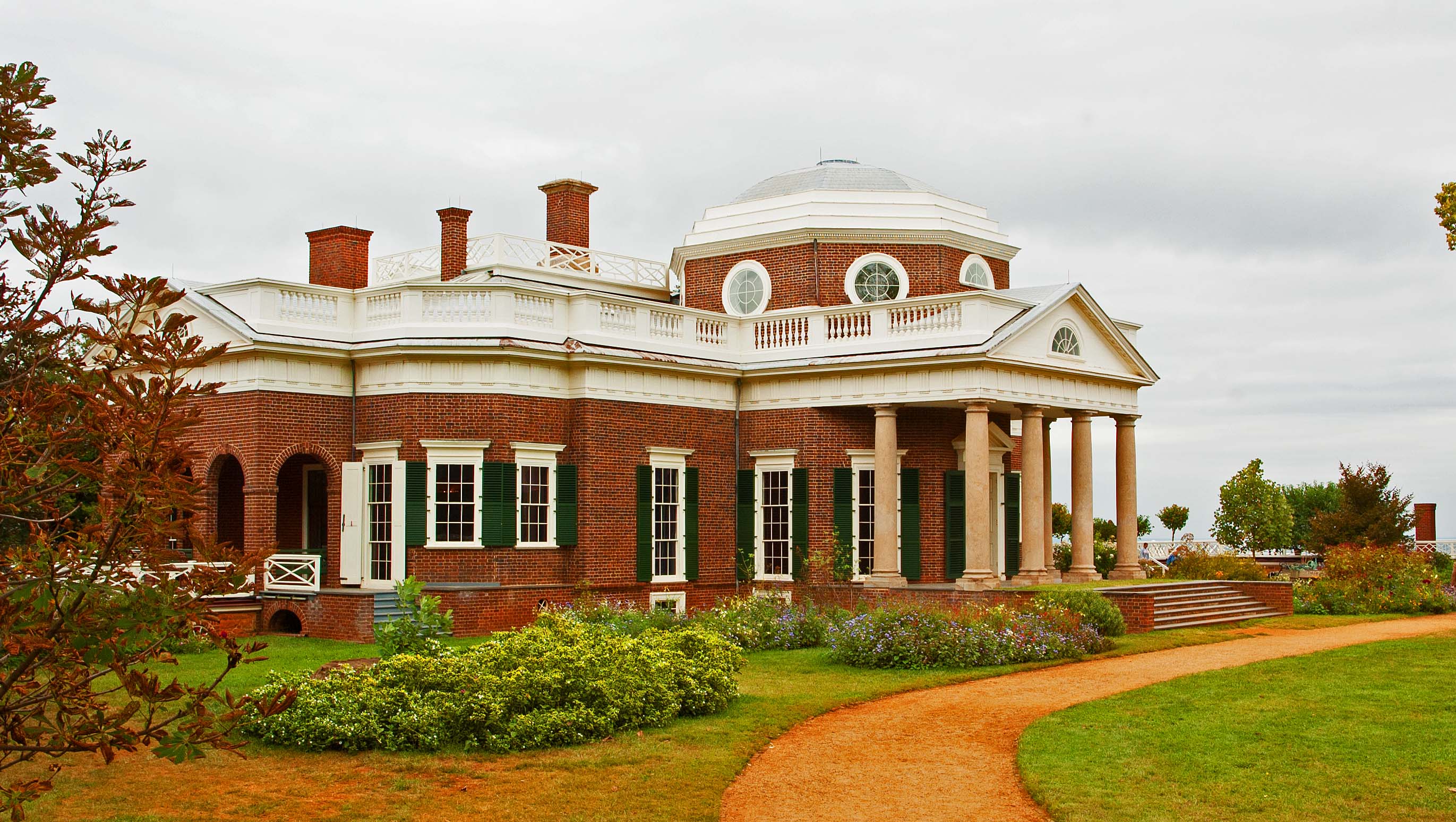
From the Tavern it is a short ride over to Montecello. The former President's home rests on the top of a mountain, and with a spy glass you can see the town. It is said that Mr. Jefferson donated a large sum of money to help build the university, and he could watch the construction progressing from his mountain-top home. The white railing on the right of the home is a rail along a deck that is actually a roof over rooms that are partly buried. There is one on each side. The decks extend out for about 100 feet, then turn toward the back for another 150 feet, terminating at a small building at each end. The left wing contains servants' quarters, the kitchen, and some storage. The right wing contains a large water storage cistern, horse stables and more storage. Directly elow the house are food storage rooms. The rain water that falls on the decking is routed to the large cistern for storage. Below is the view of the front, from the left side.
...and the view below is from the right side, with the front entry to the left of the image.
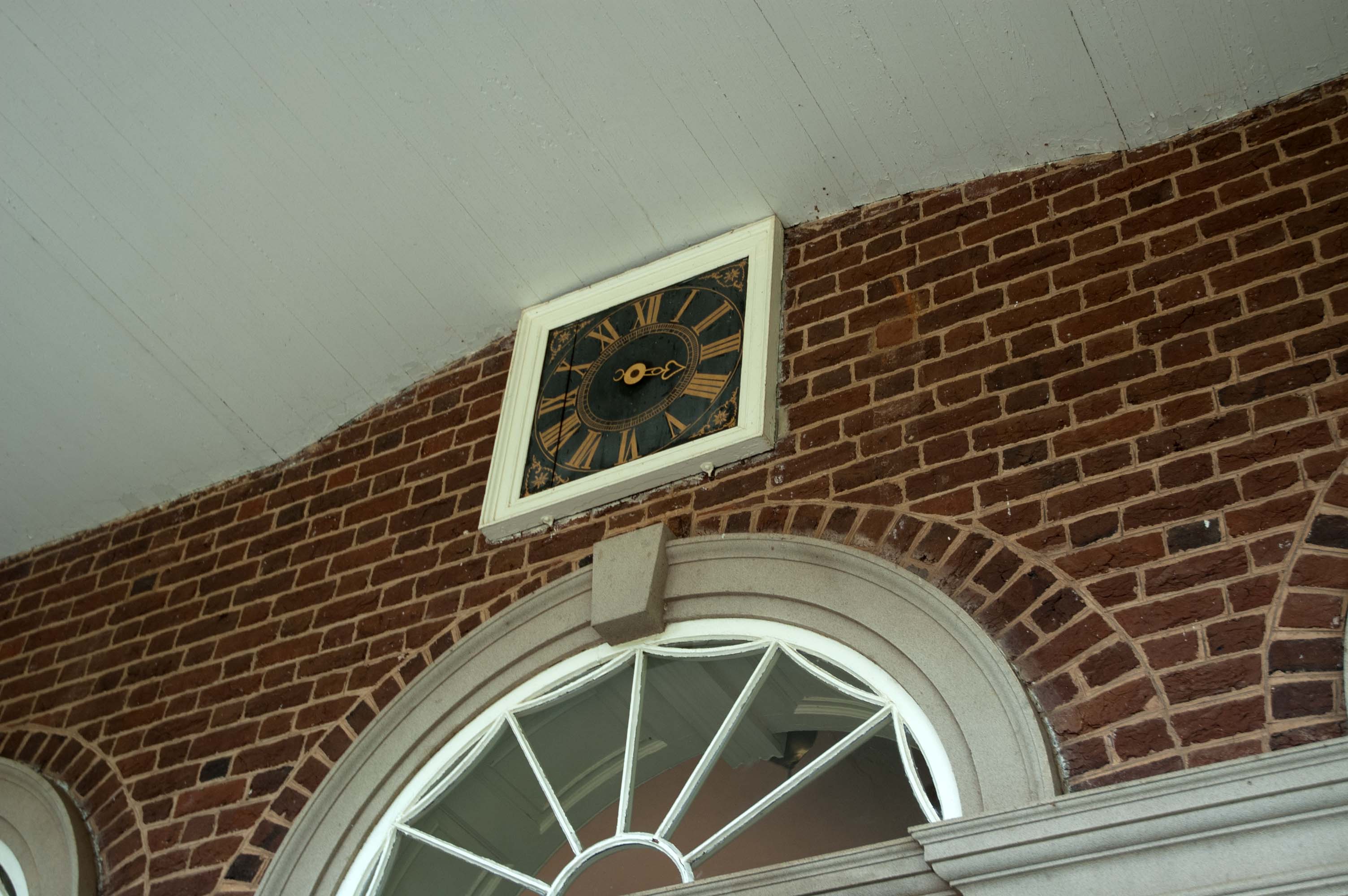
Above the front door, there is a clock face. It only uses a single hand which is the hour-hand. The clock movement is inside the front hall. The power for the clock is the weight of several cannon balls hung on a cable. They hang over to one side in a corner. Because they move down the wall toward the floor a little further each day, Jefferson put the day of the week on the wall. The cable and cannon balls drop so far in seven days, Saturday is in the basement, and a hole in the floor allows the balls to progress downward unrestricted. There is a set of hands and clock face inside the front hall also.
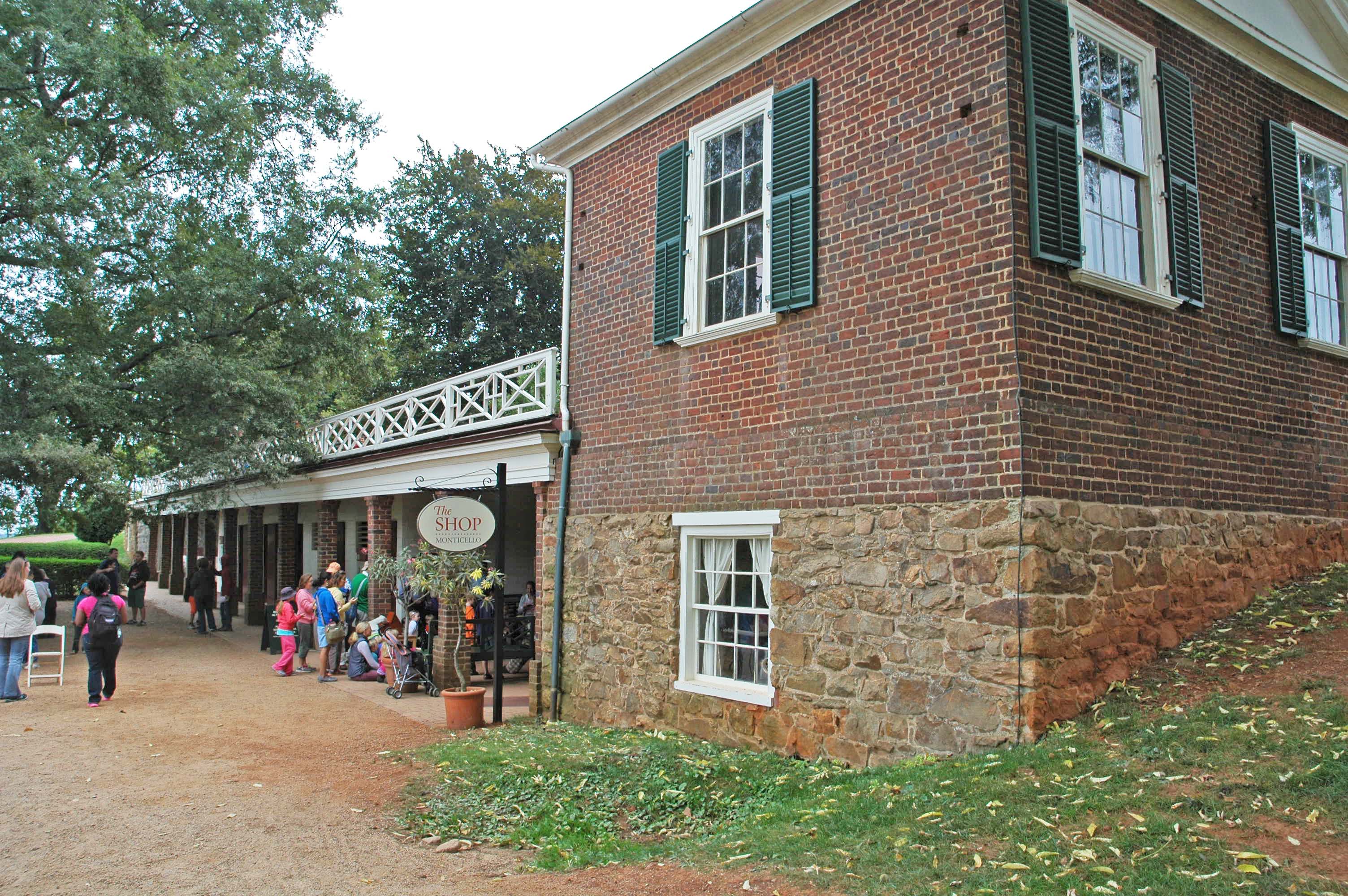
This is taken from behind the small building that is at the end of the decking that extends out from the right side of the home and then turns and goes back, behind the house. This is the side that has the horse stalls. They have opened a gift shop in the old tack room in the basement of this building.
Back on the bus we are headed to the Stonewall Jackson Hotel in Staunton. We have dinner and are getting ready to bed down and I check my e-mail. Just as I am sending out a letter... Boom! The computer goes down. Clear down! I fire it up again and just as it starts to ask me my password... Boom! Three times... same thing. It is gone. Dead. DOA! From here on out I am struggling to maintain e-mail contact and keep our blogging information complete. It is not working well. An e-mail to our son Kent and our nephew Ed about the computer and the consensus is that it is dead. So... I go to HP.com and order another, so it will be waiting for us when we get home. |
|
DAY EIGHT: Harper's Ferry and Gettysburg 09-25 After breakfast, we headed out for two destinations today. The first will be Harper's Ferry. I have heard of the town, but I really could not tell you why it was part of history, other than an early American town. I looked it up and it said: THE HISTORY OF HARPERS FERRY HAS FEW PARALLELS IN THE AMERICAN DRAMA. It is more than one event, one date, or one individual. It is multi-layered - involving a diverse number of people and events that influenced the course of our nation's history. Harpers Ferry witnessed the first successful application of interchangeable manufacture, the arrival of the first successful American railroad, John Brown's attack on slavery, the largest surrender of Federal troops during the Civil War, and the education of former slaves in one of the earliest integrated schools in the United States. In the eighteenth century most mechanical devices were built one at a time, and each piece was hand-fitted together so that you could not buy a machine or gun or mechanical device that could be repaired without building a new part for it. It was called "interchangeable parts". Can you imagine owning a car that you could not buy any parts for it? We have all heard songs about John Brown's Body.... we saw a small building where he used to work. He is well known for his work during the Civil War to help the slaves.
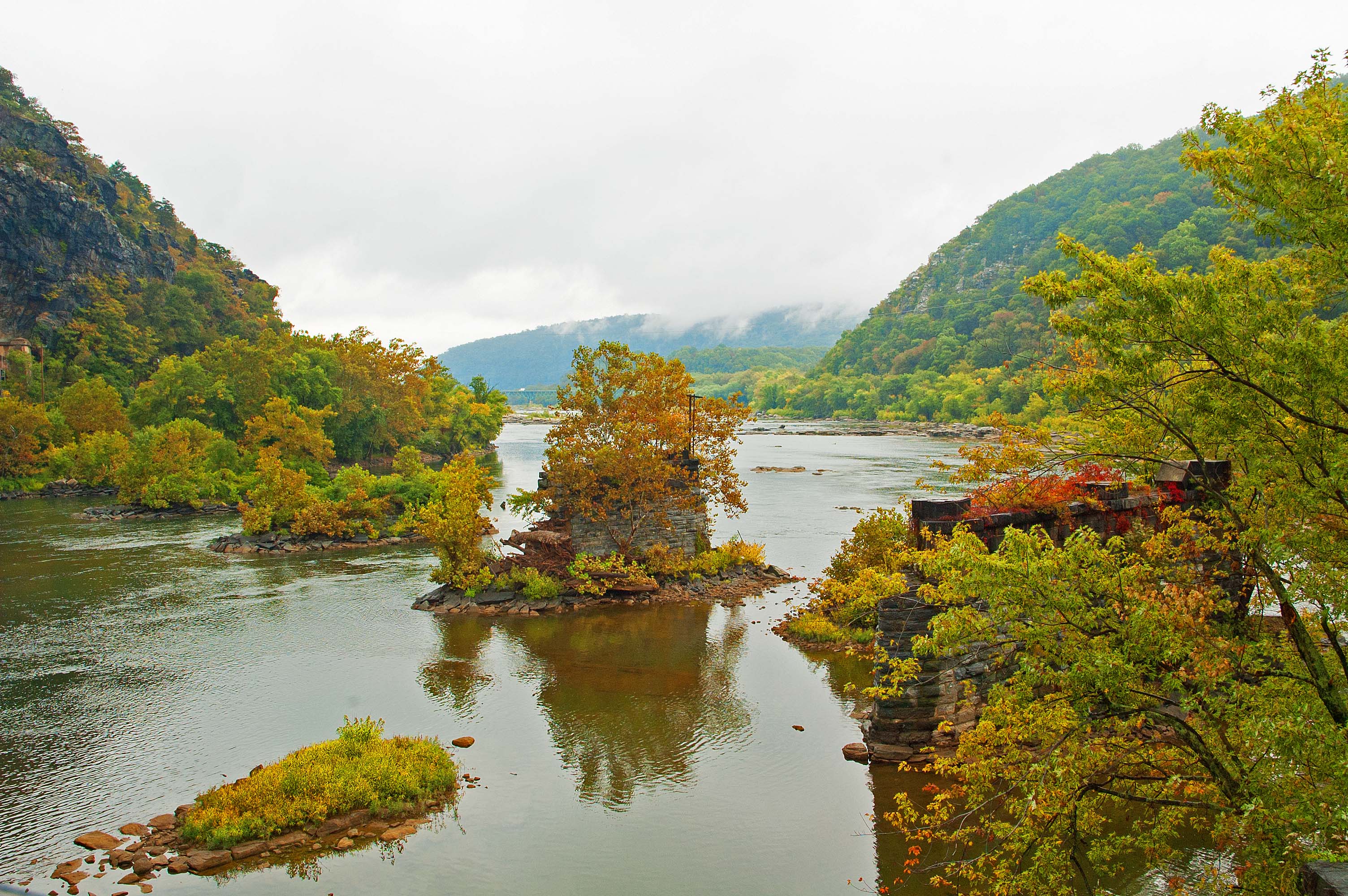
This image was taken from the south-east corner of town, at a place referred to as the "Point". We are standing in West Virginia, looking across the Potomac River. Coming in from the right is the Shenandoah River. The hill to the left is Maryland, and the hill to the right is Virginia. We are looking at masonry standards that used to hold a bridge across the Potomac. There was another discarded set crossing to the right across the Shenandoah. Out of sight to the left is a functioning railroad bridge. Originally, Mr. Harper ran a ferry across the Potomac in this area, after which the local town was named.
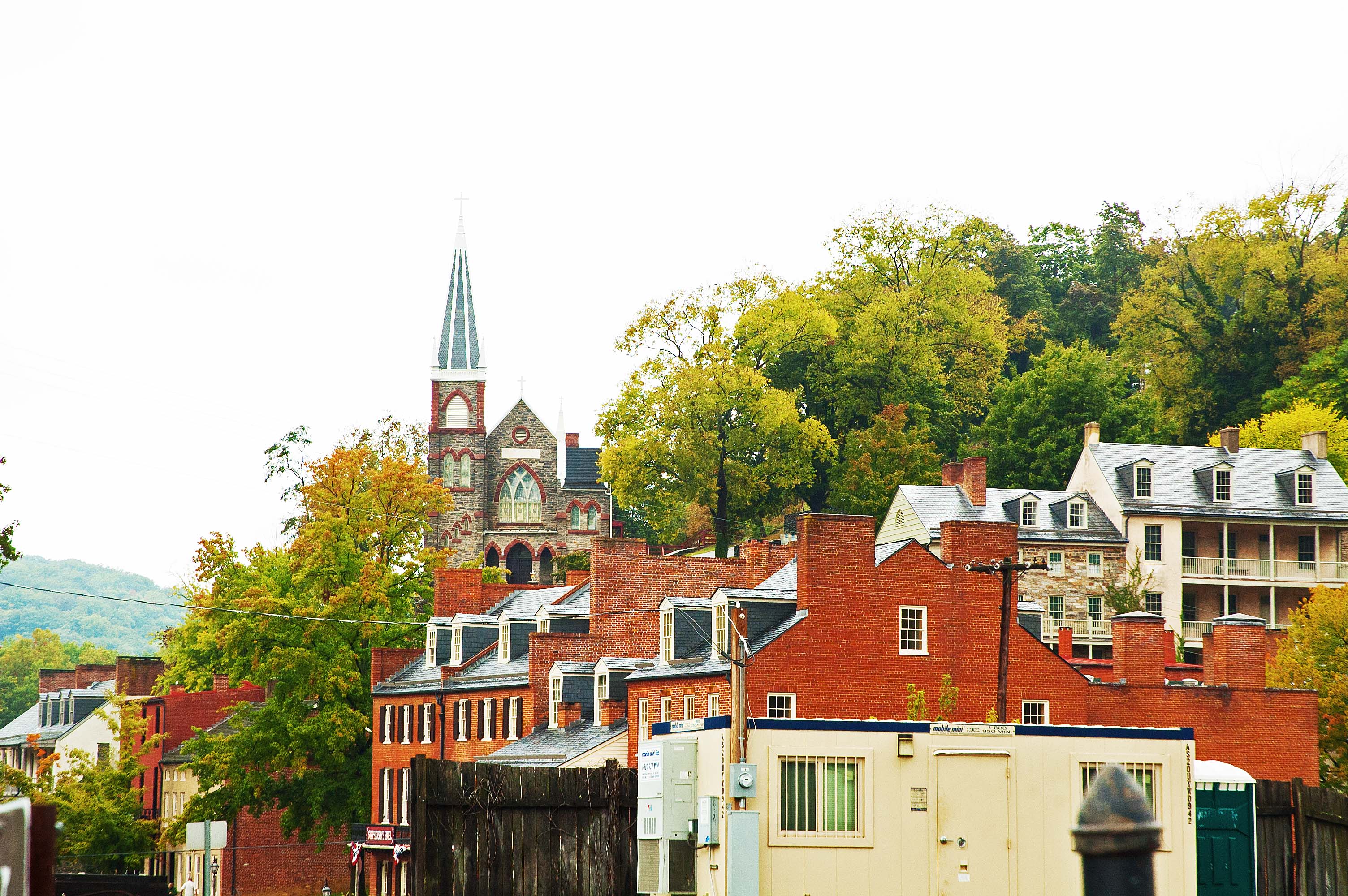
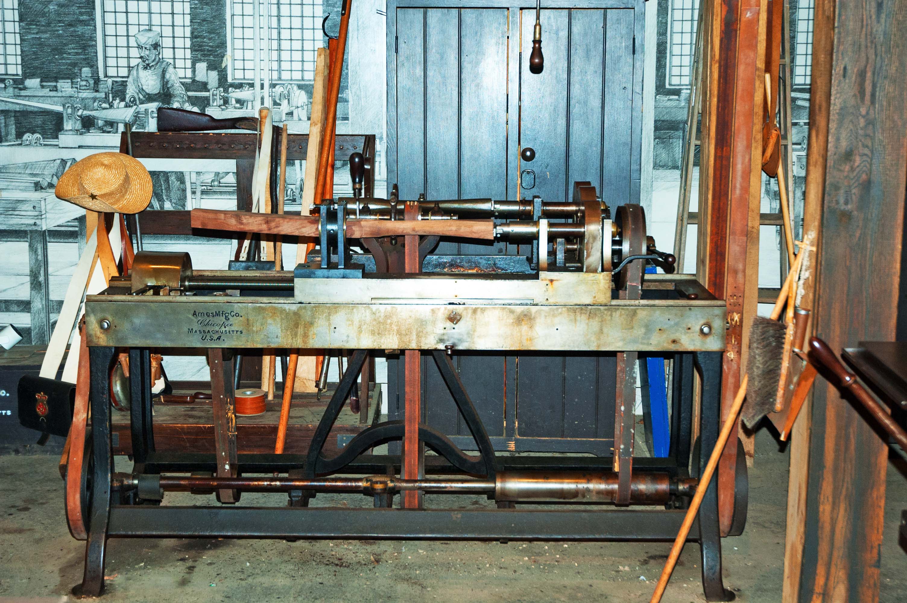
Looking back at the town we see the historic portion of the town, with St. Peter's Cathedral dominant on the hill. There is a building with some machinery set up to show a typical workplace from another time. Notice that the machine is driven by a leather belt on the right side of the machine, coming down from the power shaft running along the ceiling. This machine is a special type of a lathe that is able to automatically carve a rifle stock from a piece of wood. The machine follows a pattern that rough-cuts the shape and then it is hand-finished.
It was very peaceful and quiet in Harper's Ferry when we visited.
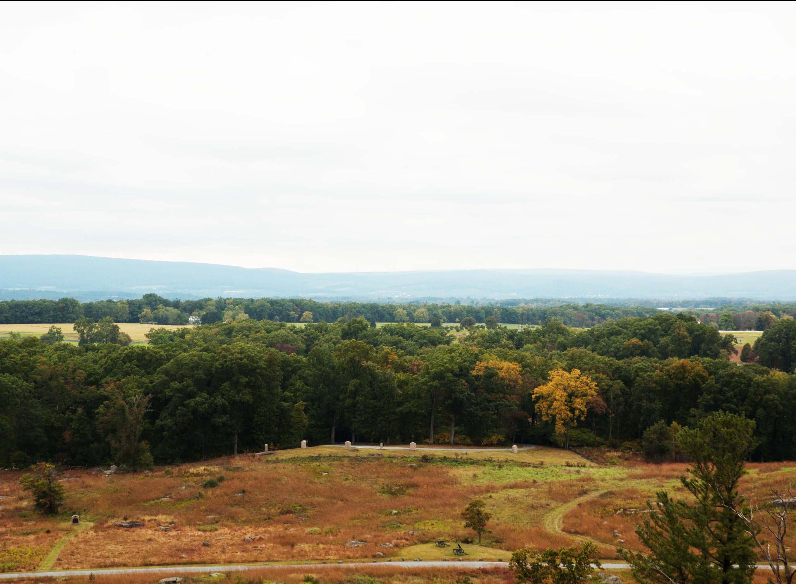
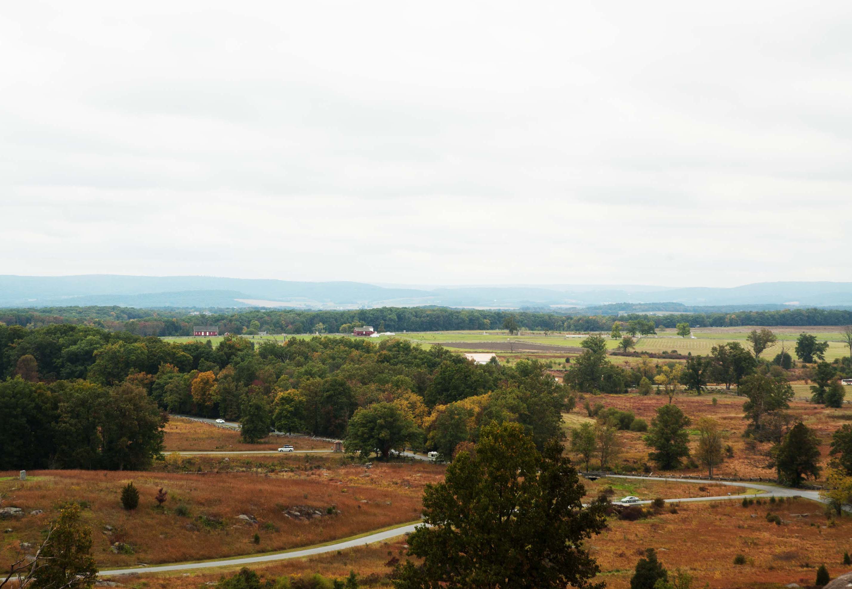
Gettysburg During the American Civil War, when half the states fought the other half, there were many battlefields that hosted battles that ended up having names. Named for a geographic feature or a nearby town, the battle of Gettysburg (July, 1863) has held a special place in history. How large was the battle ground? If you can see it in this image, it was part of it.
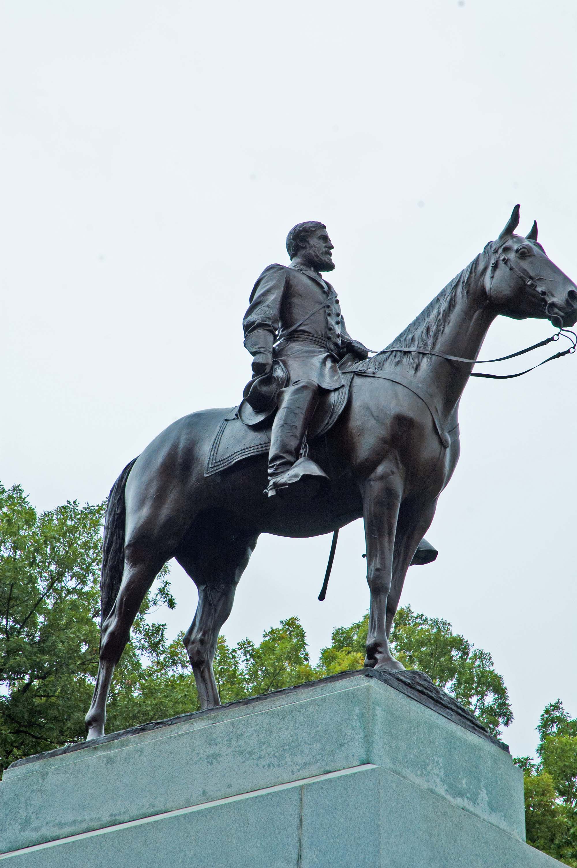
On this land stands 1,320 monuments (12 representing whole states instead of battles, groups of soldiers, or officers), 410 cannon, 148 historic buildings, 2 1/2 observation towers, and 41 miles of roads and lanes (8 unpaved). About 8,900 soldiers died and more than 22,000 soldiers were wounded in this three-day battle. The State of Virginia placed this monument and it is the largest equestrian monument on the battle field. It depicts General Robert E. Lee riding his horse 'Traveller' [sic].
The largest monument on the battlefield was erected by the State of Pennsylvania, and it contains the names of everyone of the 34,530 soldiers that fought on that battlefield. The base is 100 feet square. We spent the evening in Courtyard by Merriott Gettysburg, after a very busy day.
|
| DAY NINE: Philadelphia, PA 09/26 Bags out by 0700... breakfast and then on the coach. Destination: Philly.
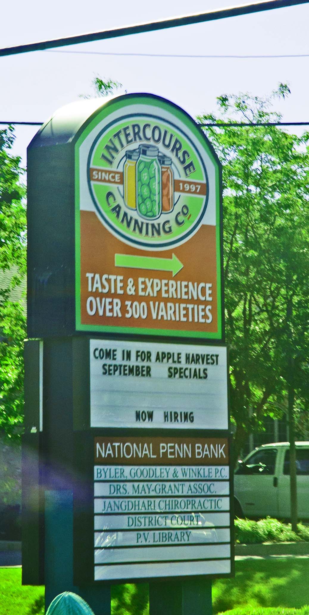
They loved the Pennsylvania area that is referred to as the Amish Country. This is where many people from the early settlers and beyond lived/live that practice somewhat strict lifestyles. Many do not take advantage of autos, power tools, or even electricity in many cases.
We asked Bessie about where they had been on a particular trip and she spoke fondly of the people and the sights that they had seen on that trip. "Oh," she said, "and we went through ... that town I can't remember its name... it's a raunchy name!" LOL. She was, of course, referring to Intercourse, PA.
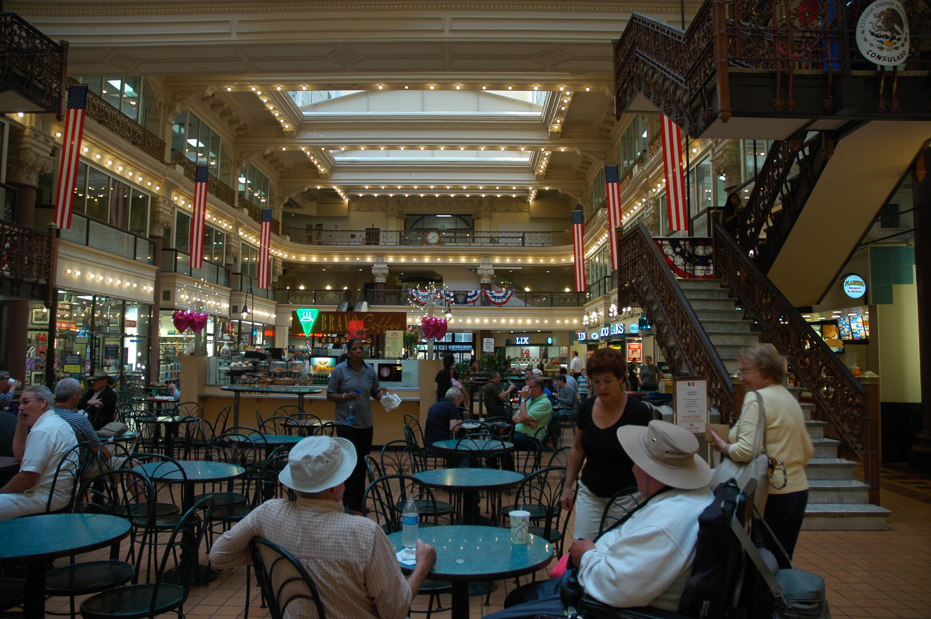
We are 'on our own' for lunch in Philly, but Carlos has arranged for us to meet for a tour through Independence Hall around 2:00 p.m. so we don't want to go too far away. After getting off the bus we spotted a place to eat. It was rather interesting. It was sort of like what large shopping centers call a "Food Court". There is a central eating area with various food kitchens along both sides. This is definitely not a shopping center, but it is an old building that is right downtown. You find the food that you are interested in trying and take it to the tables in the center area. The food was not bad at all.
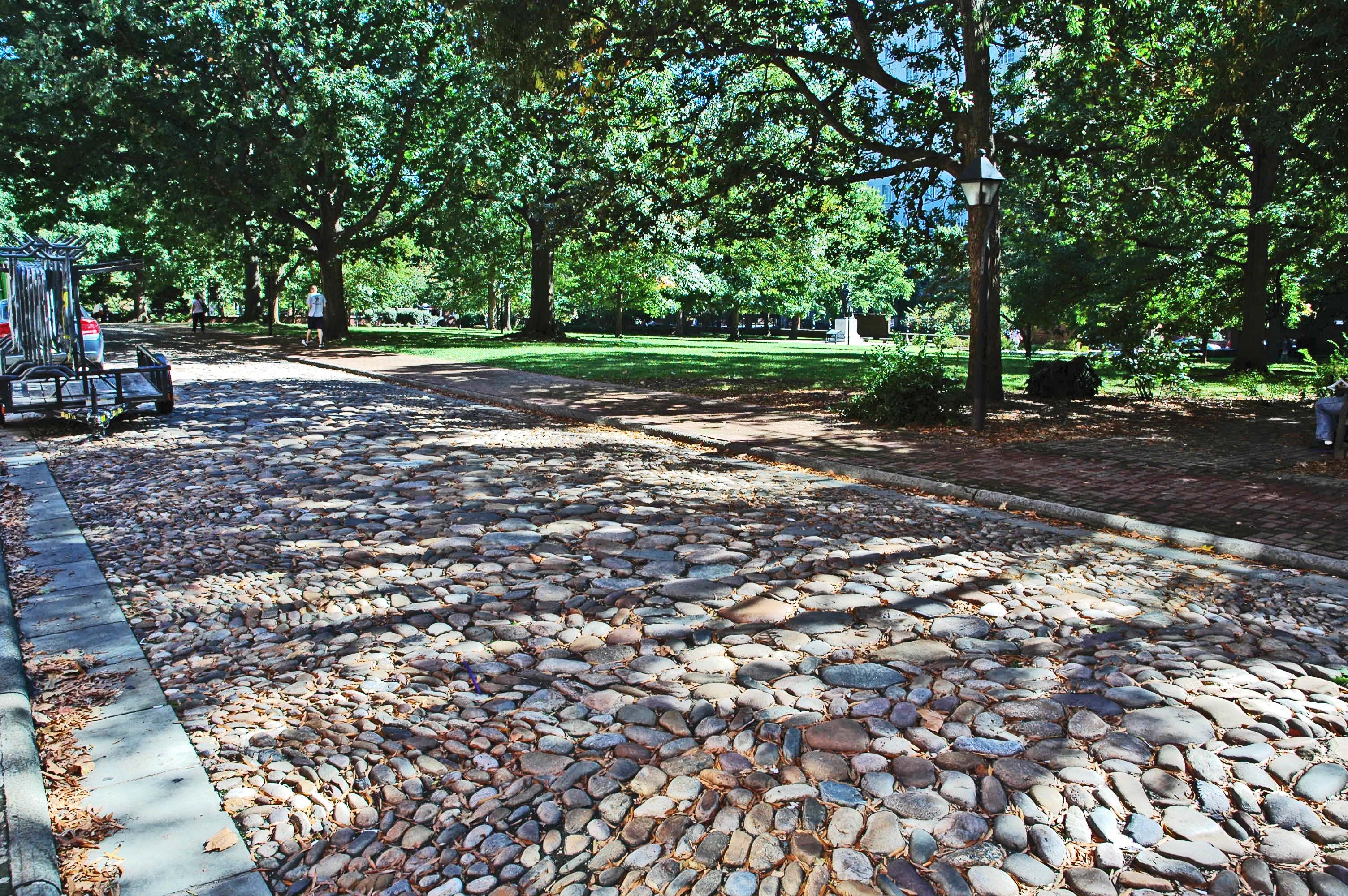
With some time left before our tour we walked around the area several blocks in either direction. Something that is rather rare in the US, especially where we live on the west coast, are the cobble-stone streets that were common centuries ago. I can just imagine a 'steel-tyred' carriage with somewhat limited suspension anyway rolling over each of these stones. Ouch!
v
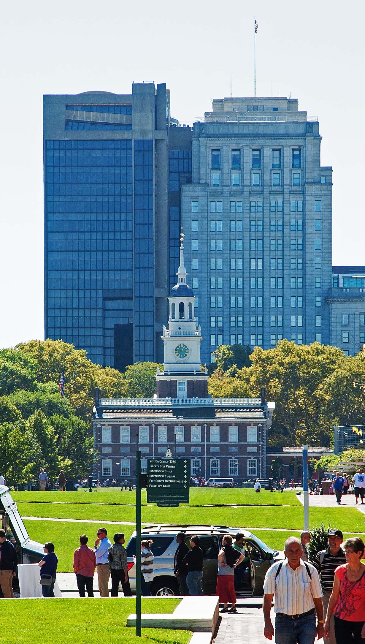
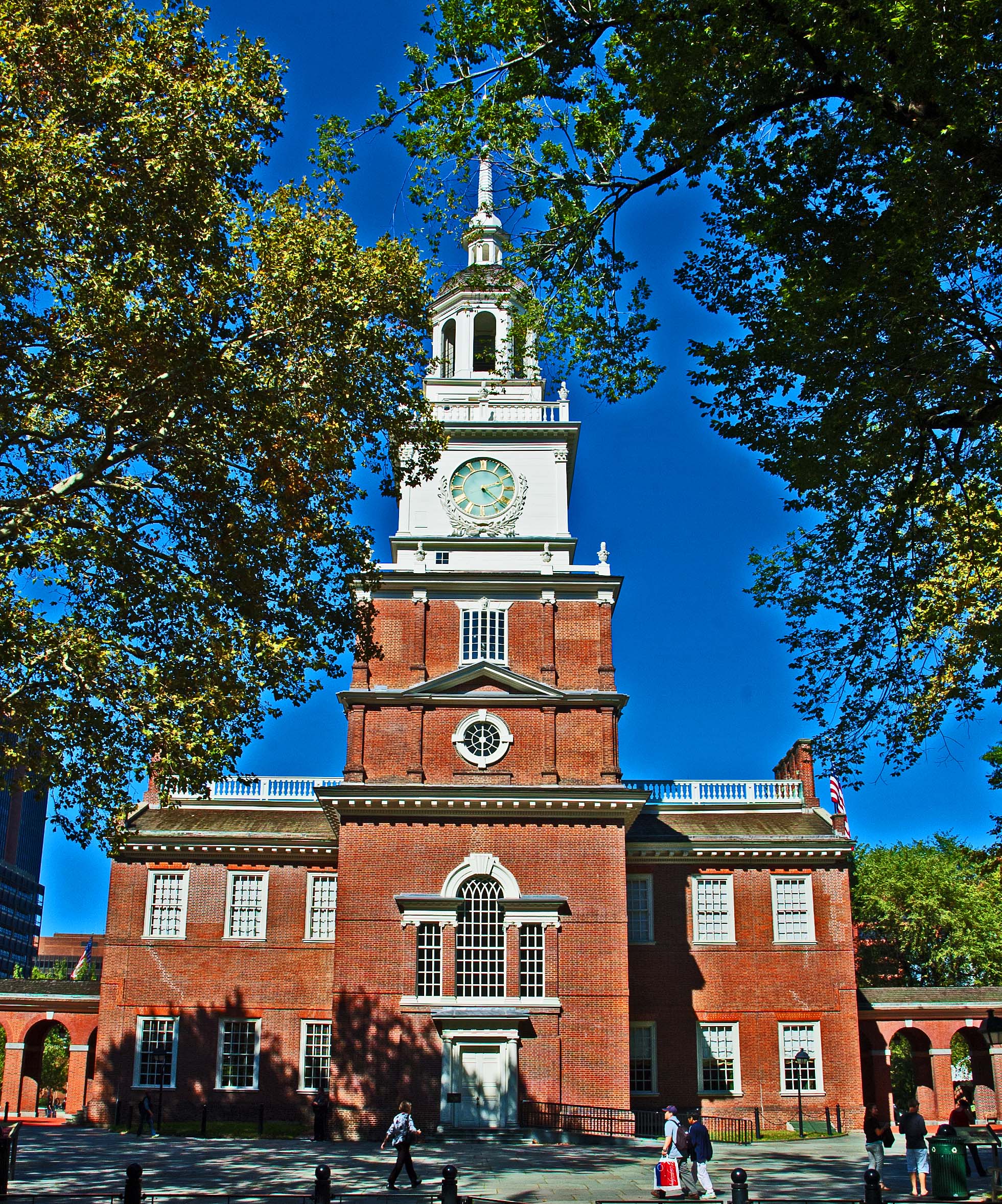
This building was originally the Pennsylvania State House and is said to be where the Declaration of Independence and the United States Constitution were debated and signed. This is the north face of the building. On the other (south) side of this building is a park, and is the side in which we entered the building.
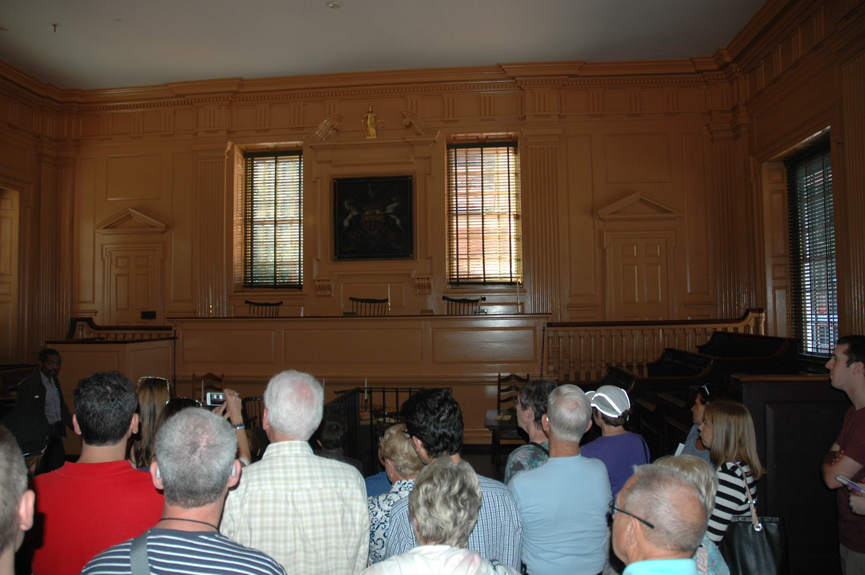
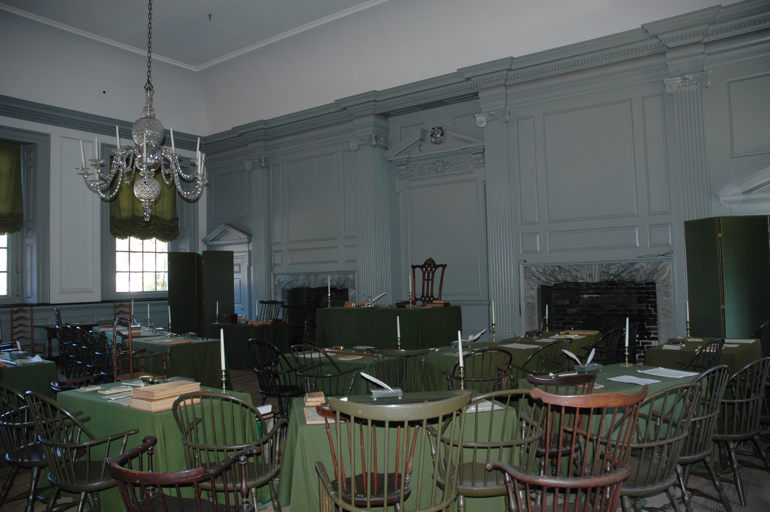
To either side of the center of the main building are the two main meeting rooms, where the Assembly and the Supreme Court met. It was used by the Second Continental Congress. The room on the left is the Assembly Room and the room on the right is the Supreme Court Room.
Our day ends at the Sheraton Society Hill Hotel.
|
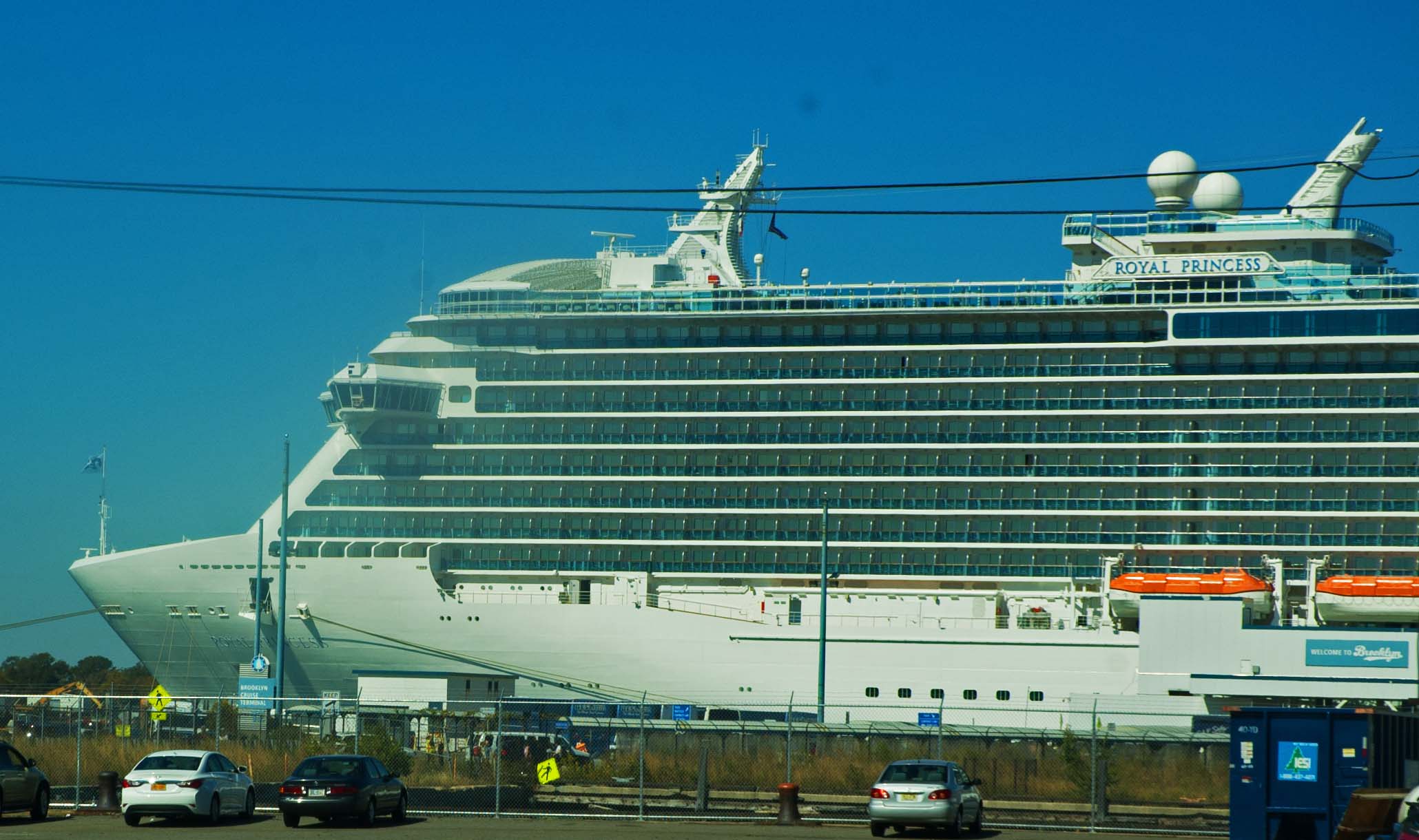
| DAY TEN: Embarkation 09/27 Breakfast and then onto the coach for our ending stretch to New York. Brooklyn specifically, which is where our terminal is that is used for the larger ships. We are sailing on the Princess Royal, one of the two latest ships Princess Cruise Lines has purchased. We are looking forward to it. We have become very much at home on Princess. The whole group seemed to be very pleased with our tour guide, and our bus driver JD as well (he first told us his name and said "just remember Jack Daniels and you will remember my name"). They both were excellent and went above and beyond to make us feel as comfortable and as informed as possible, and our guide Carlos was an excellent teacher in that we learned much of the history that went along with all of what we saw. The first day Carlos passed around a bag of chocolates, telling us how important it was to have chocolate in our lives. LOL. No one argued with that. I did ask if he had any sugar-free chocolate and he said he would see what he could do. The next day and each day after that, he also passed a bag of Hershey's Sugar-Free chocolate which tasted superb. It turned out that almost half of the group preferred the sugar-free. We would definitely encourage others to take this trip. Our bus brought us right up to the ship, which was waiting for us. The ship's people took our bags right off our bus and onto the ship. We did not have to handle it at all.
"Thar She Lies, Cap'n. She's Still Afloat!" We have gotten to know some of the people on our adventure fairly well, and look forward to spending another week with them aboard ship. You would think that with nearly 3,000 people on that boat you are likely not going to run onto someone you know, but it is amazing how some people just keep showing up, or you keep passing in the corridor. But that is good. There was no one on the coach that we would gladly skip seeing again. They were a fun group of people.
|
| CRUISE - We spent the next week on board the Royal Princess, and that can be viewed by going - HERE - |
| DAY Seventeen: Disembarkation in New York
City (Brooklyn)
10/04 The cruise portion is over, and now we are back home in Brooklyn and on our own in New York City. We wanted to stay a few days in Manhattan to see some of the sights. We had never been in "The Big Apple" before. We have to find transportation from the terminal in Brooklyn to the Strand Hotel in Manhattan... 37th between 5th and 6th... right in the heart of the Garment District and next to the Theater District.
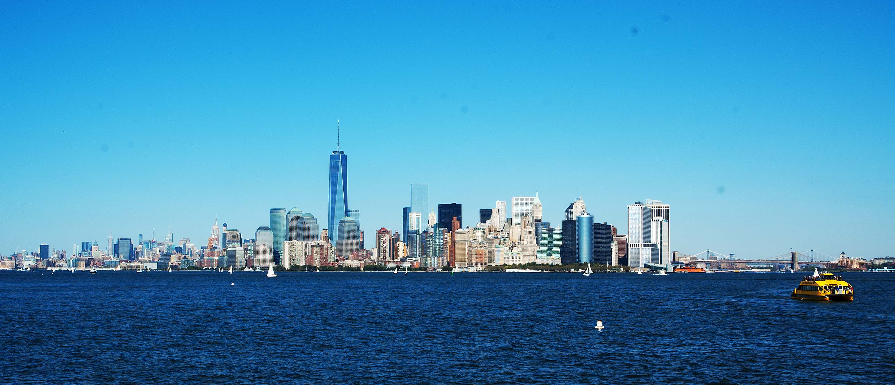
This is the view when approaching New York on a large cruise ship. We have passed under the Verrazano Bridge, and have just passed the Statue of Liberty off our port bow, as well as Ellis Island, and dead ahead is the island of Manhattan. There is a passage to the right, behind the yellow boat, and you can barely see the Brooklyn Bridge just over the boat. The land to the right of the picture is Brooklyn which is where we will berth. Larger ships are placed there. The shining tower is the new One World Center that just opened for businesses to occupy two months after this image was taken. Included in our ticket price was a shuttle to John F. Kennedy Airport, but when we got there, we had to get a taxi to our hotel. It would probably have been better to get a taxi at the ship and go straight over to Manhattan. Part of our tour... a trip through Brooklyn. The shuttle dropped us at the airport where taxis were also dropping people, but because of taxi regulations, you grab a taxi at another location. I had to flag several just-emptied taxis before one thought twice before pulling over for us. He took us over into Manhattan and down 5th Avenue to 37th street, but could not take us to the hotel as 33rd was cordoned off for some reason. So we schlepted our bags half a block to our hotel which was supposed to be there, but we could not see their sign. We were almost there before their sign could be seen. It was a nice hotel. An old hotel. But it was fine. We had a view from the window at the 17th floor level, of a lot of other buildings, some demolition work, very tall buildings, water tanks on every building roof, and a bunch of rear windows. We headed out into the cruel world of 'New Yawk' to get a bite to eat. On our phone GPS we could see a Burger King was within a couple of blocks. That gave us a chance to walk a little and see a lot. Walking back we found a CVS Pharmacy where we could pick up a couple of items we needed and then found our way back to unpack. For dinner we found a nice restaurant a couple of blocks away and walked there.
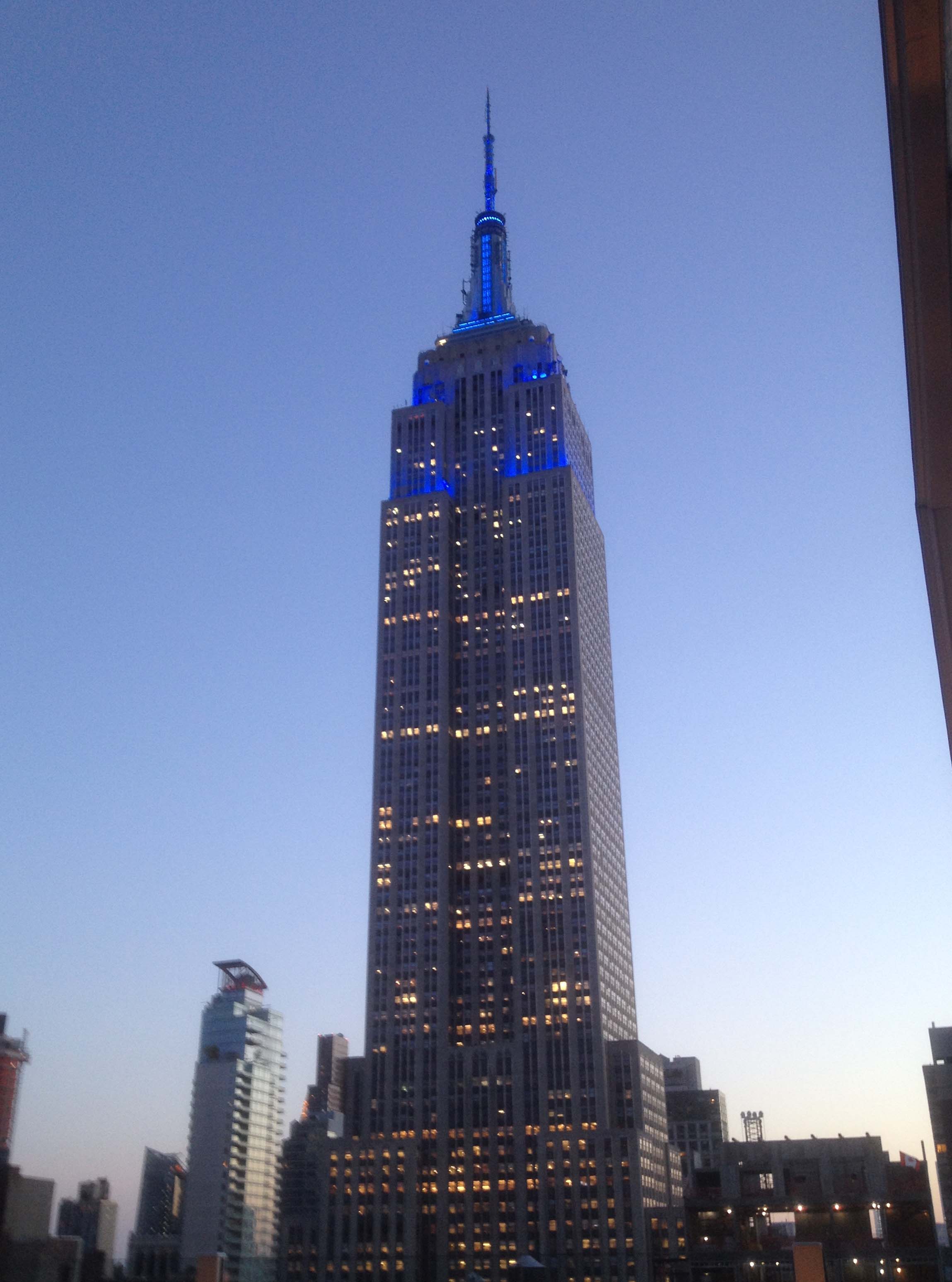
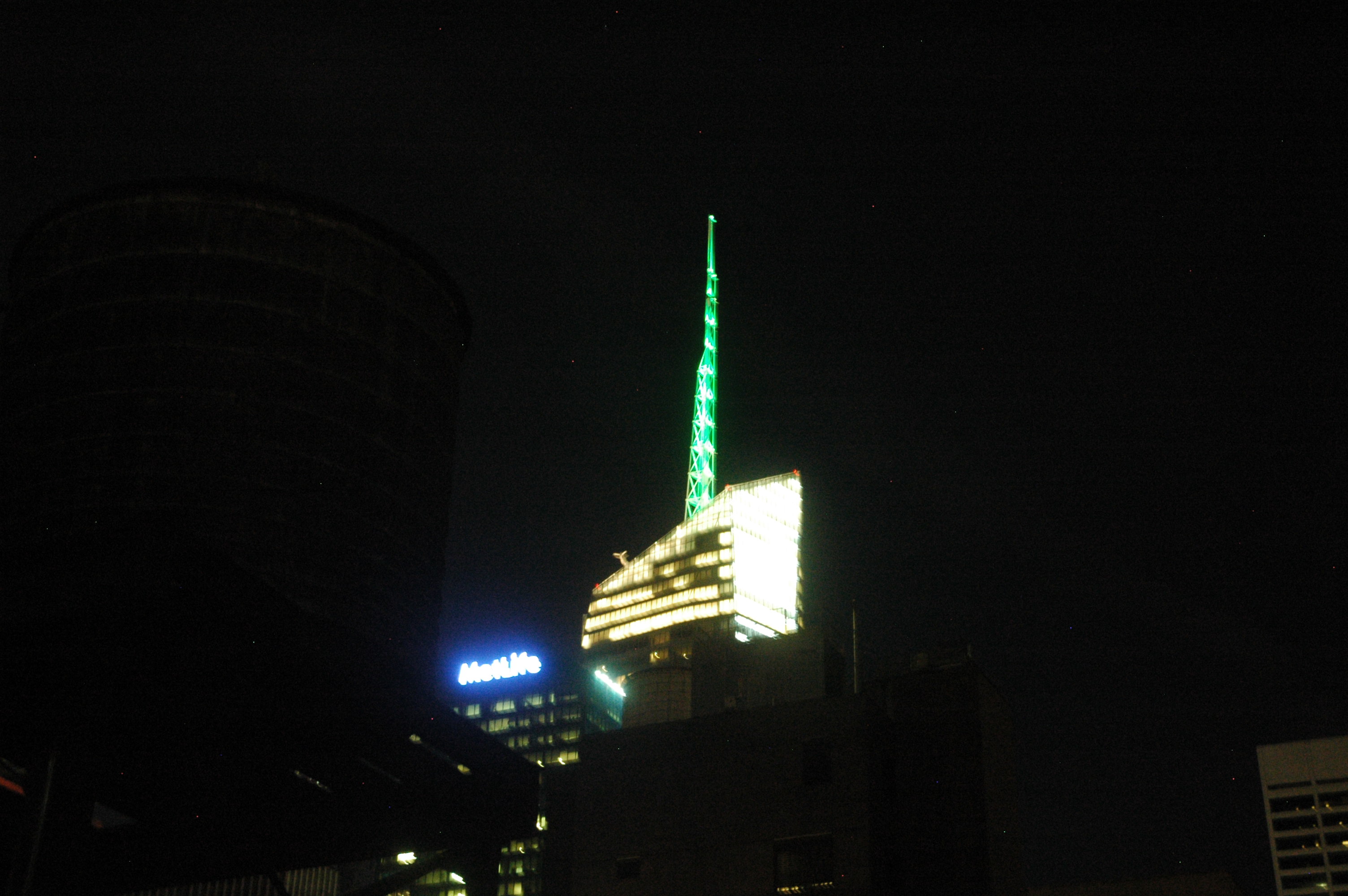
Back in our room, we found that we had a pleasing night light. Our curtains were sheers as well as heavy drapes so we can sleep with just the sheers and we can see the Bank of America building with its tall antenna that changes colors most of the night. Not a bother at all, but actually quite pleasing. Red, White, Blue, Green... a pleasing sight. Sorry for the fuzzy image.
|
| DAY Eighteen to Twenty: Tour of Lower
Manhattan
10/04
Our guide for the day was a native of New York and we got to like him as the day progressed. It was going to be an eight-hour tour so that worked out well.
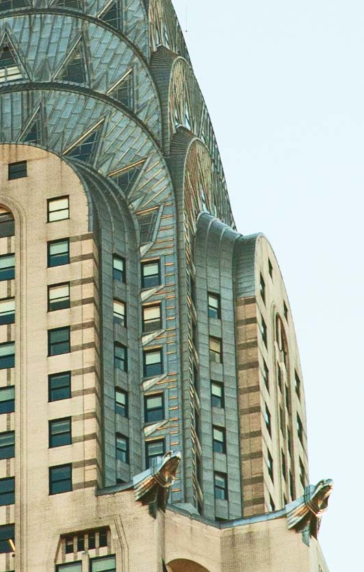
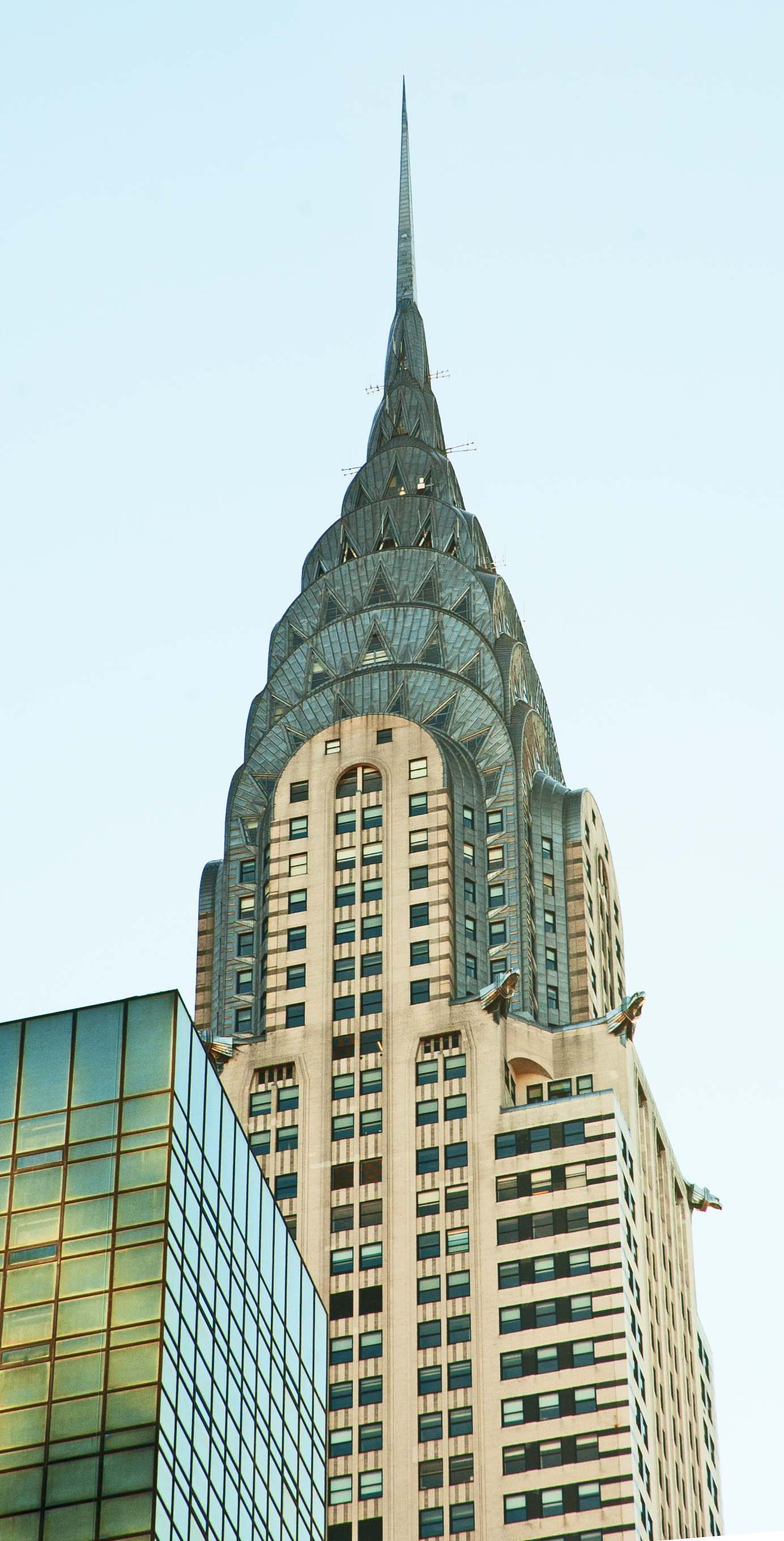
Our first main point of interest was the Chrysler Building. This building was completed in 1930 and was the tallest building in the world... for a whole 11 months, when the Empire State Building was finished. It is still the tallest BRICK building in the world. It was built by Walter P. Chrysler to be the headquarters of the Chrysler Corporation, but he paid for it himself so his heirs would have ownership when he died.
W. P. Chrysler himself had some say in the design of the building, and it is said that those gargoyles that are protruding from the building are facsimiles of the hood ornament of a Dodge car. A lot of stainless steel was used on the building. The intent was to give the building an Art Deco appearance with a "decorative jewel-like crown".
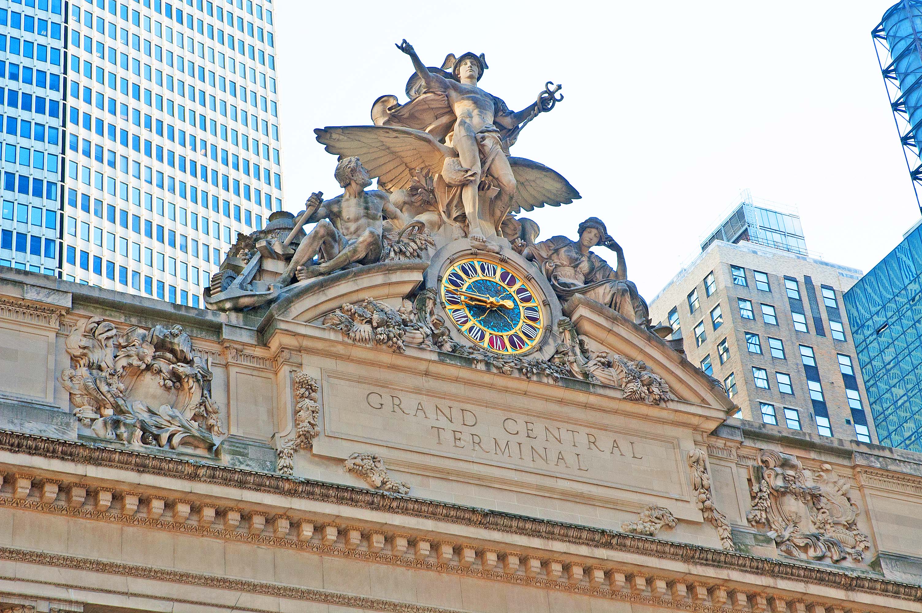
Also in Midtown Manhattan, just about a block from the Chrysler Building, is Grand Central Terminal. It is not called "station" because no trains continue on past this point. The building serves more than 100 rail tracks on two different levels and covers 48 acres. The sculpture on the facade of the 41st street side of the building contains a 13 foot diameter clock that is the largest piece of Tiffany Glass known.
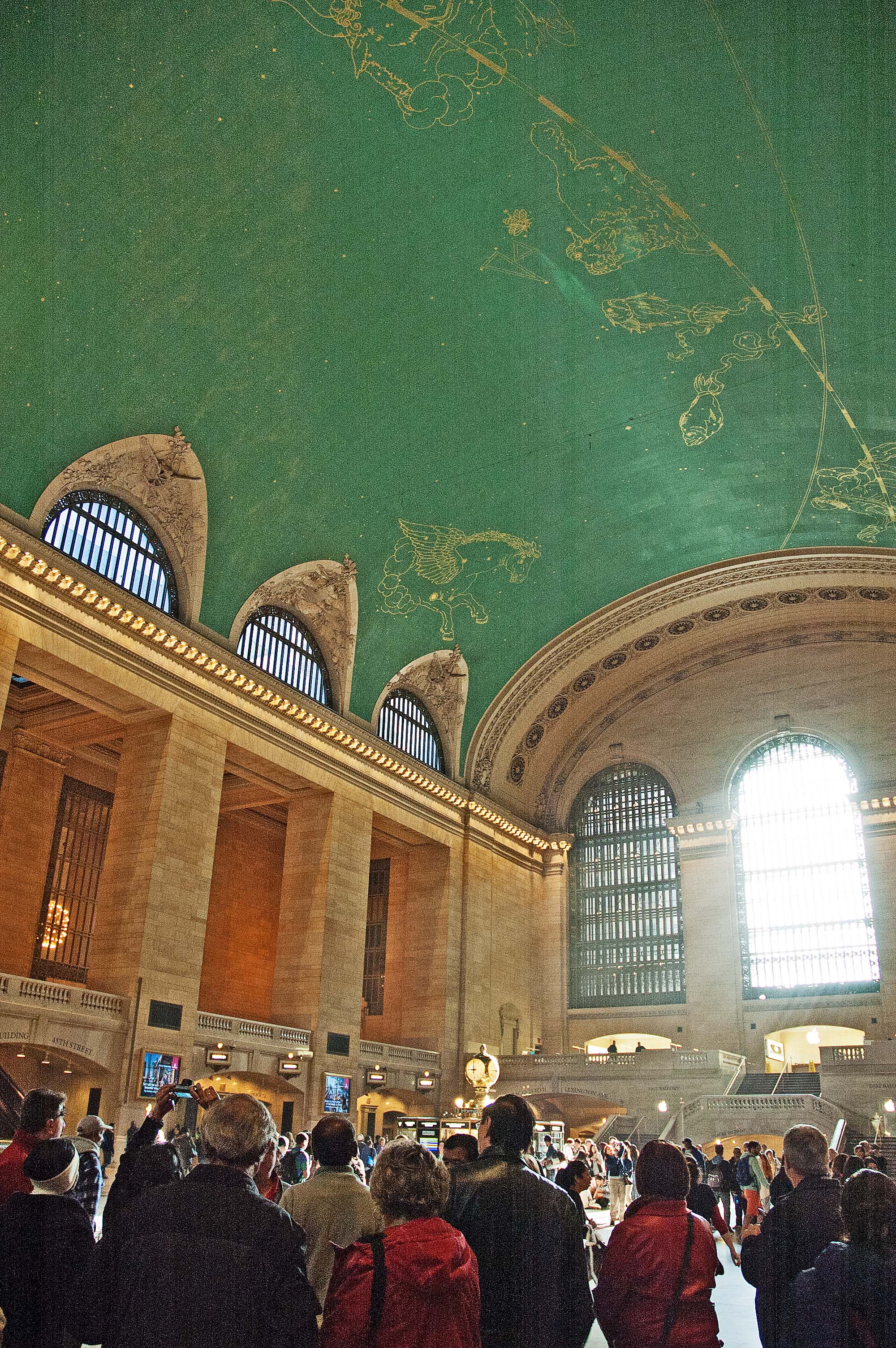
The larger street-level room is the Main Concourse where you check in and where you can purchase tickets. Like many of the old terminal and station buildings this room is cavernous at 275 feet long, 120 feet wide, and 125 feet tall. The ceiling has a reproduction of the starry skies, except that the constellations are painted as you see them from space instead of from the earth.
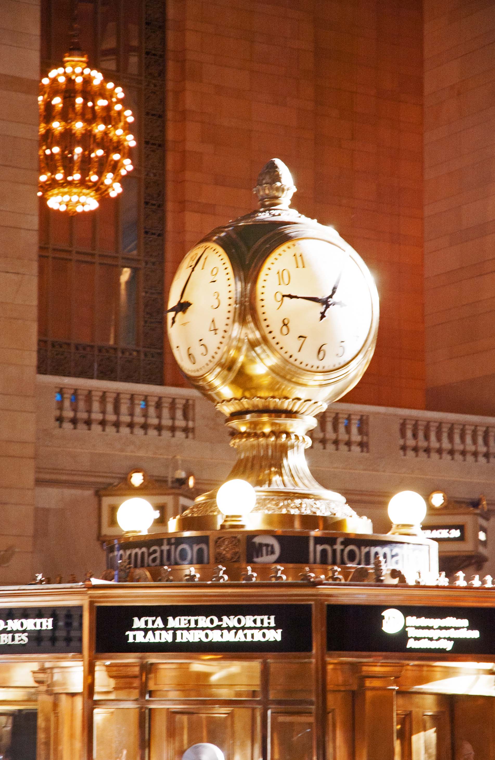
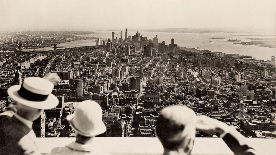
The clock standing on top of the ticket booth is recognizable from many movies. It helps to place the movie character in New York and also indicates time in the movie. The four 24 inch clock faces are made from opalescent glass and are on a main body made from polished brass. In 1998 a 12-year project to clean the ceiling of the Main Concourse was begun because it was so dirty it was difficult to see the stars. It was thought to be covered with coal and diesel smoke, but an analysis of the coating showed that it was tar from nicotine from tobacco smoke. They left a small patch of the dirty ceiling to remind people of how it was. We headed back toward our hotel where we had the opportunity to go inside the Empire State Building and ride elevators inn two stages to reach the Observatory Deck on the 86th floor. Our guide had tickets for us to bypass a lot of people waiting for an elevator. We had to go through airline-type of security, where they allowed me to take my camera and even my camera bag, but I had to leave my two small tripods that are less than six inches long. I guess the round legs looked like dynamite or something. It was a little tricky to go through the lines to return to security to retrieve my items. They gave me a claim ticket for them. Known as the world's tallest building... once... at 103 floors... it was finished in 1931, taking the credit away from the Chrysler Building. It survived the impact of a B-25 Mitchell bomber in 1945 at the 79th floor. That event kept hope alive for when the World Trade Center was hit by a plane. The two buildings were built totally differently however, and the bomber did not contain as much fuel as the later ones did. An old image that was taken from the observation deck at the 86th floor on the day the building opened to the public is shown below, and compared to a later images taken when I was there recently.
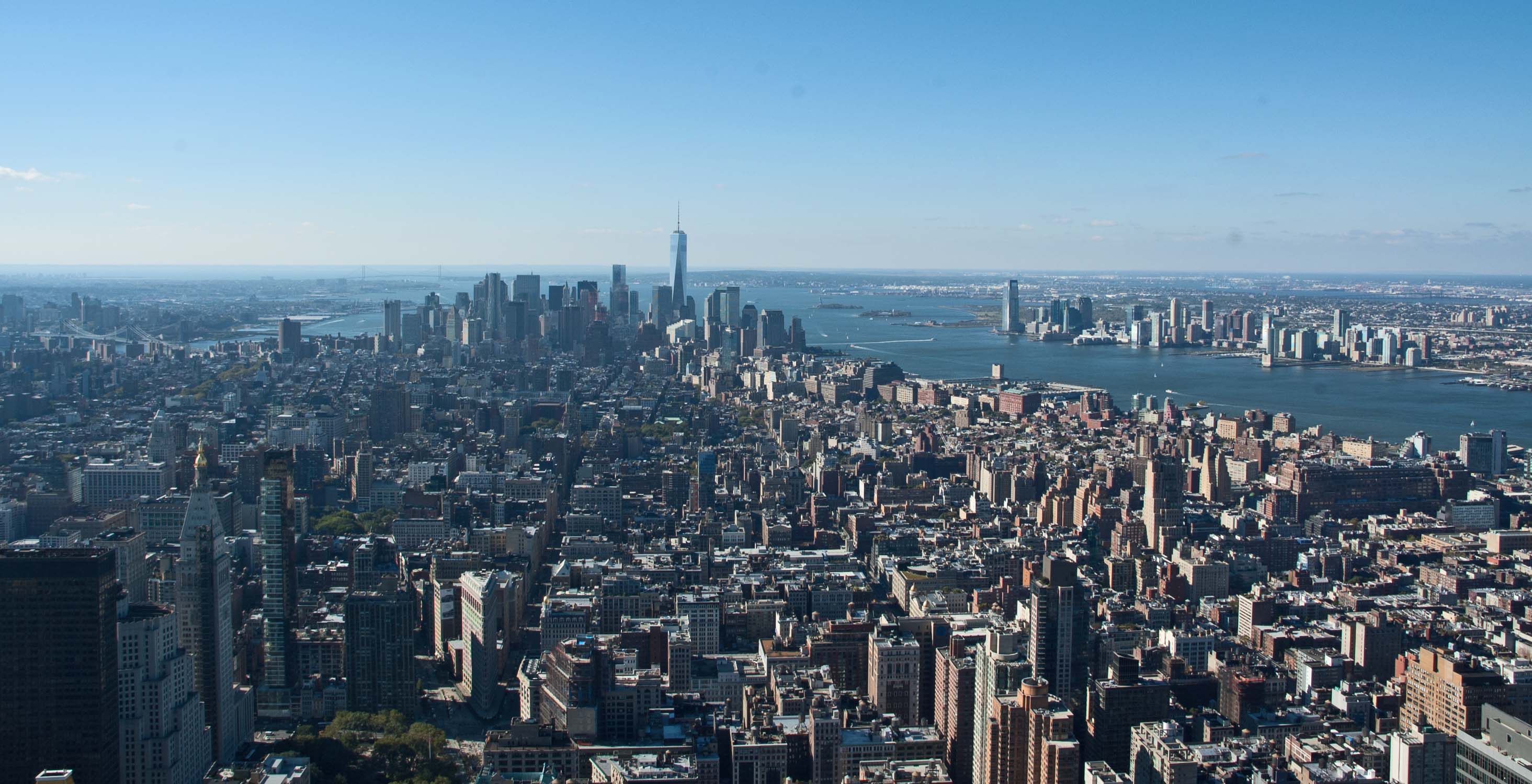
Looking southwest toward the lower tip of Lower Manhattan, we can see New Jersey on the right, across the Hudson River, and Brooklyn across the Harlem River to the left. We can also see the new One World Trade Center in the center of this image. A dozen years ago we would have seen the twin towers of the original World Trade Center standing just to the left of where this tower is now standing. Looking at the first image... the one taken back in 1931, the Brooklyn Bridge is more visible than in the later photo. Also, you can see the small Liberty Island near the New Jersey shoreline, with Miss Liberty standing proudly to greet the newcomers. Turning to the left with the camera, with the One World Trade Center building standing on the right, we can see the city of Brooklyn across the Harlem River. Manhattan Bridge can be seen crossing the river, and in about the center of the image is the Brooklyn Bridge which will require your enlarging the image. In the center of the image is the New York Life Insurance Company building with the gold conical roof. That is actually covered over with 25,000 gold plated tiles. Certainly a visible landmark. Swinging further to the south-east, the gold roof is in the lower right corner.
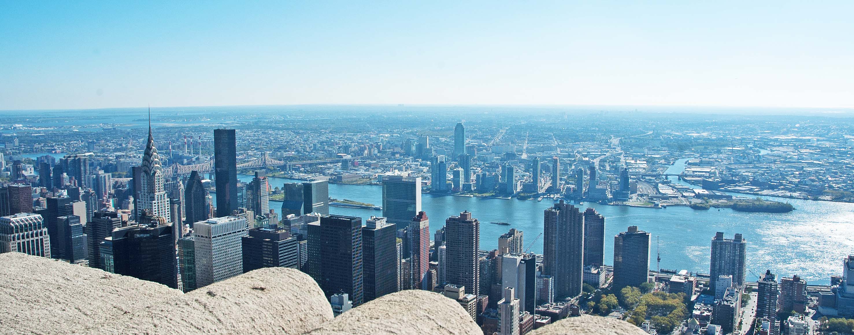
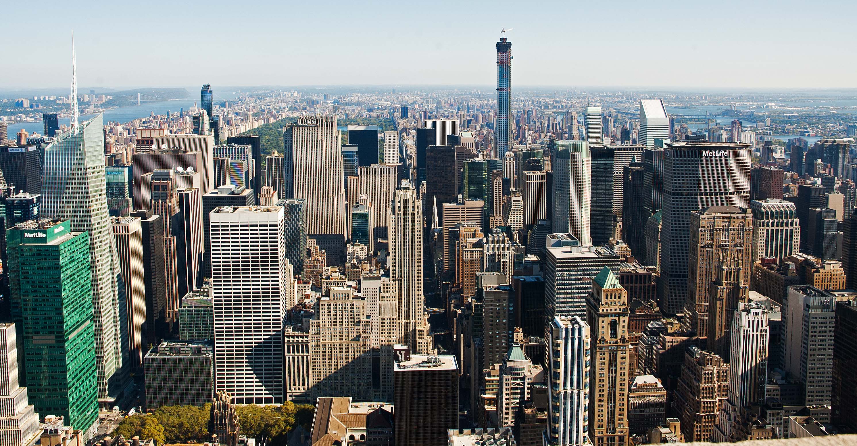
Looking to the north-east, below, we can see the Chrysler Building on the left near the dark tower.
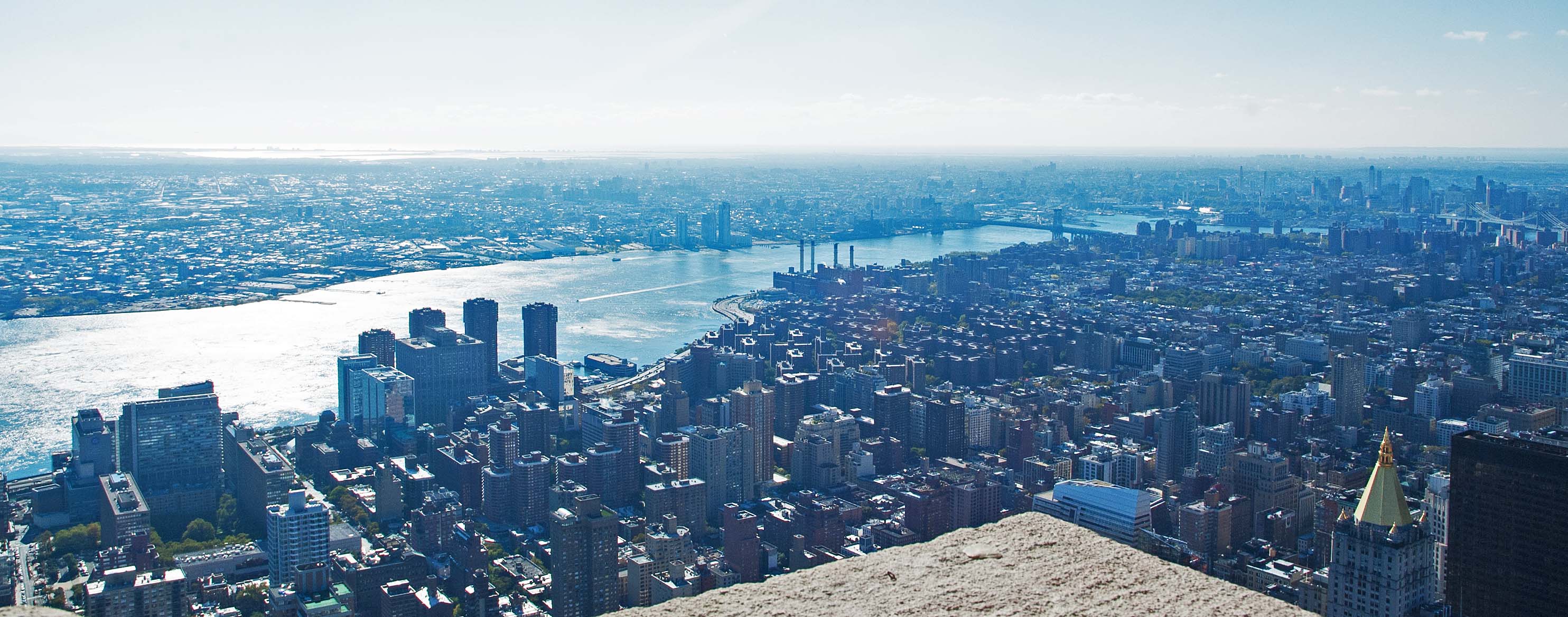
Notice the last building to the left, the one that looks like it has a nice observation deck at the top. You will see it again in the image below, which is looking directly north from our view point. That same building is near the right side of the next image. To the left of that building is a taller building with the name MetLife on the top. Grand Central Terminal lies between MetLife and the brown building that is blocking our view of the lower part of MetLife. Looking back at the image above lets us see how far the Terminal building is from the Chrysler building. To the left of the image is a green building, with a taller building behind it with a radio tower above it. The green building is another MetLife building. The taller building is a banking building, and the radio tower on top is lighted so that it changes colors every half a minute or so, changing to four different colors. These two buildings were our direct view from our hotel window. Our hotel is in a direct line from where the camera is and those two buildings.
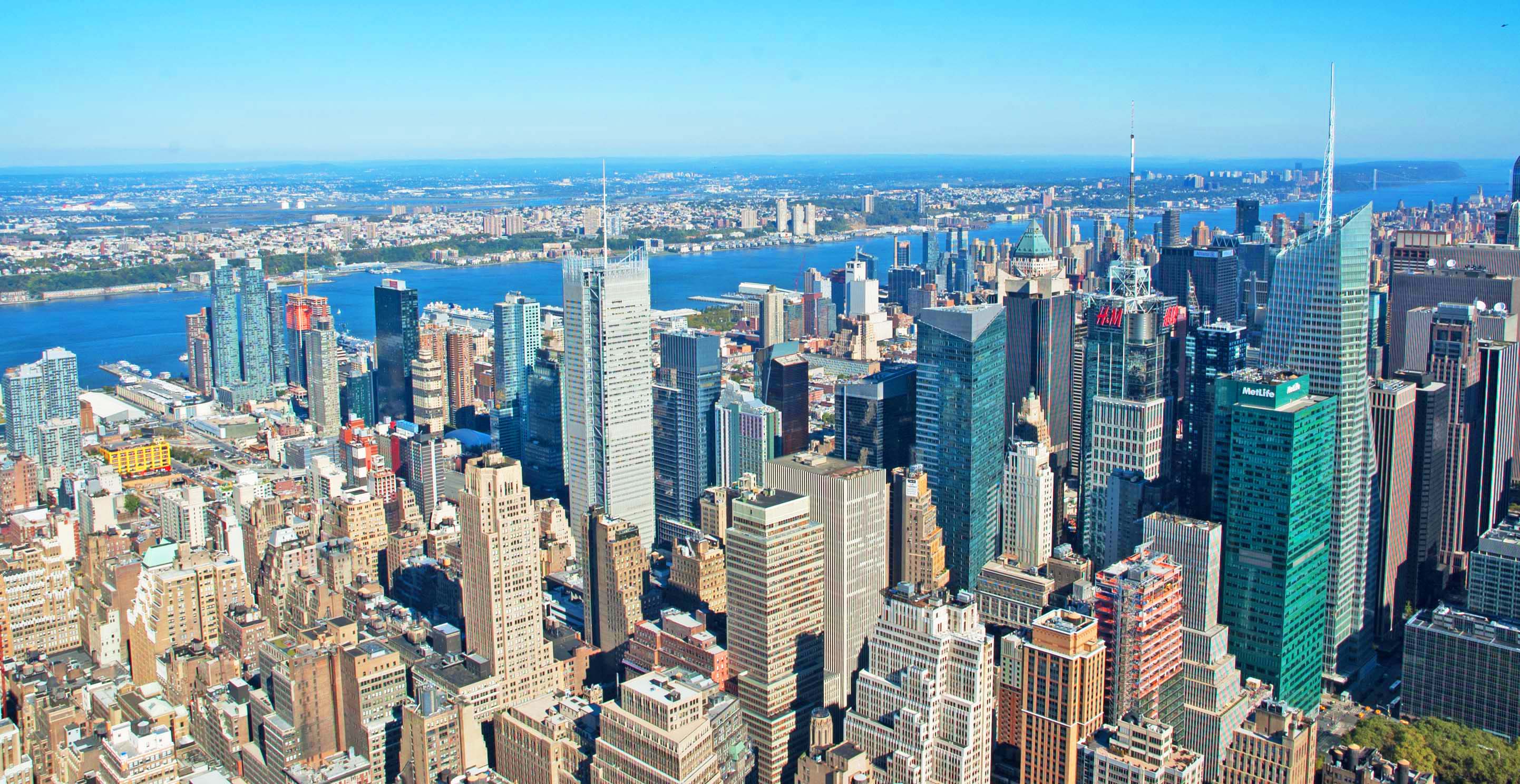
Turning a little more to the left, we have the north-west view. We can see the Hudson River, made rather noteworthy as the new landing strip for 'Sully' Sullenberger and Jeff Skiles when they landed an airliner with two dead engines without the loss of life. They had just left LaGuardia Airport south of here. We are looking at Union City in the distance.
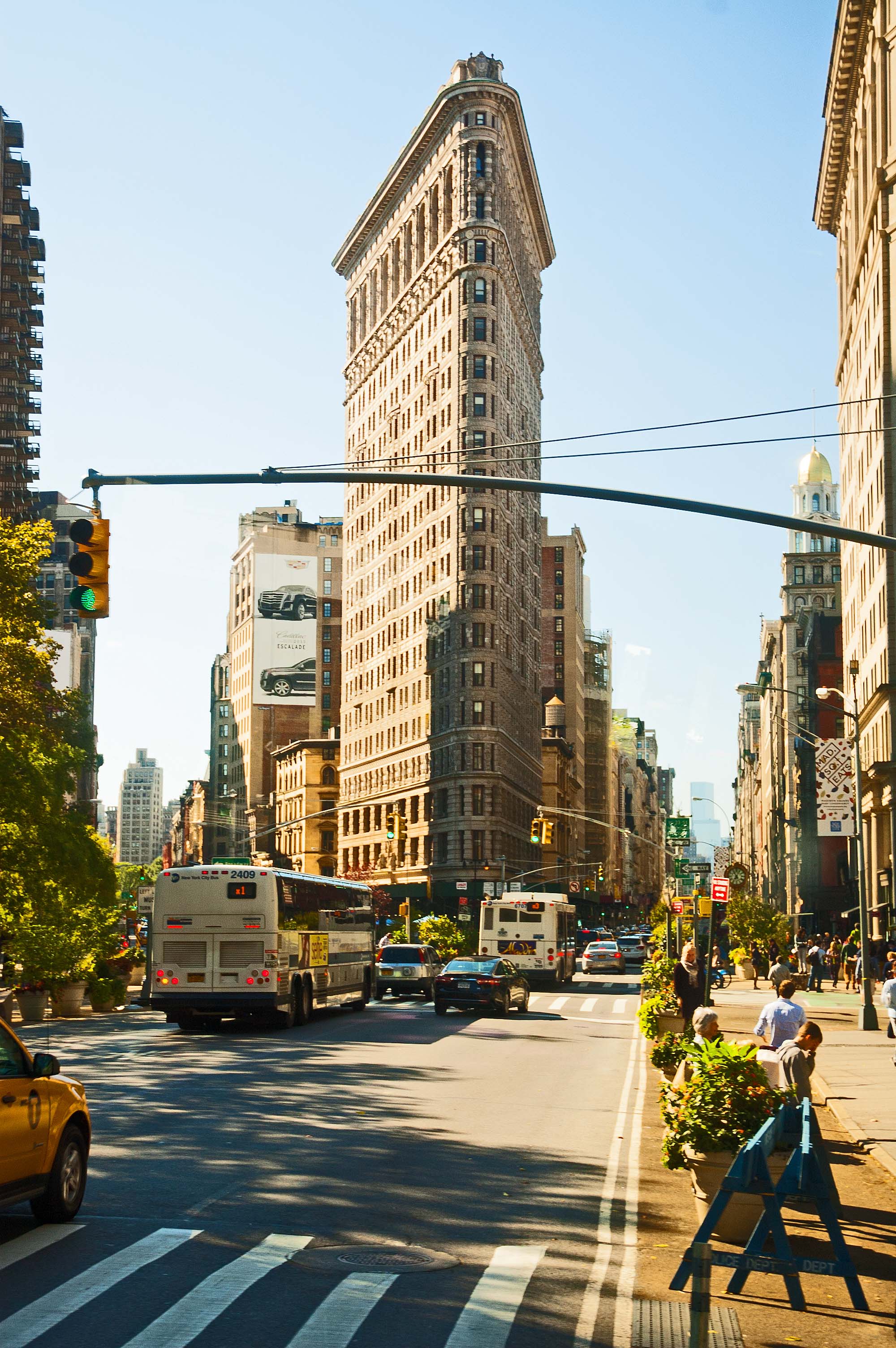
On our way to have lunch, we passed the "Flatiron Building. It was finished in 1902 and is named for its shape and not who built it, who uses it, or where it is located. There are actually twenty-one buildings in the US that share the name "Flatiron Building", including a second one in New York and two of them in San Francisco. The shape evolved due to the high value of real estate causing builders to utilize every square foot of real estate. This building follows the shape of the lot, which is "pie-shaped" because the left street runs at an oblique angle to the street on the right. Property in large cities sell by the "street-foot" because of the exposure to walking and driving traffic. The area that surrounds this building is known as the "Flatiron District" of New York.
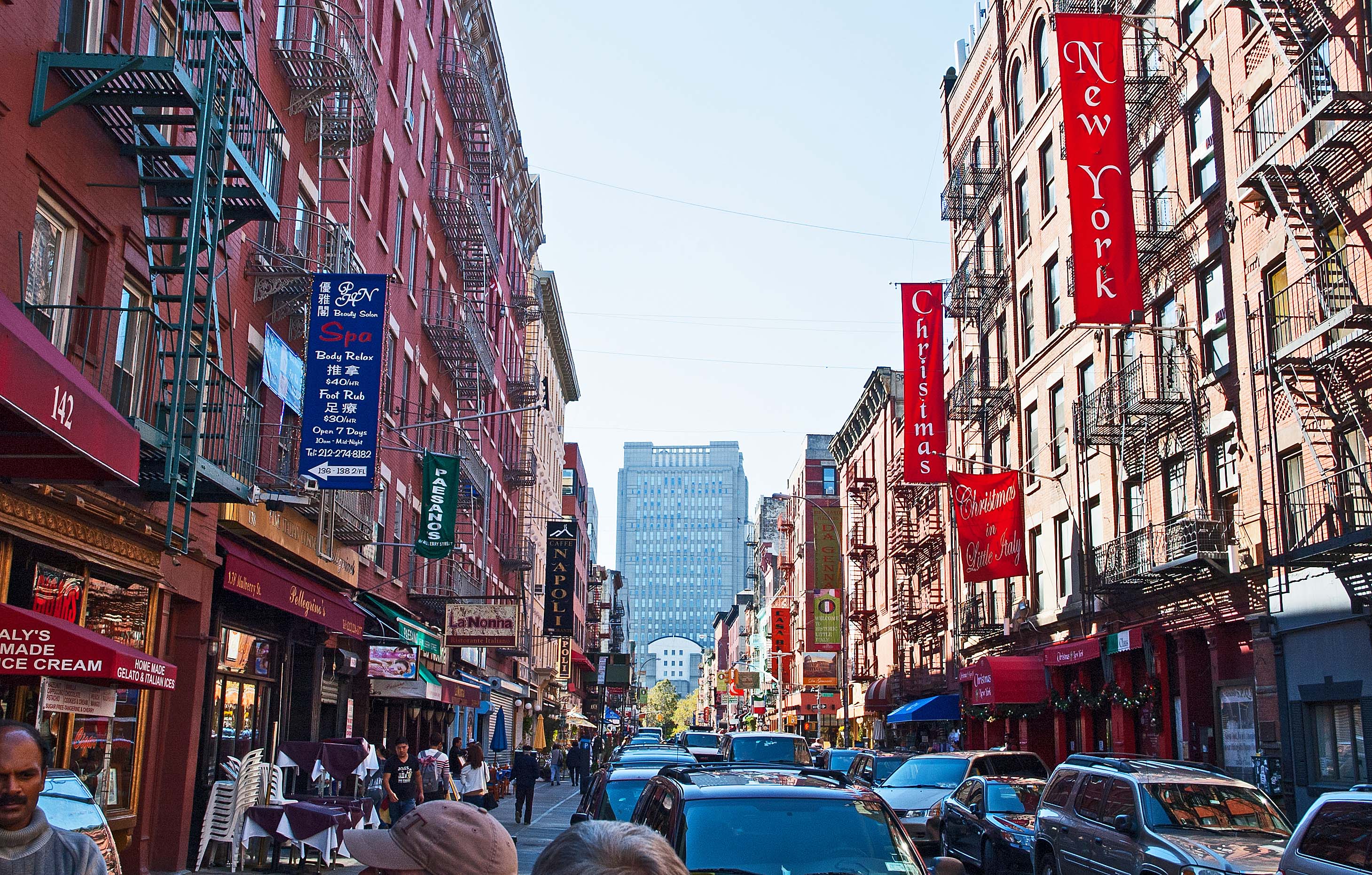
We had to leave the coach, due to the density of the cars, and walked a few blocks to our planned destination for lunch. It was a restaurant that was a favorite of the guide, down in "Little Italy", one more neighborhood that makes up New York City. The food was good, and not rediculously expensive. The people running the place were friendly and fun.
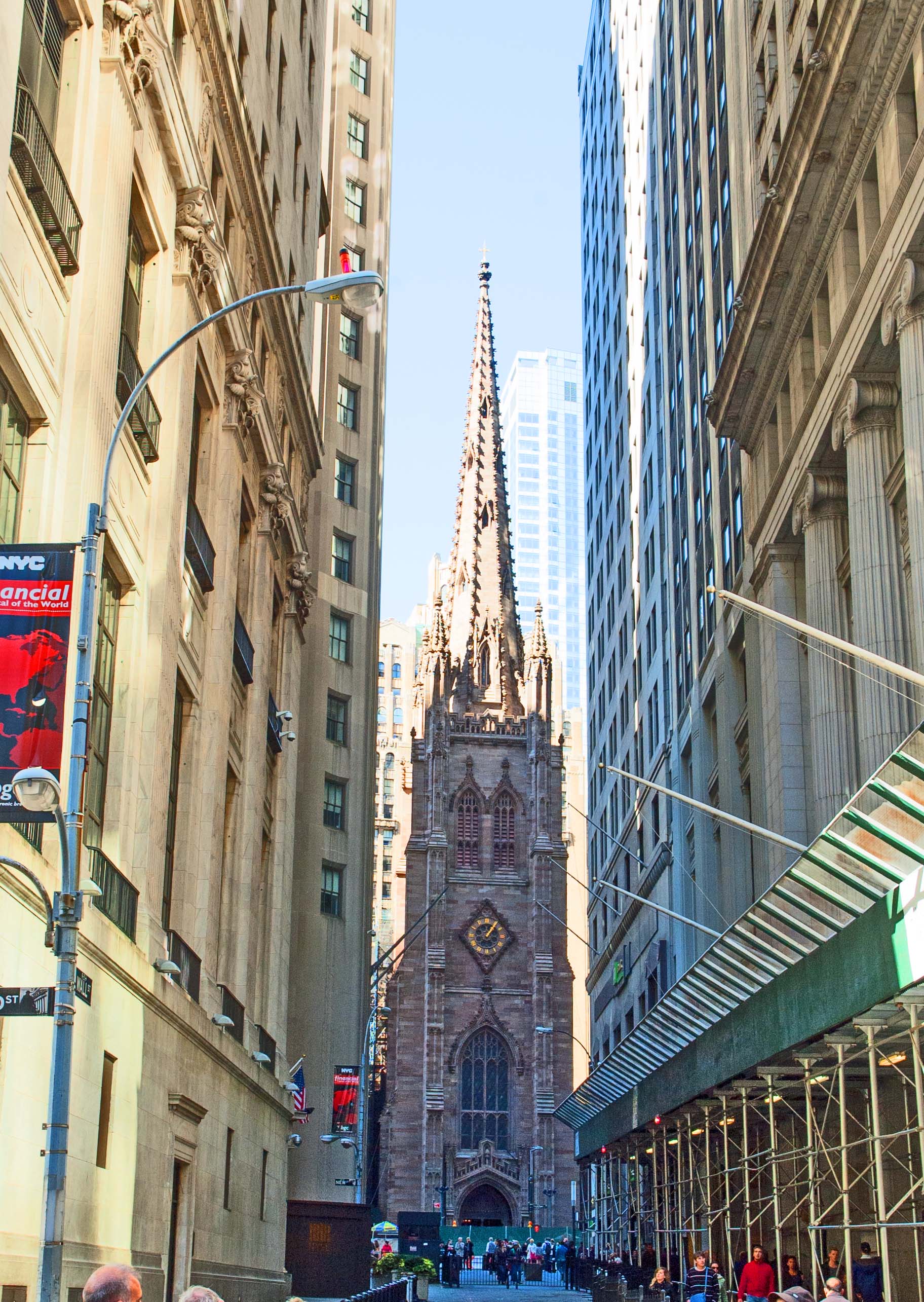
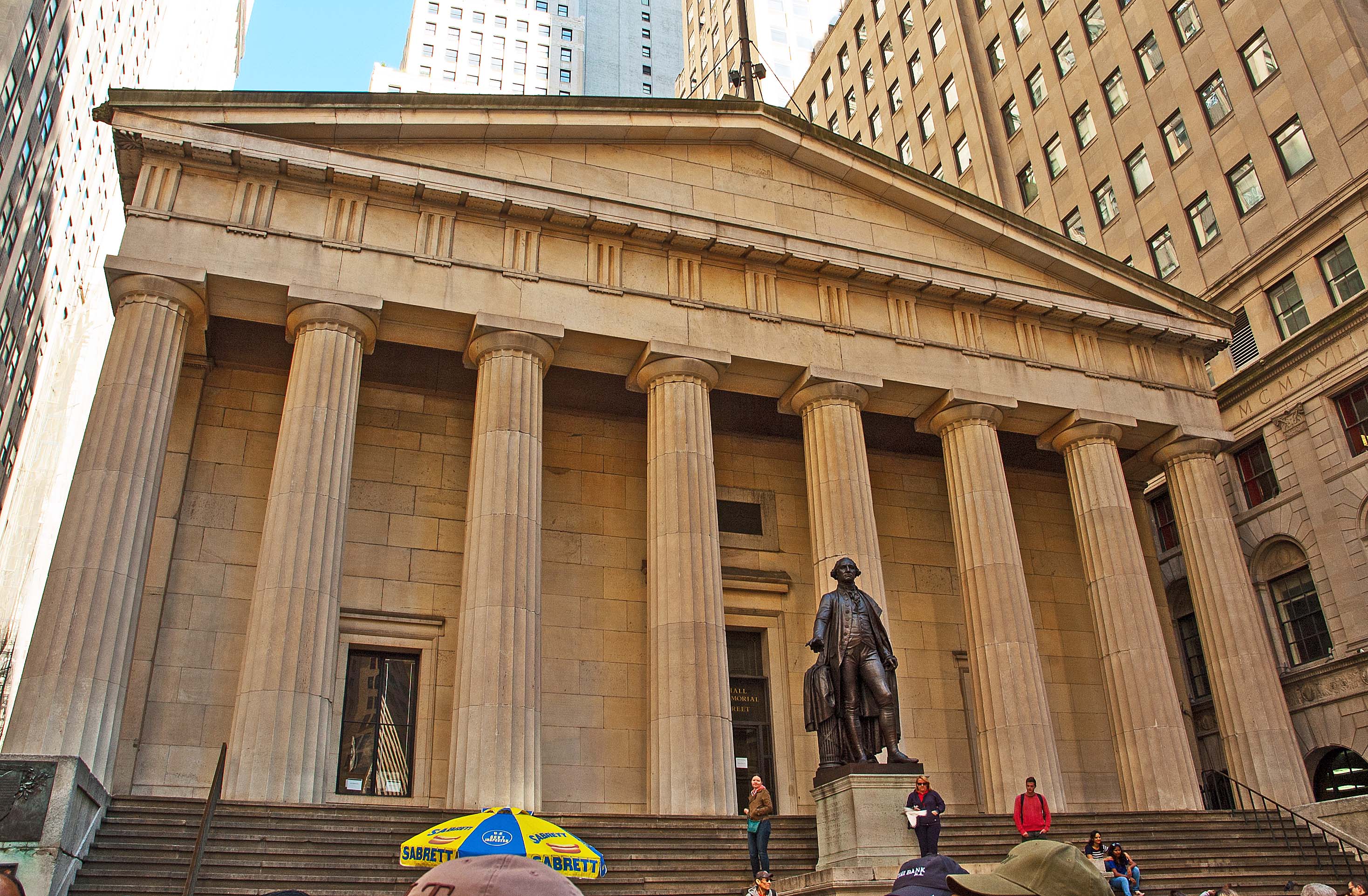
Walking over to Wall Street, about a block from the New York Stock Exchange building is this beautiful building. The Trinity Church is standing on land set aside back in the Colonial settlement days by England for the purpose of being a church. The current building was completed in 1846, and is now completely surrounded by the Financial District. Behind me as I took this picture was the building called Federal Hall. The building that originally stood here was New York City's 18th century City Hall. The First Congress met there and wrote the Bill of Rights. George Washington, commemorated by his likeness standing in front of the entrance, was inaugurated there as the country's first President in 1789, and it was replaced by the current building in 1842 which was the United States Customs House and then was used as a 'sub-treasury' building.
This is considered to be one of the most significant buildings/locations in the country, but is usually overshadowed by the New York Stock Exchange building which is diagonally across the street from this building.
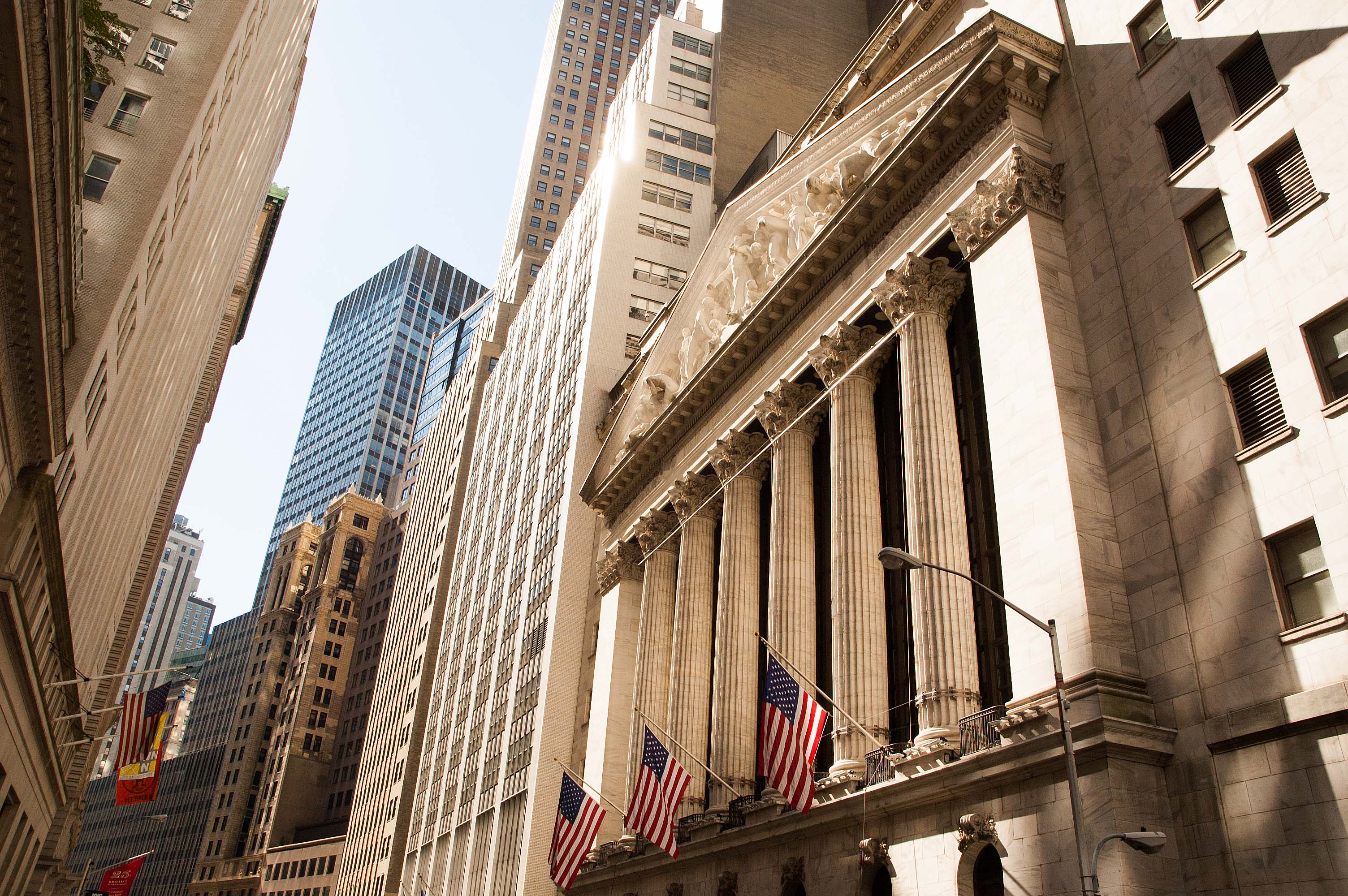
This view is looking down Wall Street. They were not allowing tours through the Stock Exchange any more. The guide said his brother is working inside, and they have to get special permission for him to even visit his brother inside. He also mentioned that more and more of the actual transactions are happening online now. We bussed further south in Manhattan to the World Trade Center Memorial. I'm sure you know that it is a memorial established on the location of and in honor of the victims of the loss of the two towers that were destroyed by terrorist actions on September eleventh, two thousand and one. Our guide had mentioned earlier in the year that this locations was NOT his favorite place to visit. Since he lived most of his life in New York I assumed that he might have some history or connection with the tragedy. We were visiting the site and the group had dispersed to see the sights and I asked him what his connection was with the WTC. He said that he lost two cousins when the towers were destroyed. He also said that his wife had an office in the south tower, but she had to stay home with a sick child that fateful day. His wife has yet to visit the area.
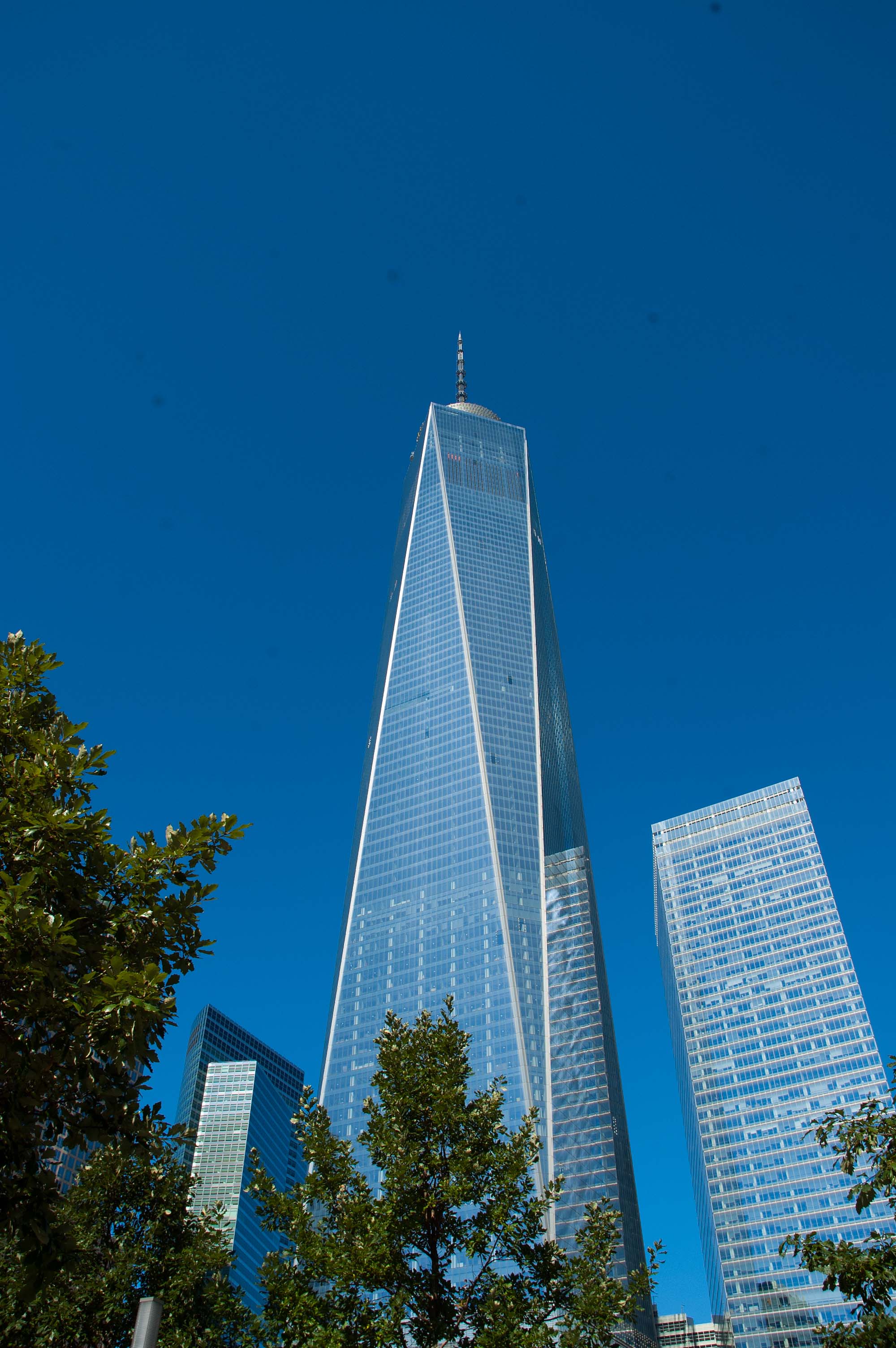
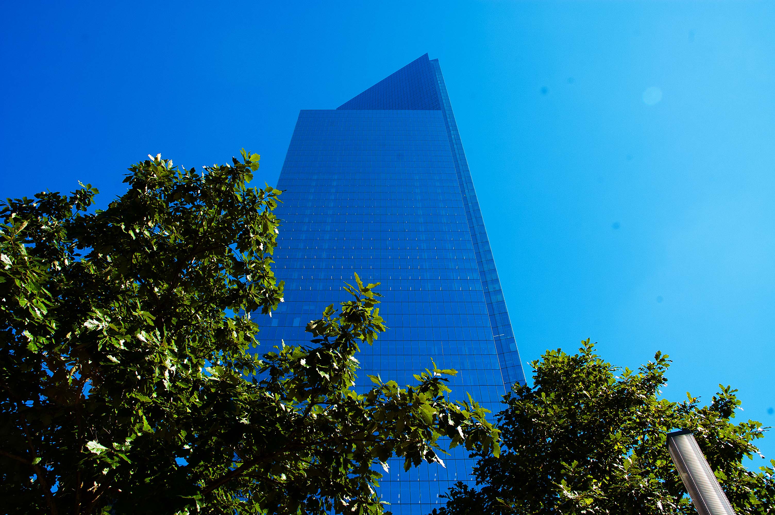
I also learned from the guide that there were originally seven buildings that made up the original WTC, and even though we watched the two main buildings come down, they did not fall delicately into their own footprint. They sent steel beams flying in all directions. Those beams pierced into surrounding buildings, damaging them structurally, enough that all seven have since been dismantled and removed. The saboteurs did not destroy two buildings... they destroyed SEVEN. Fortunately, the other five were emptied of all occupants first. On the left is an image of One World Trade Center, also known as Freedom Tower. Following the taking of this image, occupants were starting to move into the building. This building is just slightly shorter than the original towers, but to make up the loss of the floor space of the original towers, the other WTC buildings will be taller than they originally were. An example of that is the new Four World Trade Center, pictured below. The original was less than sixteen floors high.
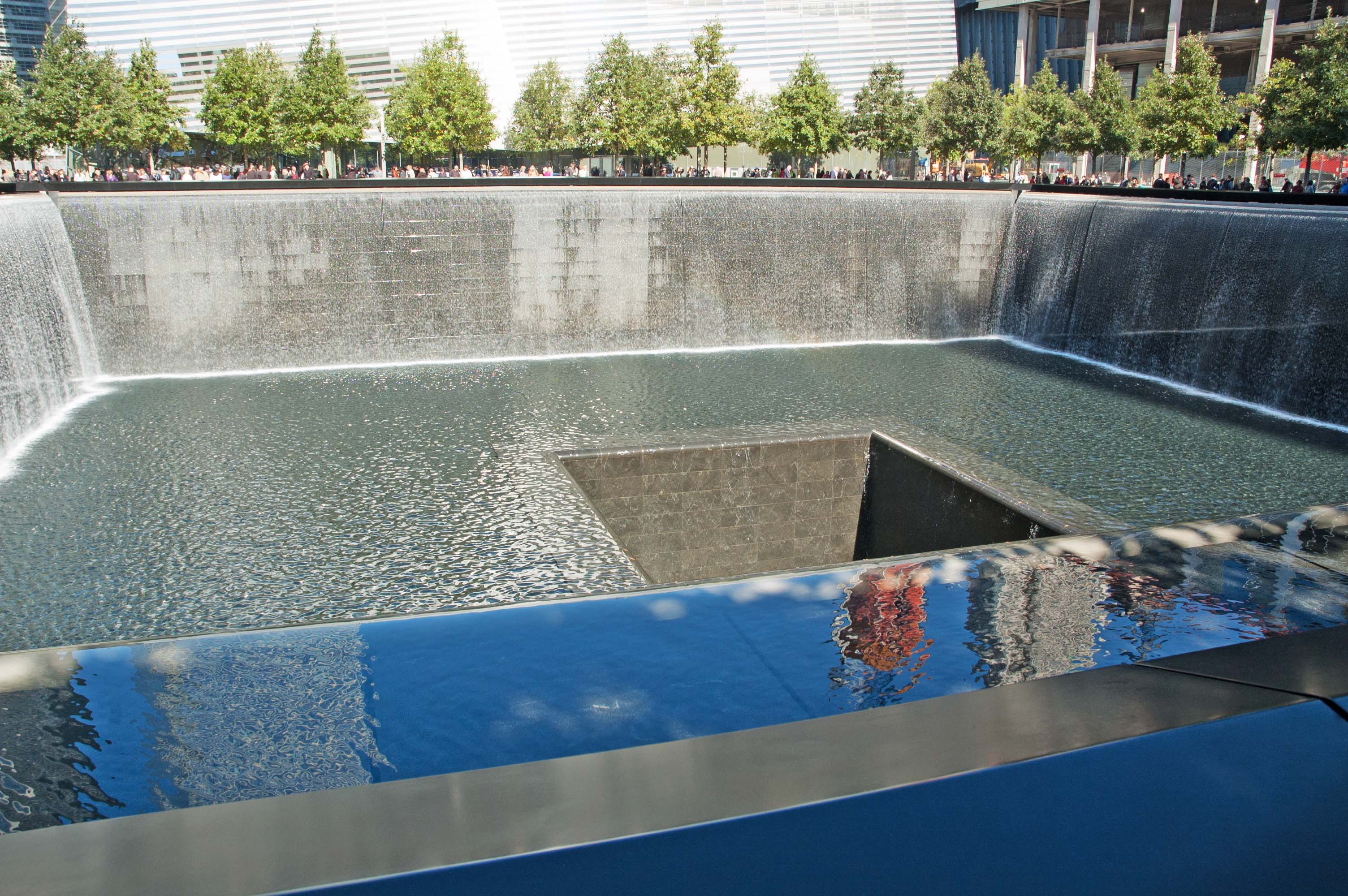
This is referred to as the South Pool. It is the footprint of the South Tower. It has the engraved marble perimeter that contains the names of every life that was lost during the 9/11 invasion. There is another identical pool to the right where the other tower stood. The water is cascading all the way around the pool. There is a marble bottom to the hole, about forty feet-deep, with an even deeper hole in the center that is maybe twenty-feet on a side. Moving on down to the south end of Manhattan we went through a really tough security check to board a ferry to head out across the harbor to Liberty Island and the Statue of Liberty. We had a second security check at the statue. They even had us remove our watches. We don't do that at the airports. This was taken from the railing of the ferry on the way out to the statue. It is the Manhattan Island Skyline. One World Tower is prominent on the skyline.
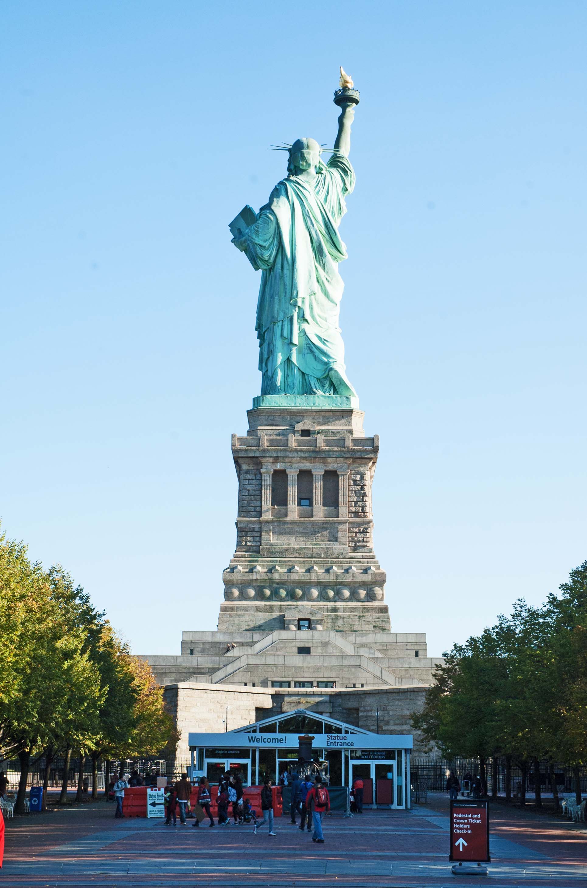
Now, I ask you... how many times have you seen Miss Liberty... from the rear? I have pictures from the front, but in the late afternoon such as when we were there, her left side is heavily shadowed, and this is not what you normally see... unless you are visiting. The ferry crosses in front of her and swings around behind her to the dock. We had just walked off the ferry when this image was taken. Looking closely you can see a walkway below the actual statue and above the large windows of the pedestal. You can see the heavy railing around the statue base. We were given "Pedestal Tickets" by the tour director. That allowed us up to where we could see the inside of the statue and had a nice view from the top of the pedestal. We were told that they still actually offer tickets to reach the head, but only 150 a day. It is not a trip for the weary or claustrophobic by any means. The statue has no windows until you reach the crown, and the stairs are small and many. There was a day when 354 steps did not phase me, but that's the equivalent of climbing 27 floors in a private home, by my calculations. After three weeks of walking all over Colonial America and the eastern coast line, we were satisfied with a pedestal visit. The small building at the base is the requisite curio shop and ticket office. The second security check is also performed here. Anything not allowed to go with you into the statue can be stored in small lockers for a couple of dollars. Your password to get back into the locker is your thumbprint. You cannot forget that. We were about the last ferry ride back to Manhattan. They do a full sweep of the island and statue to clear it of anyone attempting to spend the night with Miss Liberty. They did not disclose how the do that sweep, but the say it is very effective. Our guide got us back to our coach and we continued the tour by heading back to the area that is near our hotel. It is the Financial District and the Theater District. Broadway. Showtime. We started our tour in the Theater District so that is where we left the coach. We decided to walk down Broadway which was well lit and populated so probably 'safer' than taking a dark adjacent street that is not well lit and like walking a canyon between those tall buildings. Well, that did not work well as it was almost impossible to navigate the crowd. Everyone was doing what we were doing... Walkin' an' Gawkin'. Not looking where you are walking, looking up at all of the sights.
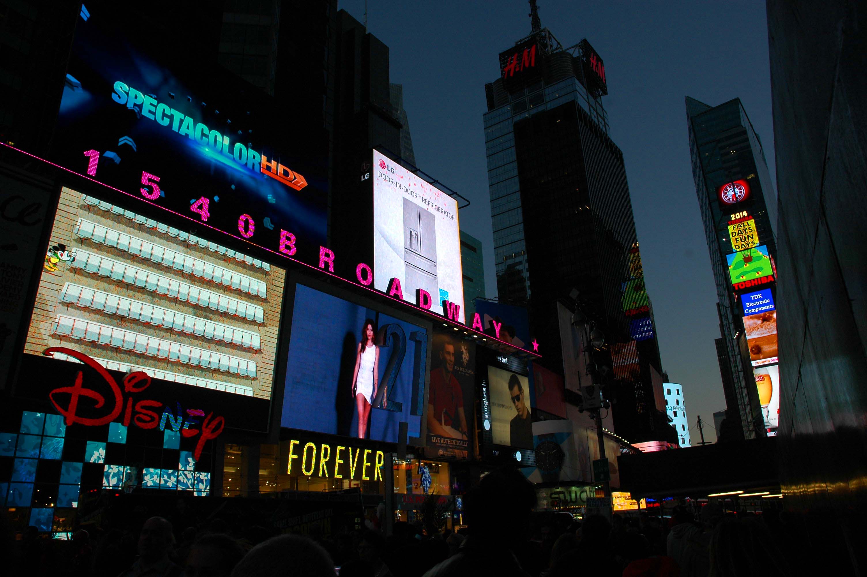
We noticed that lighted signs and neon has been replaced... Video... Digital... those huge billboards that you see are actually huge video screens. Constantly changing format and content, it is entertaining just to stand and watch the boards. The signs at the right side of the screen, climbing up the building, are topped off at the top of the building with the Lighted Ball that descends on the ten-count as New York steps over the line into the next year. You feel like yelling Happy New Year when you stand here. Because the sidewalk "traffic" is so bad, we decided to head over to the next street to reach our hotel. We were given a bonus for making that choice. The Empire State Building was standing proudly above the nearby buildings, displaying its 'colors'. You can go online and find a 'calendar' for the lighting.
Since 1976 lighting at the top of the building has been used to celebrate certain occasions. In 2012 they installed a computer-controlled system that uses LEDs to provide 16 million color variations, and can change colors instantly. On the day we took this image, they were celebrating the 125th Anniversary of Barnard College. A new day has dawned and we decided that this would be an ‘easy’ day. We went out rather late and walked about, toward the south, six blocks in total. We found a nice restaurant for lunch/brunch, and went back to the hotel. We were able to get the desk to print out our airline vouchers and Rosalee was able to get the concierge to arrange a car to take us to JFK Airport in the morning, around 11:00 am. It is an hour to the airport and we fly out around 3:30 pm Eastern. That will put us in San Francisco about 7:00 pm. It will be nice to be home. I am anxious to get to the last little bit of work to get the Carriage House at home signed off by the city. That will let us get the ball rolling on our next project: Solar PV system, to give us free electricity. Yeah! We went out around 7:00 pm for dinner. Food is expensive in Manhattan, but they give you twice what we can eat. That makes dieting soooo easy. LOL.
The next morning we took a ride to JFK Airport and boarded a plane for San Francisco. It was nice to return home, to heart and hearth. |

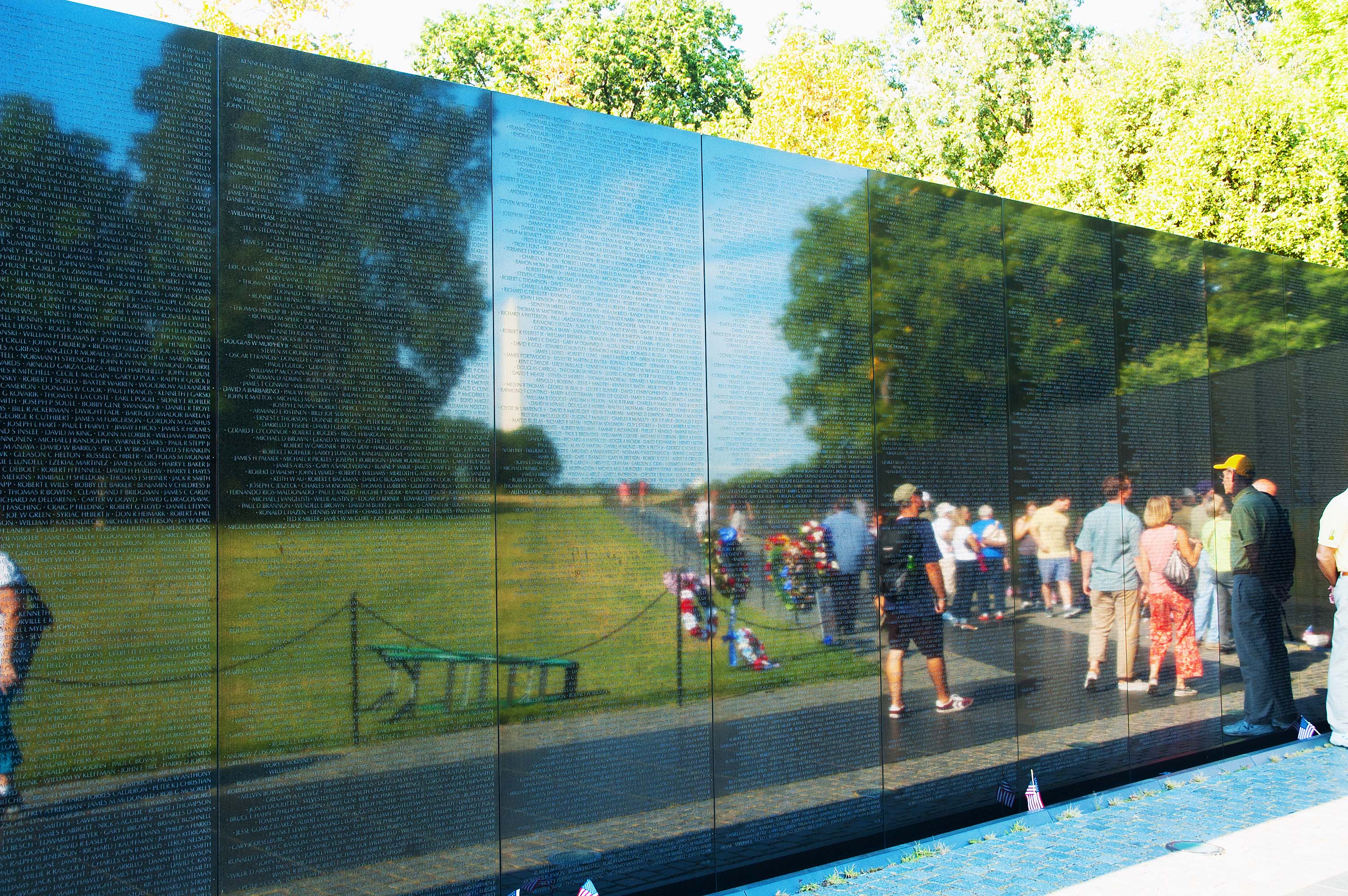
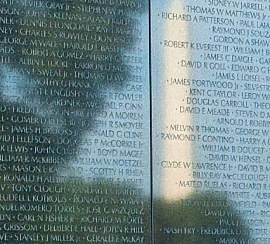 The
panels are polished black granite that came from India, one of three
places in the world where black granite panels of this size can be
found. The second view illustrates the intent of the design to
reflect the Washington in the distance and the illusion the tapered
wall gives that it is longer than it actually is. Standing in front
of the eastern section gives the same effect with the Lincoln
Memorial in the distance.
The
panels are polished black granite that came from India, one of three
places in the world where black granite panels of this size can be
found. The second view illustrates the intent of the design to
reflect the Washington in the distance and the illusion the tapered
wall gives that it is longer than it actually is. Standing in front
of the eastern section gives the same effect with the Lincoln
Memorial in the distance. 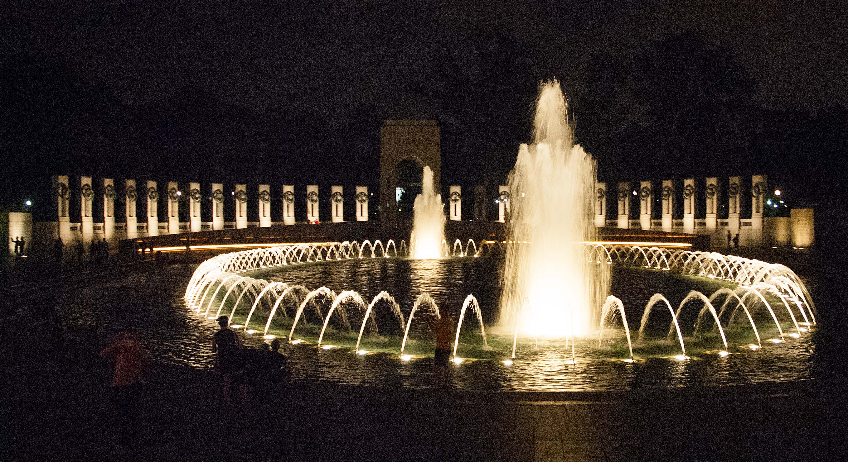
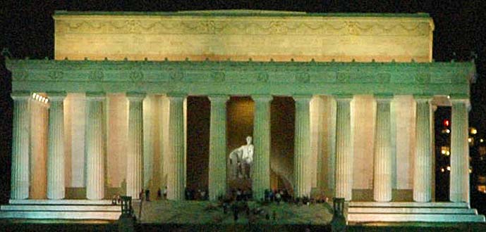 While
standing in the WWII Memorial we could see the Lincoln Memorial,
close to a mile away. I cropped this image from a shot taken over
that great distance. It is a bit grainy and out of focus. I include
it because when we got to the Lincoln Memorial it was pouring rain
and the walk from the bus to the monument would have played havoc
with the camera as well as with my bronchial infection I have
managed to pick up.
While
standing in the WWII Memorial we could see the Lincoln Memorial,
close to a mile away. I cropped this image from a shot taken over
that great distance. It is a bit grainy and out of focus. I include
it because when we got to the Lincoln Memorial it was pouring rain
and the walk from the bus to the monument would have played havoc
with the camera as well as with my bronchial infection I have
managed to pick up. 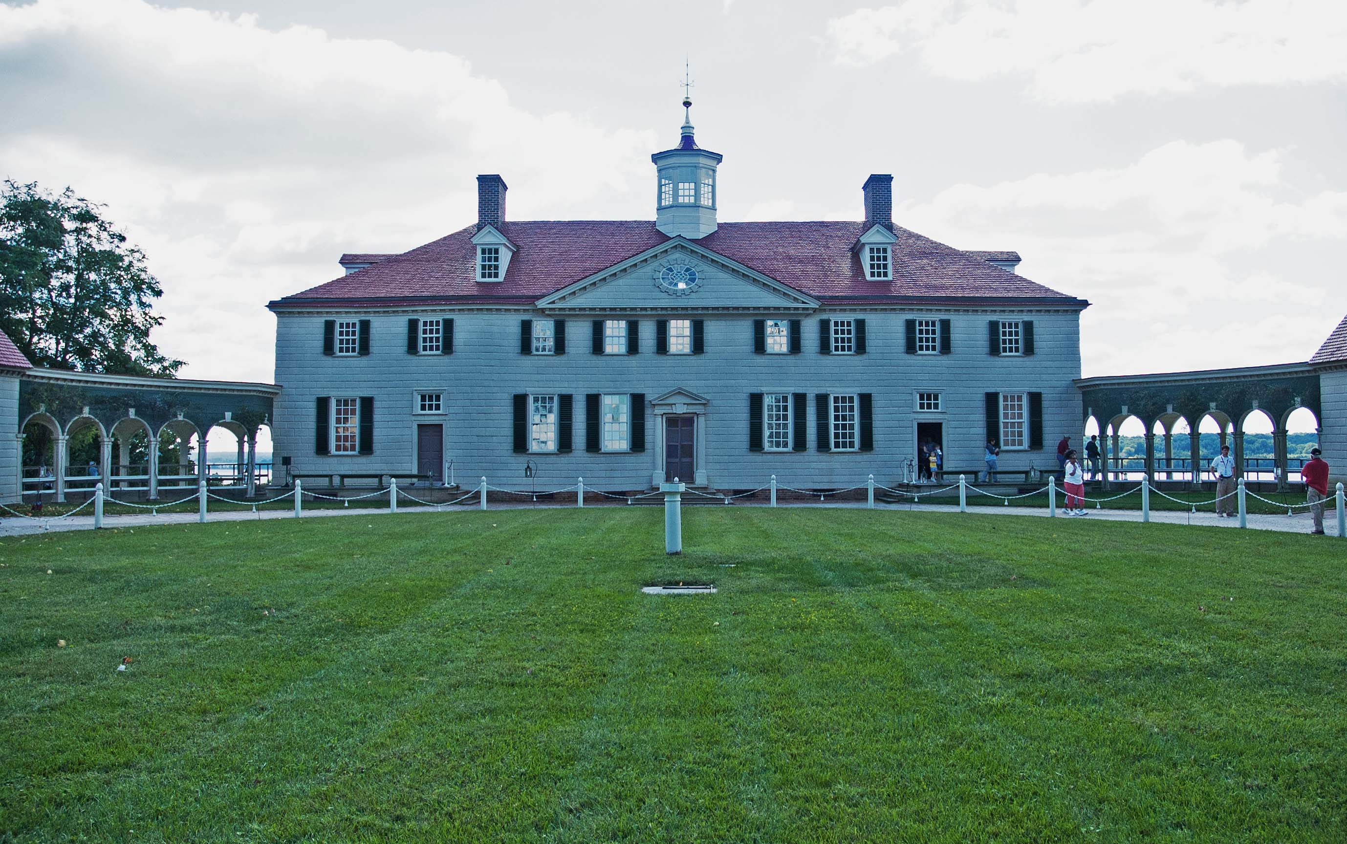
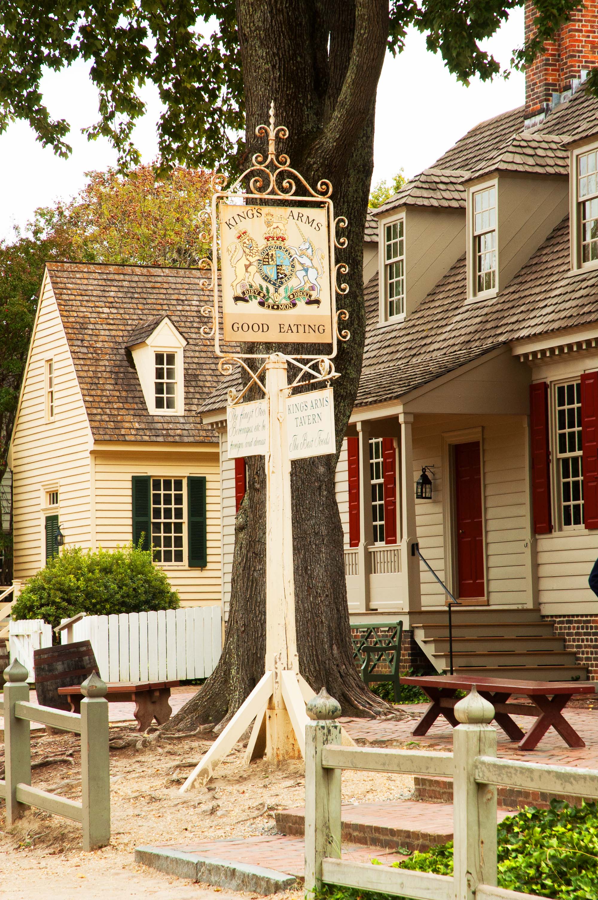 We
pulled into Williamsburg, the re-constructed town that looks like a
typical town did back in the Colonial days, and stopped on a back street
(where
the coach could have access). Most roads in town do not allow
motorized vehicles. We got off the bus and went around to the King’s
Arms Tavern where they had for us a scrumptious Prime Rib dinner. It
was very good.
We
pulled into Williamsburg, the re-constructed town that looks like a
typical town did back in the Colonial days, and stopped on a back street
(where
the coach could have access). Most roads in town do not allow
motorized vehicles. We got off the bus and went around to the King’s
Arms Tavern where they had for us a scrumptious Prime Rib dinner. It
was very good. 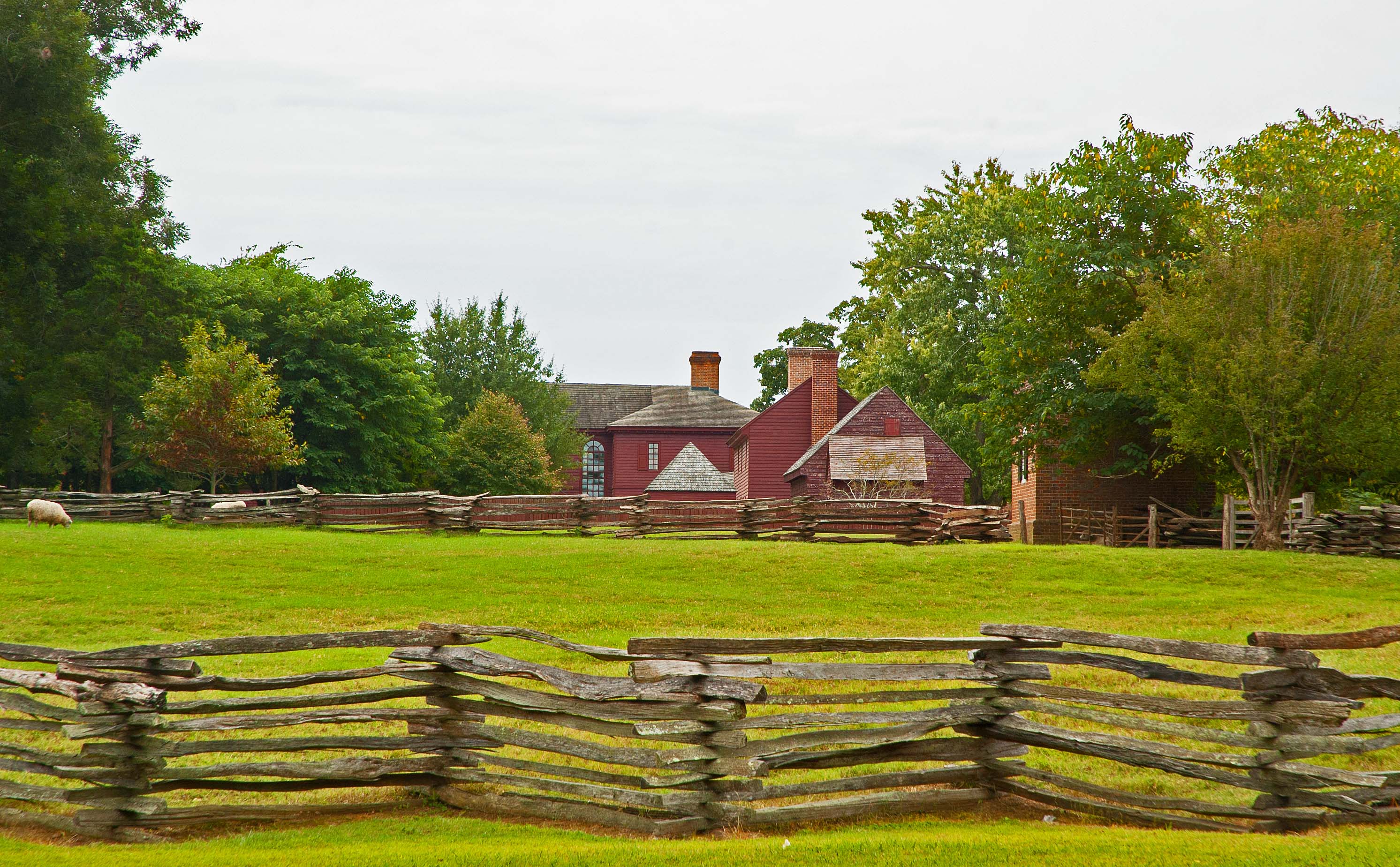
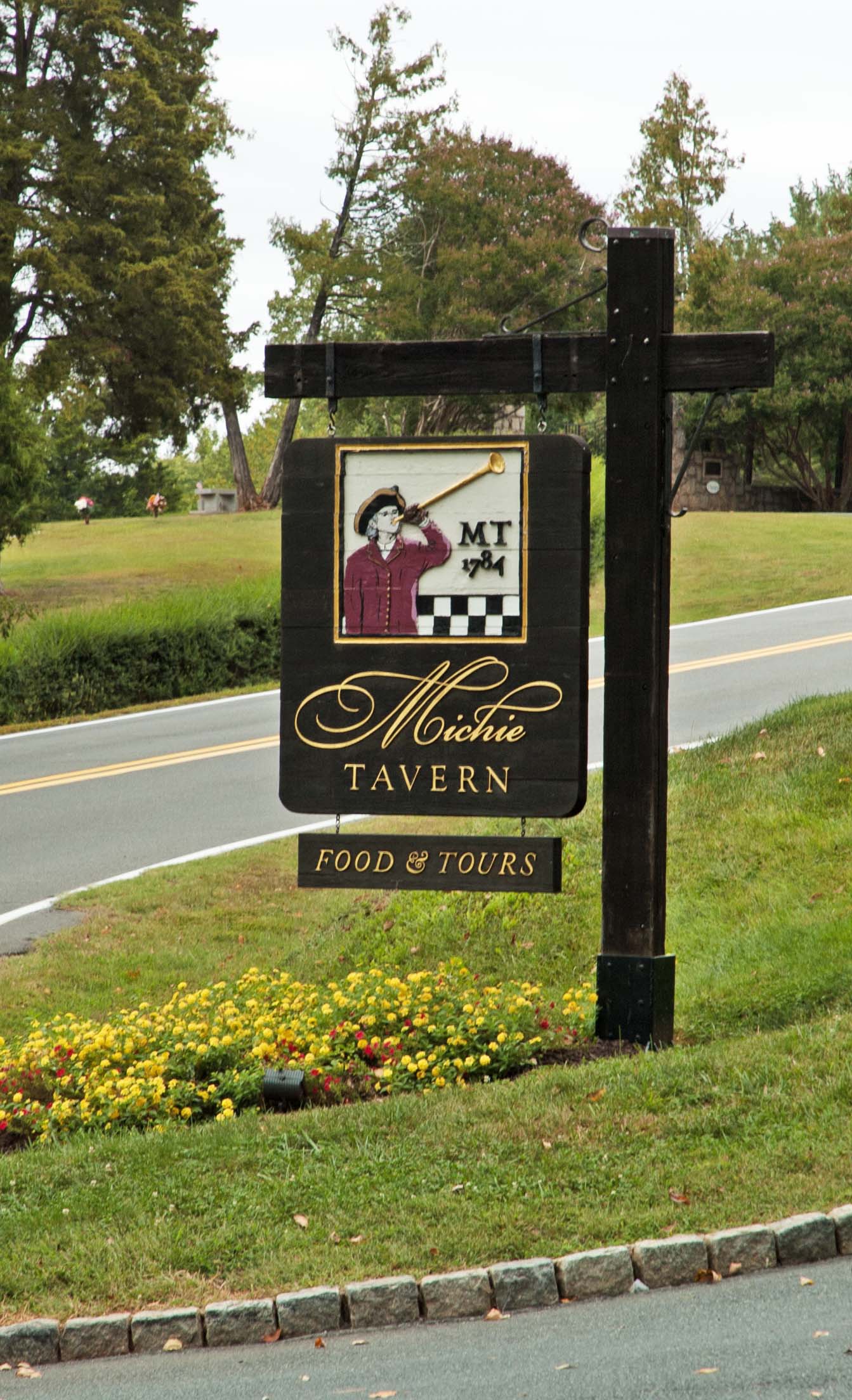 Thomas
Jefferson was a man with an eclectic taste for life. He was a
statesman, a farmer, an author, a pseudo-scientist, a weatherman,
and an inventor. During my youth I read about some of his
inventions, some of which he has incorporated into his home. I
honestly never expected to view them first hand. We will have the
opportunity today to do just that. But first, we had some
distance to travel. When we are very near to Monticello, we will
stop at Michie Tavern for a home-fried chicken lunch. And it was
very good.
Thomas
Jefferson was a man with an eclectic taste for life. He was a
statesman, a farmer, an author, a pseudo-scientist, a weatherman,
and an inventor. During my youth I read about some of his
inventions, some of which he has incorporated into his home. I
honestly never expected to view them first hand. We will have the
opportunity today to do just that. But first, we had some
distance to travel. When we are very near to Monticello, we will
stop at Michie Tavern for a home-fried chicken lunch. And it was
very good. 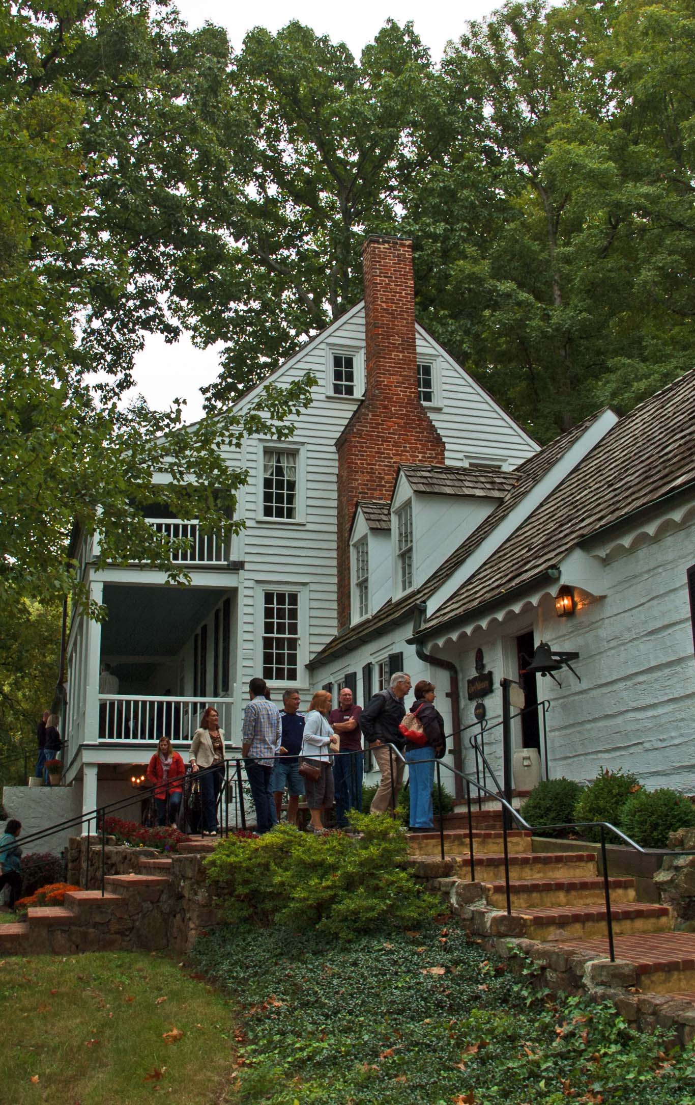
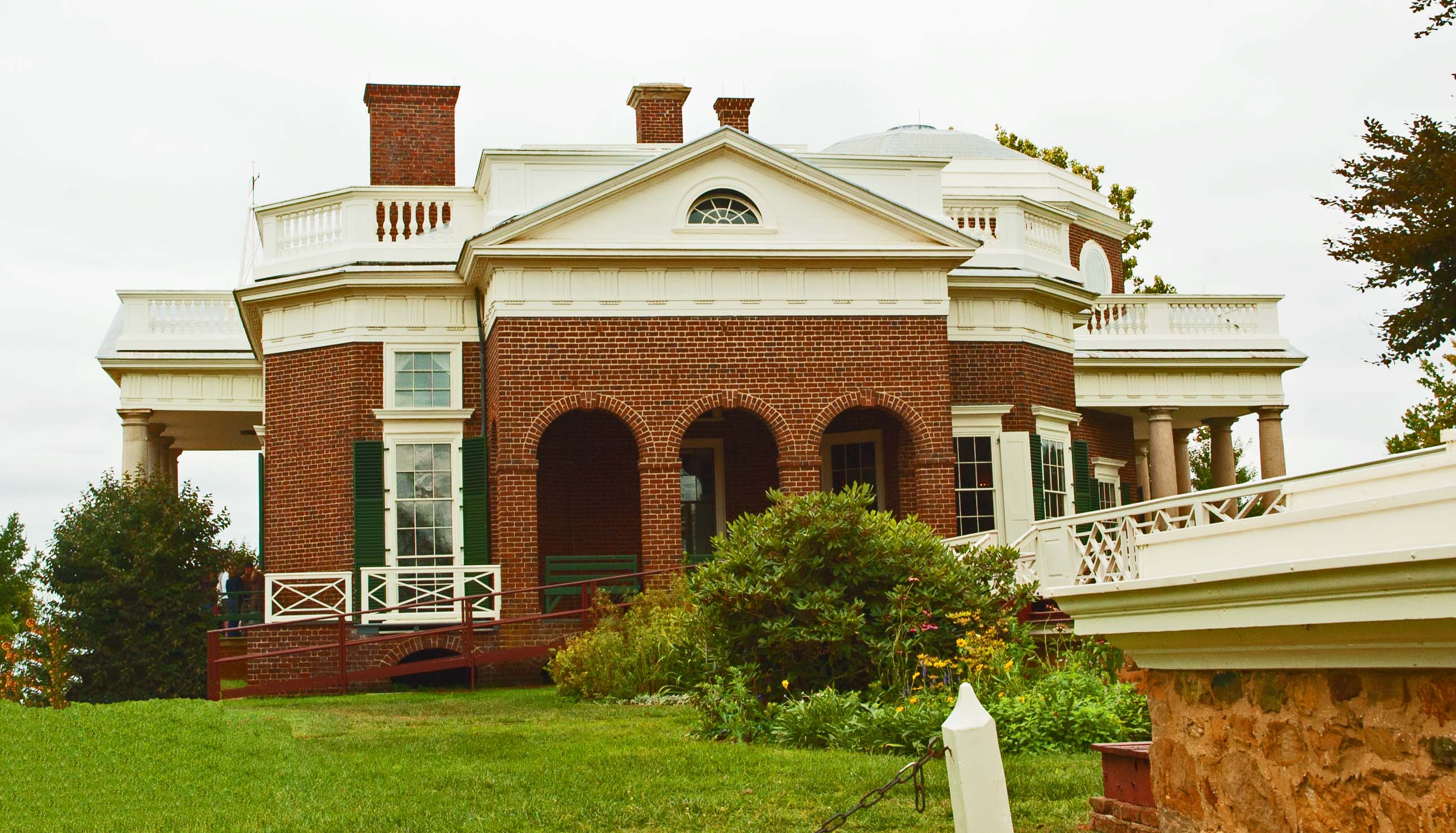
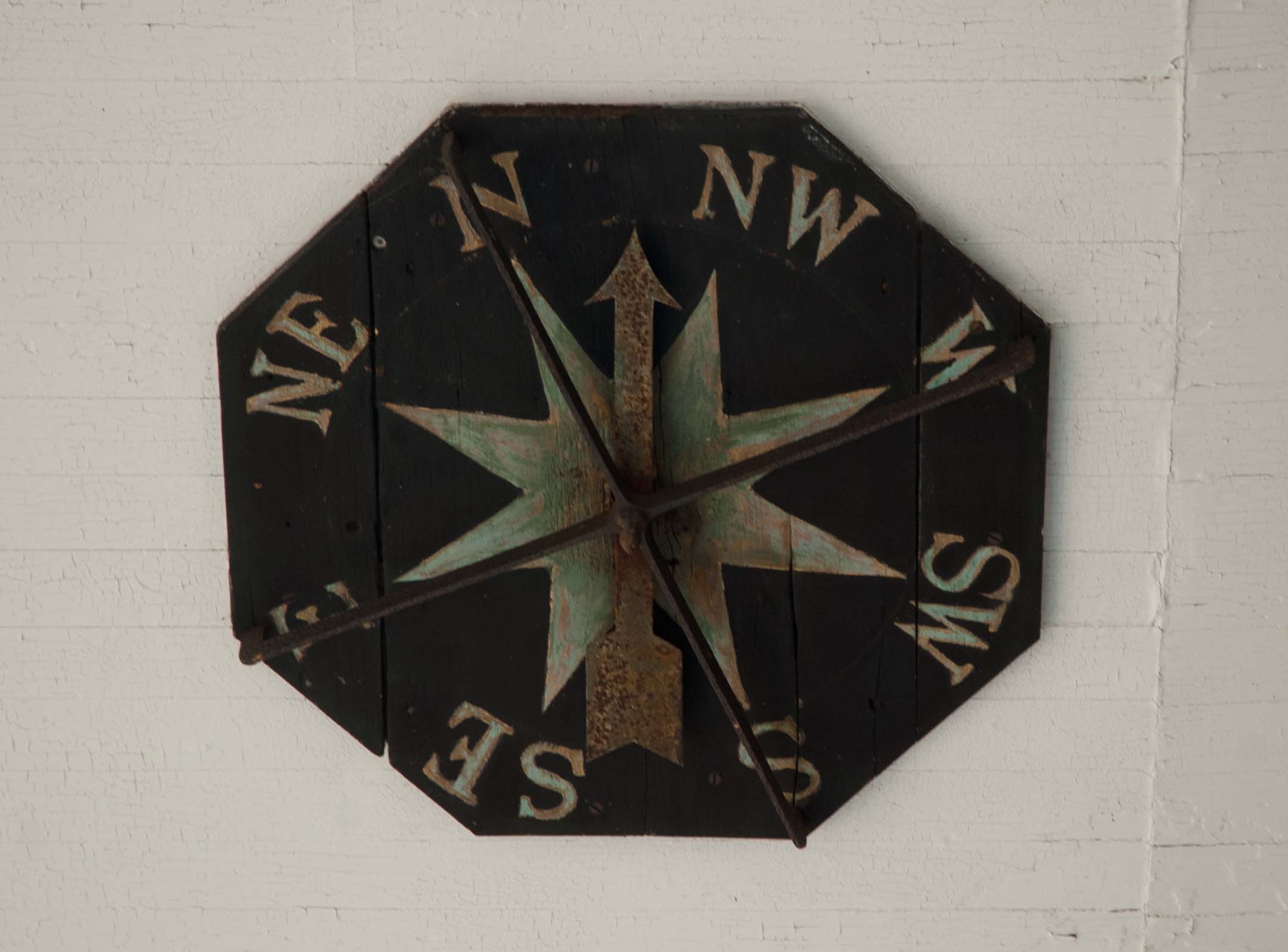 In
two of the views a small, white metal tri-pod frame can be seen over the front
porch. It is a weathervane. But to see what it is telling you, you
only had to step out the front door and look up at the ceiling of
the porch and you will see the compass display telling you which way
the wind is blowing.
In
two of the views a small, white metal tri-pod frame can be seen over the front
porch. It is a weathervane. But to see what it is telling you, you
only had to step out the front door and look up at the ceiling of
the porch and you will see the compass display telling you which way
the wind is blowing.
 As
we traveled from the Gettysburg area we passed through a town that
brought back some memories. Rosalee's mom and dad did a lot of
traveling during their later years, partly when he was still doing a
lot of traveling for the National Federation of Independent
Businesses soliciting memberships from small business owners.
As
we traveled from the Gettysburg area we passed through a town that
brought back some memories. Rosalee's mom and dad did a lot of
traveling during their later years, partly when he was still doing a
lot of traveling for the National Federation of Independent
Businesses soliciting memberships from small business owners.
 Rosalee had arranged for a
tour the following day, and we needed to figure out how to get to
the point where we were to meet the tour bus. It was at the
corner of 51st and Broadway. That seemed like a long way to go, but
with our experience in Washington D.C. with their Metro system, we
figured that we could work it out. We had to be at our destination
around 8:00 a.m., so we started early enough that if we were
unsuccessful with getting a ride we should be able to walk the
distance. We were about walked out after all of this walking for the
last two weeks, but as it worked out, we walked the distance. We
arrived in time to sit and have a Starbucks treat before the coach
showed up.
Rosalee had arranged for a
tour the following day, and we needed to figure out how to get to
the point where we were to meet the tour bus. It was at the
corner of 51st and Broadway. That seemed like a long way to go, but
with our experience in Washington D.C. with their Metro system, we
figured that we could work it out. We had to be at our destination
around 8:00 a.m., so we started early enough that if we were
unsuccessful with getting a ride we should be able to walk the
distance. We were about walked out after all of this walking for the
last two weeks, but as it worked out, we walked the distance. We
arrived in time to sit and have a Starbucks treat before the coach
showed up.